TopoQuest Logo
Do you find TopoQuest useful?
Help keep TopoQuest running and adding new maps/features by donating!
Bitcoin:  19c7KJd3qBynnjoSw5npx9KScwjBe4ifkT
Litecoin:  LXs6TkuXGGXo1vDsWCkWVdjQX94eUKd6ui
Home View Maps Find Maps Find Places Resources & Links


Garfield Peak, Montana Topographic Map

USGS Map Title: Garfield Peak, MT
USGS Map MRC: 45106F4
DRG (GeoTIFF) Download: o45106f4.tif


Neighboring USGS Topographic Map Quads:


  Colstrip SE, MT  
45106G5
 

  Hammond Draw SW, MT  
45106G4
 

  Hammond Draw, MT  
45106G3
 

  Badger Peak, MT  
45106F5
 

  Garfield Peak, MT  
45106F4
 

  Ashland NE, MT  
45106F3
 

  Fisher Butte, MT  
45106E5
 

  Hollowwood Creek, MT  
45106E4
 

  Ashland, MT  
45106E3


Map MRC Location:

N46°
W107°
N46°
W106°
H8 H7 H6 H5 H4 H3 H2 H1
G8 G7 G6 G5 G4 G3 G2 G1
F8 F7 F6 F5 F4 F3 F2 F1
E8 E7 E6 E5 E4 E3 E2 E1
D8 D7 D6 D5 D4 D3 D2 D1
C8 C7 C6 C5 C4 C3 C2 C1
B8 B7 B6 B5 B4 B3 B2 B1
A8 A7 A6 A5 A4 A3 A2 A1
N45°
W107°
N45°
W106°

Garfield Peak, MT USGS 1:24K Topographic Map Preview:
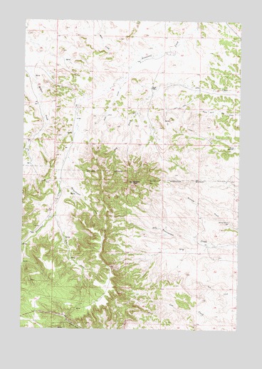
Garfield Peak, MT USGS Topographic Map
Click on map above to begin viewing in our Map Viewer.

This topographic map contains these locations and features:
Feature Name Type Latitude Longitude GNIS ID View Map
01S42E25BDAB01 SpringSpringN45.7272°W106.4943°811461View Map
01S43E21CACD01 WellWellN45.7331°W106.4336°811505View Map
01S43E23BBBB01 WellWellN45.7431°W106.3978°811592View Map
01S43E27ADAD01 WellWellN45.7242°W106.4000°811433View Map
01S43E28DBAA01 WellWellN45.7214°W106.4261°811411View Map
01S43E29ACCC01 WellWellN45.7228°W106.4509°811420View Map
01S43E30DACA01 WellWellN45.7194°W106.4639°811391View Map
01S43E31CACD01 SpringSpringN45.7043°W106.4751°811280View Map
01S43E32AABC01 WellWellN45.7133°W106.4450°811352View Map
01S43E33BDAA01 WellWellN45.7106°W106.4303°811333View Map
01S43E34BCBC01 SpringSpringN45.7097°W106.4189°811330View Map
01S43E35AADB01 WellWellN45.7119°W106.3797°811336View Map
02S42E01BBAD01 WellWellN45.7008°W106.4978°811248View Map
02S42E01CACB01 WellWellN45.6917°W106.4964°811178View Map
02S43E02DBBD01 WellWellN45.6914°W106.3861°811174View Map
02S43E04ADDA01 WellWellN45.6942°W106.4200°811194View Map
Ash CreekStreamN45.6717°W106.4811°768360View Map
Burning Coal Vein AreaLocaleN45.6686°W106.3806°769415View Map
Coal CreekStreamN45.7272°W106.4411°769968View Map
Fields ReservoirReservoirN45.6988°W106.3783°771336View Map
Garfield PeakSummitN45.6844°W106.4356°771710View Map
Greenleaf School (historical)SchoolN45.6519°W106.4934°1716548View Map
Hollowbreast CreekStreamN45.6864°W106.4784°772480View Map
Wood PlacePopulated PlaceN45.7228°W106.4242°778665View Map

Note: Coordinates in the location and feature list above are referenced to NAD83 datum.


Copyright (C) 2008-2025 Ryan Niemi / Sunset Dynamics ... All Rights Reserved