TopoQuest Logo
Do you find TopoQuest useful?
Help keep TopoQuest running and adding new maps/features by donating!
Bitcoin:  19c7KJd3qBynnjoSw5npx9KScwjBe4ifkT
Litecoin:  LXs6TkuXGGXo1vDsWCkWVdjQX94eUKd6ui
Home View Maps Find Maps Find Places Resources & Links


Hammond Draw SW, Montana Topographic Map

USGS Map Title: Hammond Draw SW, MT
USGS Map MRC: 45106G4
DRG (GeoTIFF) Download: o45106g4.tif


Neighboring USGS Topographic Map Quads:


  Colstrip East, MT  
45106H5
 

  Hammond Draw NW, MT  
45106H4
 

  John Hen Creek, MT  
45106H3
 

  Colstrip SE, MT  
45106G5
 

  Hammond Draw SW, MT  
45106G4
 

  Hammond Draw, MT  
45106G3
 

  Badger Peak, MT  
45106F5
 

  Garfield Peak, MT  
45106F4
 

  Ashland NE, MT  
45106F3


Map MRC Location:

N46°
W107°
N46°
W106°
H8 H7 H6 H5 H4 H3 H2 H1
G8 G7 G6 G5 G4 G3 G2 G1
F8 F7 F6 F5 F4 F3 F2 F1
E8 E7 E6 E5 E4 E3 E2 E1
D8 D7 D6 D5 D4 D3 D2 D1
C8 C7 C6 C5 C4 C3 C2 C1
B8 B7 B6 B5 B4 B3 B2 B1
A8 A7 A6 A5 A4 A3 A2 A1
N45°
W107°
N45°
W106°

Hammond Draw SW, MT USGS 1:24K Topographic Map Preview:
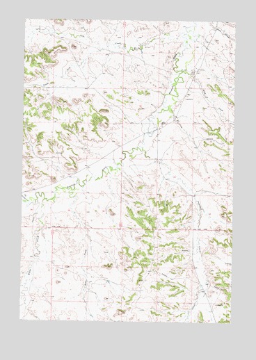
Hammond Draw SW, MT USGS Topographic Map
Click on map above to begin viewing in our Map Viewer.

This topographic map contains these locations and features:
Feature Name Type Latitude Longitude GNIS ID View Map
01N42E01CDB_01 SpringSpringN45.8633°W106.4550°812864View Map
01N42E12ABBA01 WellWellN45.8606°W106.4509°812825View Map
01N42E13BCAC01 WellWellN45.8419°W106.4597°812659View Map
01N42E22CABD01 WellWellN45.8236°W106.4970°812475View Map
01N42E25BBCC01 WellWellN45.8144°W106.4620°812334View Map
01N42E25BCDD01 WellWellN45.8111°W106.4583°812282View Map
01N42E34ACAB01 WellWellN45.7989°W106.4906°812147View Map
01N43E04ADDD01 WellWellN45.8694°W106.3789°812910View Map
01N43E08ACCA01 WellWellN45.8544°W106.4086°812773View Map
01N43E08ACDC01 WellWellN45.8547°W106.4067°812774View Map
01N43E09DDDA01 WellWellN45.8478°W106.3792°812725View Map
01N43E17AACA01 WellWellN45.8447°W106.4036°812687View Map
01N43E18DDBA01 WellWellN45.8361°W106.4239°812601View Map
01N43E20CCCD01 WellWellN45.8178°W106.4181°812395View Map
01N43E21CBCA01 WellWellN45.8225°W106.3975°812459View Map
01N43E29BCDA01 WellWellN45.8117°W106.4108°812294View Map
01N43E30BBDB01 WellWellN45.8150°W106.4383°812355View Map
01N43E31ADBC01 WellWellN45.7981°W106.4250°812142View Map
01N43E31BADC01 WellWellN45.7994°W106.4339°812152View Map
01N43E32DDAA01 WellWellN45.7917°W106.4003°812072View Map
01N43E33BBBB01 WellWellN45.8028°W106.3992°812187View Map
01N43E34BBDC01 SpringSpringN45.7997°W106.3758°812157View Map
01S42E12C___01 WellWellN45.7631°W106.4964°811768View Map
01S42E12CBDC01 WellWellN45.7642°W106.4992°811787View Map
01S43E11BDDC01 WellWellN45.7661°W106.3906°811801View Map
01S43E11CBDA01 WellWellN45.7633°W106.3939°811772View Map
01S43E15AADD01 WellWellN45.7544°W106.3997°811691View Map
01S43E16ABCC01 WellWellN45.7547°W106.4289°811694View Map
01S43E17BCAC01 WellWellN45.7528°W106.4583°811668View Map
06S43E20DDBB01 WellWellN45.7967°W106.4850°812121View Map
Bean CemeteryCemeteryN45.8536°W106.4017°768570View Map
Bean CreekStreamN45.8042°W106.4711°768571View Map
Bean CreekStreamN45.8542°W106.4067°768572View Map
Brown CemeteryCemeteryN45.8322°W106.4186°769260View Map
Cow CreekStreamN45.8692°W106.4058°770226View Map
Greenleaf CreekStreamN45.8214°W106.4292°771978View Map
Hay CouleeValleyN45.8003°W106.4981°772231View Map
Lee (historical)Populated PlaceN45.8678°W106.3900°1716783View Map
Lee Post Office (historical)Post OfficeN45.8678°W106.3900°1716782View Map
Lee School (historical)SchoolN45.8158°W106.4442°1716551View Map
Miller CreekStreamN45.8000°W106.4872°774243View Map
Red Cloud Sioux-Bozeman Party Battlefield (historical)LocaleN45.8444°W106.3950°1716536View Map
South Fork Cow CreekStreamN45.8633°W106.4539°776814View Map

Note: Coordinates in the location and feature list above are referenced to NAD83 datum.


Copyright (C) 2008-2025 Ryan Niemi / Sunset Dynamics ... All Rights Reserved