TopoQuest Logo
Do you find TopoQuest useful?
Help keep TopoQuest running and adding new maps/features by donating!
Bitcoin:  19c7KJd3qBynnjoSw5npx9KScwjBe4ifkT
Litecoin:  LXs6TkuXGGXo1vDsWCkWVdjQX94eUKd6ui
Home View Maps Find Maps Find Places Resources & Links


Garland Prairie, Arizona Topographic Map

USGS Map Title: Garland Prairie, AZ
USGS Map MRC: 35111B8
DRG (GeoTIFF) Download: o35111b8.tif


Neighboring USGS Topographic Map Quads:


  Sitgreaves Mountain, AZ  
35112C1
 

  Parks, AZ  
35111C8
 

  Wing Mountain, AZ  
35111C7
 

  Davenport Hill, AZ  
35112B1
 

  Garland Prairie, AZ  
35111B8
 

  Bellemont, AZ  
35111B7
 

  White Horse Lake, AZ  
35112A1
 

  Sycamore Point, AZ  
35111A8
 

  Dutton Hill, AZ  
35111A7


Map MRC Location:

N36°
W112°
N36°
W111°
H8 H7 H6 H5 H4 H3 H2 H1
G8 G7 G6 G5 G4 G3 G2 G1
F8 F7 F6 F5 F4 F3 F2 F1
E8 E7 E6 E5 E4 E3 E2 E1
D8 D7 D6 D5 D4 D3 D2 D1
C8 C7 C6 C5 C4 C3 C2 C1
B8 B7 B6 B5 B4 B3 B2 B1
A8 A7 A6 A5 A4 A3 A2 A1
N35°
W112°
N35°
W111°

Garland Prairie, AZ USGS 1:24K Topographic Map Preview:
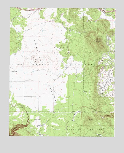
Garland Prairie, AZ USGS Topographic Map
Click on map above to begin viewing in our Map Viewer.

This topographic map contains these locations and features:
Feature Name Type Latitude Longitude GNIS ID View Map
Alive TankReservoirN35.1789°W111.9710°2089543View Map
Allan TankReservoirN35.2276°W111.9616°25594View Map
Aso Number Two TankReservoirN35.2267°W111.9116°25817View Map
Bankhead TankReservoirN35.1924°W111.9342°25948View Map
Blue TankReservoirN35.1747°W111.9841°2089544View Map
Boynton TankRangeN35.1853°W111.9210°2089542View Map
Camp NavajoLocaleN35.1986°W111.8889°2091551View Map
Corsair TankReservoirN35.1538°W111.9159°2089546View Map
Dow SpringSpringN35.1550°W111.9858°28583View Map
Dutch Kid TankReservoirN35.1944°W111.9910°28698View Map
Garjon TankReservoirN35.1266°W111.8923°29263View Map
Garland PrairieFlatN35.1895°W111.9593°29264View Map
Garland Prairie TankReservoirN35.2287°W111.9297°29265View Map
Garland SpringSpringN35.1878°W111.9977°29266View Map
Gray SpringSpringN35.1267°W111.9627°29560View Map
Gray TankReservoirN35.1742°W111.9842°2089545View Map
Great Dane TankReservoirN35.2471°W111.9408°37821View Map
Green TankReservoirN35.2061°W111.9229°45026View Map
Horse LakeLakeN35.1995°W111.9707°30144View Map
Horse Lake TankReservoirN35.2022°W111.9735°2089536View Map
Horse TankReservoirN35.2007°W111.9818°30172View Map
Johnson TankReservoirN35.2411°W111.8935°2089534View Map
Kilgore TankReservoirN35.2183°W111.9428°37878View Map
L O SpringSpringN35.1532°W111.9843°30817View Map
Little Joe TankReservoirN35.1861°W111.9407°2089539View Map
Long ParkFlatN35.1842°W111.8791°31255View Map
Long Park TankReservoirN35.1824°W111.8783°31257View Map
Lower Hull SpringSpringN35.1416°W111.9632°31359View Map
Manterola TankReservoirN35.1757°W111.9562°31488View Map
McDermit CanyonValleyN35.2375°W111.9427°31648View Map
Mickle TankReservoirN35.1691°W111.9110°31797View Map
Mineral SpringSpringN35.2428°W111.9983°42046View Map
Montezuma TankReservoirN35.2179°W111.9348°37944View Map
Mooney MountainSummitN35.1420°W111.9054°31989View Map
Morgan TankReservoirN35.2060°W111.9305°32032View Map
Mustang TankReservoirN35.1992°W111.9535°2089537View Map
Pitman ValleyValleyN35.2272°W111.9838°33043View Map
Poison SpringSpringN35.1339°W111.9752°33078View Map
Power Line TankReservoirN35.1448°W111.9903°33173View Map
Powerline TankReservoirN35.1861°W111.9824°2089541View Map
Railroad SpringSpringN35.1355°W111.9600°33329View Map
Ramon TankReservoirN35.2145°W111.9883°38025View Map
Raymond PitMineN35.1797°W111.9402°42045View Map
Robin TankRangeN35.2008°W111.9371°2089538View Map
Rybery TankReservoirN35.1984°W111.9171°38048View Map
Sawmill TankReservoirN35.1396°W111.8967°38057View Map
Sheep TankReservoirN35.1403°W111.9235°34350View Map
Spitz Spring OverpassCrossingN35.2478°W111.9785°38084View Map
Spitz Spring UnderpassCrossingN35.2481°W111.9791°38085View Map
Stump TankReservoirN35.2494°W111.9863°42047View Map
Sunrise Ranch AirportAirportN35.2373°W111.9334°45562View Map
Toy TankReservoirN35.2296°W111.9805°2089535View Map
Triangle SpringSpringN35.1720°W111.9566°38122View Map
Upper Hull SpringSpringN35.1444°W111.9643°35688View Map
Volunteer MountainSummitN35.2181°W111.8954°35790View Map
Volunteer TankReservoirN35.2355°W111.9256°38143View Map
Wright TanksReservoirN35.1881°W111.9718°2089540View Map

Note: Coordinates in the location and feature list above are referenced to NAD83 datum.


Copyright (C) 2008-2024 Ryan Niemi / Sunset Dynamics ... All Rights Reserved