TopoQuest Logo
Do you find TopoQuest useful?
Help keep TopoQuest running and adding new maps/features by donating!
Bitcoin:  19c7KJd3qBynnjoSw5npx9KScwjBe4ifkT
Litecoin:  LXs6TkuXGGXo1vDsWCkWVdjQX94eUKd6ui
Home View Maps Find Maps Find Places Resources & Links


Garnett East, Kansas Topographic Map

USGS Map Title: Garnett East, KS
USGS Map MRC: 38095C2
DRG (GeoTIFF) Download: o38095c2.tif


Neighboring USGS Topographic Map Quads:


  Richmond, KS  
38095D3
 

  Garnett NW, KS  
38095D2
 

  Lane, KS  
38095D1
 

  Garnett West, KS  
38095C3
 

  Garnett East, KS  
38095C2
 

  Garnett SE, KS  
38095C1
 

  Welda, KS  
38095B3
 

  Bush City, KS  
38095B2
 

  Centerville, KS  
38095B1


Map MRC Location:

N39°
W96°
N39°
W95°
H8 H7 H6 H5 H4 H3 H2 H1
G8 G7 G6 G5 G4 G3 G2 G1
F8 F7 F6 F5 F4 F3 F2 F1
E8 E7 E6 E5 E4 E3 E2 E1
D8 D7 D6 D5 D4 D3 D2 D1
C8 C7 C6 C5 C4 C3 C2 C1
B8 B7 B6 B5 B4 B3 B2 B1
A8 A7 A6 A5 A4 A3 A2 A1
N38°
W96°
N38°
W95°

Garnett East, KS USGS 1:24K Topographic Map Preview:
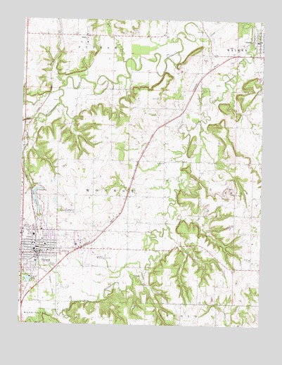
Garnett East, KS USGS Topographic Map
Click on map above to begin viewing in our Map Viewer.

This topographic map contains these locations and features:
Feature Name Type Latitude Longitude GNIS ID View Map
Anderson County CourthouseBuildingN38.2804°W95.2414°2625072View Map
Anderson County Emergency Medical ServicesBuildingN38.2800°W95.2494°2696568View Map
Anderson County Historical MuseumBuildingN38.2785°W95.2487°2694960View Map
Anderson County Sheriff's OfficeBuildingN38.2804°W95.2409°2504085View Map
Beachner Grain Elevator Number 20LocaleN38.2795°W95.2293°2695326View Map
Beachner Grain Elevator Number 21LocaleN38.3665°W95.1306°2695327View Map
Cedar Bluff (historical)LocaleN38.2764°W95.1939°482391View Map
City of GarnettCivilN38.2844°W95.2405°485581View Map
City of GreeleyCivilN38.3677°W95.1272°2394972View Map
Crystal LakeReservoirN38.2683°W95.2461°477654View Map
Dry BranchStreamN38.3581°W95.1969°477592View Map
First Baptist ChurchChurchN38.2802°W95.2445°2690027View Map
First Christian ChurchChurchN38.2828°W95.2438°2690028View Map
First United Methodist ChurchChurchN38.2828°W95.2425°2688685View Map
GarnettPopulated PlaceN38.2806°W95.2419°477665View Map
Garnett Assembly of God ChurchChurchN38.2880°W95.2462°2689263View Map
Garnett CemeteryCemeteryN38.2965°W95.2276°477657View Map
Garnett Church of the NazareneChurchN38.2877°W95.2453°2690381View Map
Garnett City HallBuildingN38.2802°W95.2431°2693160View Map
Garnett City Park DamDamN38.3050°W95.2436°479860View Map
Garnett Country ClubLocaleN38.2962°W95.2372°2694561View Map
Garnett Elementary CenterSchoolN38.2865°W95.2432°480788View Map
Garnett FairgroundsLocaleN38.2931°W95.2409°2692649View Map
Garnett Fire DepartmentBuildingN38.2806°W95.2433°2111348View Map
Garnett Municipal AirportAirportN38.2796°W95.2144°477655View Map
Garnett Municipal Water PlantLocaleN38.2694°W95.2450°2692145View Map
Garnett Police DepartmentBuildingN38.2801°W95.2435°2503934View Map
Garnett Post OfficePost OfficeN38.2818°W95.2419°2693732View Map
Garnett Public LibraryBuildingN38.2807°W95.2436°2694833View Map
Garnett Senior CenterBuildingN38.2796°W95.2429°2692754View Map
GreeleyPopulated PlaceN38.3667°W95.1269°477597View Map
Greeley City CemeteryCemeteryN38.3747°W95.1260°2673181View Map
Greeley City HallBuildingN38.3664°W95.1275°2693139View Map
Greeley City Marshal's OfficeBuildingN38.3668°W95.1306°2503973View Map
Greeley Fire DepartmentBuildingN38.3667°W95.1277°2695545View Map
Greeley United Methodist ChurchChurchN38.3682°W95.1275°2690224View Map
Holy Angels Catholic ChurchChurchN38.2806°W95.2339°2690029View Map
Irving Primary CenterSchoolN38.2827°W95.2371°480791View Map
Judy CemeteryCemeteryN38.3094°W95.1755°477660View Map
Judy SchoolSchoolN38.3164°W95.1764°477661View Map
Kansas Department of Transportation Area 42 ShopBuildingN38.2888°W95.2500°2693138View Map
Kansas Highway Patrol Troop H Anderson CountyBuildingN38.2796°W95.2434°2504270View Map
Lake GarnettReservoirN38.2986°W95.2414°477658View Map
Lake Garnett ParkParkN38.2978°W95.2391°477659View Map
Longfellow Elementary SchoolSchoolN38.2778°W95.2461°480789View Map
Prairie Plaza Business ParkLocaleN38.2784°W95.2281°2692232View Map
Saint Boniface Catholic CemeteryCemeteryN38.3640°W95.2115°2673182View Map
Saint Boniface Catholic ChurchChurchN38.3657°W95.2171°2690031View Map
Saint John CemeteryCemeteryN38.3547°W95.1257°477663View Map
Saint John Elementary School (historical)SchoolN38.3623°W95.1251°2437468View Map
Saint Rose Philippine Duchesne Catholic Grade SchoolSchoolN38.2806°W95.2328°480790View Map
Saint Rose Philippine Duchesne Catholic Grade SchoolSchoolN38.2806°W95.2328°2437477View Map
ScipioPopulated PlaceN38.3684°W95.2178°477662View Map
Southeast Kansas Multi - County Health Department Anderson CountyBuildingN38.2834°W95.2483°2694981View Map
Township of MonroeCivilN38.3063°W95.1983°477653View Map
Trinity Baptist ChurchChurchN38.2791°W95.2251°2690033View Map

Note: Coordinates in the location and feature list above are referenced to NAD83 datum.


Copyright (C) 2008-2024 Ryan Niemi / Sunset Dynamics ... All Rights Reserved