TopoQuest Logo
Do you find TopoQuest useful?
Help keep TopoQuest running and adding new maps/features by donating!
Bitcoin:  19c7KJd3qBynnjoSw5npx9KScwjBe4ifkT
Litecoin:  LXs6TkuXGGXo1vDsWCkWVdjQX94eUKd6ui
Home View Maps Find Maps Find Places Resources & Links


Garo, Colorado Topographic Map

USGS Map Title: Garo, CO
USGS Map MRC: 39105A8
DRG (GeoTIFF) Download: o39105a8.tif


Neighboring USGS Topographic Map Quads:


  Fairplay West, CO  
39106B1
 

  Fairplay East, CO  
39105B8
 

  Elkhorn, CO  
39105B7
 

  Jones Hill, CO  
39106A1
 

  Garo, CO  
39105A8
 

  Hartsel, CO  
39105A7
 

  Marmot Peak, CO  
38106H1
 

  Antero Reservoir, CO  
38105H8
 

  Antero Reservoir NE, CO  
38105H7


Map MRC Location:

N40°
W106°
N40°
W105°
H8 H7 H6 H5 H4 H3 H2 H1
G8 G7 G6 G5 G4 G3 G2 G1
F8 F7 F6 F5 F4 F3 F2 F1
E8 E7 E6 E5 E4 E3 E2 E1
D8 D7 D6 D5 D4 D3 D2 D1
C8 C7 C6 C5 C4 C3 C2 C1
B8 B7 B6 B5 B4 B3 B2 B1
A8 A7 A6 A5 A4 A3 A2 A1
N39°
W106°
N39°
W105°

Garo, CO USGS 1:24K Topographic Map Preview:
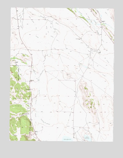
Garo, CO USGS Topographic Map
Click on map above to begin viewing in our Map Viewer.

This topographic map contains these locations and features:
Feature Name Type Latitude Longitude GNIS ID View Map
63 RanchLocaleN39.0083°W105.9695°183752View Map
Alden and Milligan DitchCanalN39.0861°W105.9014°183764View Map
Antero Feeder DitchCanalN39.1139°W105.9756°183772View Map
Berry DitchCanalN39.1055°W105.9506°183770View Map
Bronlow and Stephens DitchCanalN39.1000°W105.9528°183771View Map
Buffalo Springs CampgroundLocaleN39.0339°W105.9897°196737View Map
Buffalo Springs CemeteryCemeteryN39.0055°W105.9725°2377209View Map
Buffalo Springs SchoolSchoolN39.0483°W105.9761°183757View Map
Burlingame Number 3 DitchCanalN39.0800°W105.9789°169495View Map
Cargill RanchLocaleN39.0839°W105.8942°183763View Map
Deadman GulchValleyN39.0045°W105.9691°183750View Map
Dudley DitchLocaleN39.0917°W105.9111°183765View Map
Duval Discovery MineMineN39.0914°W105.8920°1703820View Map
Elisha-Alden DitchCanalN39.0955°W105.8895°202955View Map
Fourmile DitchCanalN39.1189°W105.9872°202947View Map
Fourmile RanchLocaleN39.0967°W105.9158°183766View Map
GaroPopulated PlaceN39.1078°W105.8903°184095View Map
Garo Prospect MineMineN39.0928°W105.8933°1703821View Map
Guiraud DitchCanalN39.1194°W105.8928°183767View Map
Harrington RanchLocaleN39.0255°W105.9775°183754View Map
Johnson RanchLocaleN39.0736°W105.9936°183761View Map
Kester Sweet DitchCanalN39.0694°W105.9903°183760View Map
McDowell RanchLocaleN39.1128°W105.8900°183769View Map
Miller Fourmile DitchCanalN39.1167°W105.9872°202956View Map
Milligan DitchCanalN39.0839°W105.9033°183762View Map
Nelson Ditch Number 3CanalN39.0850°W105.9422°183755View Map
Nelson High Creek DitchCanalN39.0792°W105.9581°183756View Map
Parmalee and Shoemaker DitchCanalN39.0361°W105.9736°183753View Map
Parmalee and Shoemaker Ditch Number 3CanalN39.0167°W105.9561°183751View Map
Pole GulchValleyN39.0241°W105.9754°180459View Map
Prince DitchCanalN39.0983°W105.8922°183768View Map
Rogers DitchCanalN39.0650°W105.9700°183759View Map
Rogers RanchLocaleN39.0564°W105.9756°183758View Map
Shirley May MineMineN39.0925°W105.8933°1703819View Map

Note: Coordinates in the location and feature list above are referenced to NAD83 datum.


Copyright (C) 2008-2025 Ryan Niemi / Sunset Dynamics ... All Rights Reserved