TopoQuest Logo
Do you find TopoQuest useful?
Help keep TopoQuest running and adding new maps/features by donating!
Bitcoin:  19c7KJd3qBynnjoSw5npx9KScwjBe4ifkT
Litecoin:  LXs6TkuXGGXo1vDsWCkWVdjQX94eUKd6ui
Home View Maps Find Maps Find Places Resources & Links


Gash Point, Montana Topographic Map

USGS Map Title: Gash Point, MT
USGS Map MRC: 46114D3
DRG (GeoTIFF) Download: o46114d3.tif


Neighboring USGS Topographic Map Quads:


  Ranger Peak, ID  
46114E4
 

  Saint Joseph Peak, MT  
46114E3
 

  Saint Mary Peak, MT  
46114E2
 

  White Sand Lake, ID  
46114D4
 

  Gash Point, MT  
46114D3
 

  Victor, MT  
46114D2
 

  Blodgett Mountain, ID  
46114C4
 

  Printz Ridge, MT  
46114C3
 

  Hamilton North, MT  
46114C2


Map MRC Location:

N47°
W115°
N47°
W114°
H8 H7 H6 H5 H4 H3 H2 H1
G8 G7 G6 G5 G4 G3 G2 G1
F8 F7 F6 F5 F4 F3 F2 F1
E8 E7 E6 E5 E4 E3 E2 E1
D8 D7 D6 D5 D4 D3 D2 D1
C8 C7 C6 C5 C4 C3 C2 C1
B8 B7 B6 B5 B4 B3 B2 B1
A8 A7 A6 A5 A4 A3 A2 A1
N46°
W115°
N46°
W114°

Gash Point, MT USGS 1:24K Topographic Map Preview:
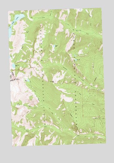
Gash Point, MT USGS Topographic Map
Click on map above to begin viewing in our Map Viewer.

This topographic map contains these locations and features:
Feature Name Type Latitude Longitude GNIS ID View Map
Bear Creek Overlook Point of InterestLocaleN46.3924°W114.2907°794493View Map
Bear Creek TrailheadLocaleN46.3796°W114.2529°794494View Map
Bear LakeLakeN46.4355°W114.3519°779544View Map
Beaver CreekStreamN46.4930°W114.3182°779606View Map
Big Creek Lake DamDamN46.4949°W114.3536°796299View Map
Big Creek LakesReservoirN46.4910°W114.3657°779794View Map
Big Creek Number 2 DamDamN46.4949°W114.3543°795724View Map
Gash PointSummitN46.4335°W114.3198°783854View Map
Glen LakeLakeN46.4528°W114.2875°783986View Map
Hidden LakeLakeN46.4662°W114.3157°784835View Map
Middle Fork Bear CreekStreamN46.4110°W114.3320°787240View Map
North Fork Bear CreekStreamN46.3885°W114.3040°788091View Map
Saint Mary CreekStreamN46.4763°W114.2640°789942View Map
Sky PilotSummitN46.4362°W114.3680°390547View Map
South Fork Bear CreekStreamN46.3885°W114.3043°790904View Map
South Fork Big CreekStreamN46.4924°W114.3382°790906View Map
South Fork LakeLakeN46.4492°W114.3708°790993View Map
Starr MineMineN46.4958°W114.3134°805088View Map
Victor DivisionCivilN46.4142°W114.2557°1940735View Map

Note: Coordinates in the location and feature list above are referenced to NAD83 datum.


Copyright (C) 2008-2025 Ryan Niemi / Sunset Dynamics ... All Rights Reserved