TopoQuest Logo
Do you find TopoQuest useful?
Help keep TopoQuest running and adding new maps/features by donating!
Bitcoin:  19c7KJd3qBynnjoSw5npx9KScwjBe4ifkT
Litecoin:  LXs6TkuXGGXo1vDsWCkWVdjQX94eUKd6ui
Home View Maps Find Maps Find Places Resources & Links


Victor, Montana Topographic Map

USGS Map Title: Victor, MT
USGS Map MRC: 46114D2
DRG (GeoTIFF) Download: o46114d2.tif


Neighboring USGS Topographic Map Quads:


  Saint Joseph Peak, MT  
46114E3
 

  Saint Mary Peak, MT  
46114E2
 

  Stevensville, MT  
46114E1
 

  Gash Point, MT  
46114D3
 

  Victor, MT  
46114D2
 

  Bing, MT  
46114D1
 

  Printz Ridge, MT  
46114C3
 

  Hamilton North, MT  
46114C2
 

  Corvallis, MT  
46114C1


Map MRC Location:

N47°
W115°
N47°
W114°
H8 H7 H6 H5 H4 H3 H2 H1
G8 G7 G6 G5 G4 G3 G2 G1
F8 F7 F6 F5 F4 F3 F2 F1
E8 E7 E6 E5 E4 E3 E2 E1
D8 D7 D6 D5 D4 D3 D2 D1
C8 C7 C6 C5 C4 C3 C2 C1
B8 B7 B6 B5 B4 B3 B2 B1
A8 A7 A6 A5 A4 A3 A2 A1
N46°
W115°
N46°
W114°

Victor, MT USGS 1:24K Topographic Map Preview:
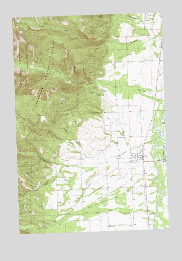
Victor, MT USGS Topographic Map
Click on map above to begin viewing in our Map Viewer.

This topographic map contains these locations and features:
Feature Name Type Latitude Longitude GNIS ID View Map
07N20W07BA__01 WellWellN46.3835°W114.1482°815925View Map
07N21W11BD__01 WellWellN46.3796°W114.1898°815892View Map
08N20W05BA__01 WellWellN46.4838°W114.1279°816485View Map
08N20W05CC__01 WellWellN46.4730°W114.1332°816423View Map
08N20W06CC__01 WellWellN46.4760°W114.1520°816437View Map
08N20W07AB__01 WellWellN46.4694°W114.1437°816403View Map
08N20W18DD__01 WellWellN46.4441°W114.1384°816296View Map
08N20W19BAAD03 WellWellN46.4419°W114.1470°816285View Map
08N20W30CA__01 WellWellN46.4185°W114.1490°816151View Map
08N20W30DC__01 WellWellN46.4149°W114.1437°816124View Map
08N20W31DDD_01 WellWellN46.4013°W114.1354°816055View Map
08N21W24ACDA01 WellWellN46.4377°W114.1629°816270View Map
08N21W24BCBA01 WellWellN46.4388°W114.1745°816275View Map
08N21W26DD__01 WellWellN46.4144°W114.1798°816121View Map
08N21W27DCB_01 WellWellN46.4163°W114.2082°816139View Map
Bear CreekStreamN46.3835°W114.2143°779504View Map
Bell Crossing Fishing Access SiteLocaleN46.4441°W114.1262°1744427View Map
Blue Bird MineMineN46.3899°W114.2323°805081View Map
Calvary Baptist ChurchChurchN46.4146°W114.1482°1803139View Map
Church of the NazareneChurchN46.4169°W114.1526°1803141View Map
Curlew (historical)LocaleN46.4541°W114.1801°1803158View Map
Curlew MineMineN46.4541°W114.1843°805075View Map
Curlew MinesMineN46.4552°W114.1851°781992View Map
Curlew School (historical)SchoolN46.4721°W114.1451°781993View Map
Dineen HillSummitN46.4088°W114.1812°782385View Map
Dunbar (historical)LocaleN46.3985°W114.1440°1803095View Map
Fulkerson GulchValleyN46.4391°W114.1593°794467View Map
Gash CreekStreamN46.4105°W114.1926°783853View Map
House of PraiseChurchN46.4166°W114.1501°1803137View Map
Indian PrairieFlatN46.4758°W114.1579°785275View Map
Kennedy GulchValleyN46.4985°W114.1315°785678View Map
Little Smith CreekStreamN46.4238°W114.1657°786366View Map
McCalla Lake DamDamN46.4916°W114.2409°798391View Map
Mittower (historical)LocaleN46.4583°W114.1287°1803071View Map
North Channel Bear CreekStreamN46.4049°W114.1340°788074View Map
Our Lady of the Bitterroot Chapel of the Society of Saint Pius XChurchN46.4155°W114.1545°1803138View Map
Pleasant View MineMineN46.3880°W114.2307°805082View Map
Printz GulchValleyN46.3810°W114.2218°789194View Map
SE SW Section 15 MineMineN46.4449°W114.2126°805096View Map
Silverthorn CreekStreamN46.4999°W114.1279°790535View Map
Smith CreekStreamN46.4121°W114.1873°790719View Map
South Channel Bear CreekStreamN46.3833°W114.1362°790888View Map
South Gash CreekStreamN46.4002°W114.2418°791097View Map
Sweat House (historical)LocaleN46.4110°W114.1926°1803054View Map
Sweathouse CreekStreamN46.4269°W114.1337°791800View Map
Tudor (historical)LocaleN46.4694°W114.1287°1803050View Map
VictorPopulated PlaceN46.4166°W114.1501°792701View Map
Victor AmbulanceBuildingN46.4174°W114.1477°2738279View Map
Victor BridgeBridgeN46.4146°W114.1265°1803009View Map
Victor CemeteryCemeteryN46.4269°W114.1568°1803178View Map
Victor Census Designated PlaceCensusN46.4161°W114.1492°2409511View Map
Victor Community ChurchChurchN46.4169°W114.1509°1803140View Map
Victor Fire DepartmentBuildingN46.4173°W114.1477°2546730View Map
Victor Heritage MuseumBuildingN46.4174°W114.1493°1803195View Map
Victor ParkParkN46.4169°W114.1468°1803167View Map
Victor Post OfficePost OfficeN46.4177°W114.1478°1803049View Map
Victor SchoolsSchoolN46.4149°W114.1509°1803240View Map

Note: Coordinates in the location and feature list above are referenced to NAD83 datum.


Copyright (C) 2008-2024 Ryan Niemi / Sunset Dynamics ... All Rights Reserved