TopoQuest Logo
Do you find TopoQuest useful?
Help keep TopoQuest running and adding new maps/features by donating!
Bitcoin:  19c7KJd3qBynnjoSw5npx9KScwjBe4ifkT
Litecoin:  LXs6TkuXGGXo1vDsWCkWVdjQX94eUKd6ui
Home View Maps Find Maps Find Places Resources & Links


Hamilton North, Montana Topographic Map

USGS Map Title: Hamilton North, MT
USGS Map MRC: 46114C2
DRG (GeoTIFF) Download: o46114c2.tif


Neighboring USGS Topographic Map Quads:


  Gash Point, MT  
46114D3
 

  Victor, MT  
46114D2
 

  Bing, MT  
46114D1
 

  Printz Ridge, MT  
46114C3
 

  Hamilton North, MT  
46114C2
 

  Corvallis, MT  
46114C1
 

  Ward Mountain, MT  
46114B3
 

  Hamilton South, MT  
46114B2
 

  Mountain House, MT  
46114B1


Map MRC Location:

N47°
W115°
N47°
W114°
H8 H7 H6 H5 H4 H3 H2 H1
G8 G7 G6 G5 G4 G3 G2 G1
F8 F7 F6 F5 F4 F3 F2 F1
E8 E7 E6 E5 E4 E3 E2 E1
D8 D7 D6 D5 D4 D3 D2 D1
C8 C7 C6 C5 C4 C3 C2 C1
B8 B7 B6 B5 B4 B3 B2 B1
A8 A7 A6 A5 A4 A3 A2 A1
N46°
W115°
N46°
W114°

Hamilton North, MT USGS 1:24K Topographic Map Preview:
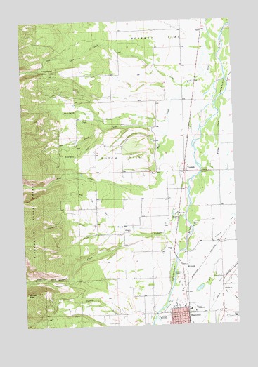
Hamilton North, MT USGS Topographic Map
Click on map above to begin viewing in our Map Viewer.

This topographic map contains these locations and features:
Feature Name Type Latitude Longitude GNIS ID View Map
06N20W05BCCC01 WellWellN46.3058°W114.1345°815292View Map
06N20W06DD__01 WellWellN46.2999°W114.1368°815240View Map
06N20W17BBCA01 WellWellN46.2819°W114.1337°815045View Map
06N20W19CC__01 WellWellN46.2549°W114.1531°814830View Map
06N20W19CCCC02 WellWellN46.2549°W114.1531°814831View Map
06N21W01CA__01 WellWellN46.3033°W114.1679°815265View Map
06N21W02BA__01 WellWellN46.3027°W114.2065°815264View Map
06N21W02DD__01 WellWellN46.2996°W114.1784°815238View Map
06N21W10CBB_01 WellWellN46.2899°W114.2159°815123View Map
06N21W11AABB01 WellWellN46.2960°W114.1784°815187View Map
06N21W11ABAA01 WellWellN46.2977°W114.1834°815206View Map
06N21W11DCCA01 WellWellN46.2855°W114.1851°815079View Map
06N21W12DB__01 WellWellN46.2888°W114.1629°815112View Map
06N21W12DBDA01 WellWellN46.2888°W114.1618°815111View Map
06N21W13CCCD01 WellWellN46.2696°W114.1743°814959View Map
06N21W14BDAC01 WellWellN46.2785°W114.1879°815026View Map
06N21W14DAAD01 WellWellN46.2752°W114.1770°814998View Map
06N21W15CDDD01 WellWellN46.2788°W114.2082°815028View Map
06N21W21ADDB01 WellWellN46.2635°W114.2204°814908View Map
06N21W22BCCA01 WellWellN46.2630°W114.2162°814902View Map
06N21W22CACA01 WellWellN46.2599°W114.2115°814885View Map
06N21W23ADAA01 WellWellN46.2649°W114.1768°814920View Map
06N21W23BABB01 WellWellN46.2688°W114.1907°814954View Map
06N21W23BDDD01 WellWellN46.2621°W114.1870°814897View Map
06N21W23CBCB01 WellWellN46.2596°W114.1965°814883View Map
06N21W23CDCB01 WellWellN46.2558°W114.1918°814845View Map
06N21W23DADA01 WellWellN46.2602°W114.1770°814886View Map
06N21W23DADD01 WellWellN46.2585°W114.1770°814872View Map
06N21W23DDAA01 WellWellN46.2583°W114.1773°814870View Map
06N21W23DDAD01 WellWellN46.2571°W114.1765°814859View Map
06N21W23DDBB01 WellWellN46.2585°W114.1812°814873View Map
06N21W23DDCB01 WellWellN46.2560°W114.1812°814847View Map
06N21W23DDDA01 WellWellN46.2566°W114.1768°814852View Map
06N21W24BAAC01 WellWellN46.2683°W114.1668°814951View Map
06N21W24CB__01 WellWellN46.2596°W114.1732°814882View Map
06N21W24CCAC01 WellWellN46.2580°W114.1720°814863View Map
06N21W24CCBB01 WellWellN46.2577°W114.1757°814861View Map
06N21W24CCBB02 WellWellN46.2583°W114.1757°814869View Map
06N21W24CCCB01 WellWellN46.2555°W114.1754°814843View Map
06N21W24DA__01 WellWellN46.2596°W114.1576°814881View Map
06N21W24DADA01 WellWellN46.2596°W114.1559°814880View Map
06N21W25AA__01 WellWellN46.2524°W114.1576°814811View Map
06N21W26AADD01 WellWellN46.2521°W114.1770°814808View Map
06N21W26ABAD01 WellWellN46.2538°W114.1840°814820View Map
06N21W26BBCA01 WellWellN46.2524°W114.1951°814812View Map
06N21W27BABA01 WellWellN46.2544°W114.2115°814823View Map
07N20W18ABBD01 WellWellN46.3702°W114.1434°815806View Map
07N20W18BB__01 WellWellN46.3691°W114.1534°815795View Map
07N20W19BA__01 WellWellN46.3544°W114.1482°815673View Map
07N20W30BB__01 WellWellN46.3399°W114.1534°815589View Map
07N20W31BB__01 WellWellN46.3255°W114.1534°815468View Map
07N21W13BBAD01 WellWellN46.3696°W114.1723°815798View Map
07N21W22BBAC01 WellWellN46.3546°W114.2151°815680View Map
07N21W22BBDB01 WellWellN46.3544°W114.2148°815674View Map
07N21W23ADB_01 WellWellN46.3519°W114.1807°815654View Map
07N21W25CAB_01 WellWellN46.3330°W114.1707°815531View Map
07N21W34CDB_01 WellWellN46.3152°W114.2123°815380View Map
07N21W35DAC_01 WellWellN46.3174°W114.1818°815394View Map
07N21W36DD__01 WellWellN46.3144°W114.1584°815372View Map
07N21W36DD__03 WellWellN46.3144°W114.1584°815373View Map
Bela (historical)LocaleN46.3235°W114.1529°1803204View Map
Big Sky Eye Care Clinic and OpticalHospitalN46.2596°W114.1565°1803188View Map
Bitter Root Baptist ChurchChurchN46.2555°W114.1426°1803118View Map
Blodgett Canyon CampgroundLocaleN46.2699°W114.2443°780116View Map
Blodgett CemeteryCemeteryN46.2883°W114.1883°780117View Map
Blodgett CreekStreamN46.2892°W114.1603°780118View Map
Blodgett Creek TrailheadLocaleN46.2685°W114.2434°794604View Map
Blodgett ParkParkN46.2944°W114.1590°780121View Map
Blodgett Park Recreation SiteLocaleN46.2960°W114.1570°794605View Map
Cantonment StevensLocaleN46.3416°W114.1315°1803197View Map
Christ CenterChurchN46.2555°W114.1370°1803119View Map
Church of ChristChurchN46.2546°W114.1662°1803111View Map
Churn CreekStreamN46.2924°W114.1632°781269View Map
City of HamiltonCivilN46.2525°W114.1603°2410694View Map
Cow CreekStreamN46.3294°W114.1645°781788View Map
Cow Creek Picnic AreaLocaleN46.3346°W114.2409°794601View Map
DalyLocaleN46.2680°W114.1443°794606View Map
Daly MansionBuildingN46.2652°W114.1356°1802980View Map
Discovery Care CentreHospitalN46.2513°W114.1676°1803193View Map
Discovery SchoolSchoolN46.2510°W114.1579°1803231View Map
Don Mackey PointSummitN46.2641°W114.2432°1765040View Map
Dutch HillSummitN46.3196°W114.1918°782729View Map
Dutch Hill (historical)Populated PlaceN46.3166°W114.1926°1803090View Map
Dutch Hill School (historical)SchoolN46.3166°W114.1926°1803094View Map
First Christian ChurchChurchN46.2535°W114.1606°1803104View Map
Fred Burr CreekStreamN46.3683°W114.1382°783705View Map
Gird CreekStreamN46.2666°W114.1370°783957View Map
Girds Creek Post Office (historical)Post OfficeN46.2658°W114.1356°1803082View Map
Hedditch AirportAirportN46.3467°W114.1707°806395View Map
Johnson (historical)LocaleN46.3596°W114.1440°1803076View Map
Kimp AirportAirportN46.2782°W114.1414°2650663View Map
KLYQ-AM (Hamilton)TowerN46.2560°W114.1634°806613View Map
Marcus Daly Mansion Historical MarkerParkN46.2660°W114.1351°1813138View Map
Mill CreekStreamN46.3485°W114.1523°787363View Map
Montana Neck and Back Pain ClinicHospitalN46.2596°W114.1565°1803189View Map
Mountain View Trailer CourtPopulated PlaceN46.2674°W114.1565°1803019View Map
North West Mobile Home ParkPopulated PlaceN46.3166°W114.1537°1802998View Map
Pines AcademySchoolN46.3294°W114.2168°1803235View Map
PinesdalePopulated PlaceN46.3294°W114.2168°794602View Map
Pinesdale CemeteryCemeteryN46.3294°W114.2168°1803176View Map
Pinesdale Post OfficePost OfficeN46.3277°W114.2180°2738323View Map
Pinesdale Volunteer Fire DepartmentBuildingN46.3274°W114.2187°2546743View Map
Poverty FlatFlatN46.3691°W114.1665°789150View Map
Putman GulchValleyN46.2508°W114.1884°789236View Map
Ravalli County AirportAirportN46.2541°W114.1269°806435View Map
Ravalli County FairgroundsLocaleN46.2569°W114.1537°1803040View Map
Ricketts Memorial MuseumBuildingN46.2546°W114.1809°1803033View Map
RiversidePopulated PlaceN46.2746°W114.1582°789610View Map
Riverside (historical)LocaleN46.2746°W114.1582°1803067View Map
Riverside Post Office (historical)Post OfficeN46.2746°W114.1582°1803068View Map
Riverside RV ParkLocaleN46.2746°W114.1582°1803020View Map
Rocky Mountain Laboratory Historical MarkerParkN46.2549°W114.1568°1803003View Map
Romney RidgeRidgeN46.2638°W114.2487°789756View Map
Sage CreekStreamN46.3310°W114.2004°789904View Map
Sand Flower Mini Shops (historical)LocaleN46.2574°W114.1587°1803175View Map
Sheafman CreekStreamN46.3349°W114.1643°790305View Map
Sheridan GulchValleyN46.3294°W114.2040°790404View Map
Shilo Christian Retreat FellowshipChurchN46.2805°W114.1648°1803113View Map
Tag Alder CreekStreamN46.2913°W114.1970°791859View Map
Tamarack CreekStreamN46.2949°W114.2004°791873View Map
Town of PinesdaleCivilN46.3339°W114.2232°2413135View Map
TuckerPopulated PlaceN46.3708°W114.1426°792433View Map
Tucker Crossing West Fishing Access SiteLocaleN46.3721°W114.1390°1744433View Map
Valley Baptist ChurchChurchN46.2549°W114.1620°1803110View Map
Victor Fire Department Station 2BuildingN46.3706°W114.1929°2546570View Map
Willow CreekStreamN46.3435°W114.1329°793351View Map
WoodsidePopulated PlaceN46.3133°W114.1551°793527View Map
Woodside (historical)LocaleN46.3133°W114.1551°1803045View Map
Woodside BridgeBridgeN46.3124°W114.1457°1803013View Map
Woodside Bridge Fishing Access SiteLocaleN46.3146°W114.1432°1744437View Map
Woodside CrossingPopulated PlaceN46.3127°W114.1451°793528View Map
Woodside Mennonite ChurchChurchN46.3133°W114.1551°1803152View Map
Woodside Post Office (historical)Post OfficeN46.3133°W114.1551°1803044View Map

Note: Coordinates in the location and feature list above are referenced to NAD83 datum.


Copyright (C) 2008-2025 Ryan Niemi / Sunset Dynamics ... All Rights Reserved