TopoQuest Logo
Do you find TopoQuest useful?
Help keep TopoQuest running and adding new maps/features by donating!
Bitcoin:  19c7KJd3qBynnjoSw5npx9KScwjBe4ifkT
Litecoin:  LXs6TkuXGGXo1vDsWCkWVdjQX94eUKd6ui
Home View Maps Find Maps Find Places Resources & Links


Gearhart Mountain, Oregon Topographic Map

USGS Map Title: Gearhart Mountain, OR
USGS Map MRC: 42120D7
DRG (GeoTIFF) Download: o42120d7.tif


Neighboring USGS Topographic Map Quads:


  Sandhill Crossing, OR  
42120E8
 

  Lee Thomas Crossing, OR  
42120E7
 

  Coffeepot Creek, OR  
42120E6
 

  Campbell Reservoir, OR  
42120D8
 

  Gearhart Mountain, OR  
42120D7
 

  Coleman Point, OR  
42120D6
 

  Paradise Mountain, OR  
42120C8
 

  Quartz Valley, OR  
42120C7
 

  Cougar Peak, OR  
42120C6


Map MRC Location:

N43°
W121°
N43°
W120°
H8 H7 H6 H5 H4 H3 H2 H1
G8 G7 G6 G5 G4 G3 G2 G1
F8 F7 F6 F5 F4 F3 F2 F1
E8 E7 E6 E5 E4 E3 E2 E1
D8 D7 D6 D5 D4 D3 D2 D1
C8 C7 C6 C5 C4 C3 C2 C1
B8 B7 B6 B5 B4 B3 B2 B1
A8 A7 A6 A5 A4 A3 A2 A1
N42°
W121°
N42°
W120°

Gearhart Mountain, OR USGS 1:24K Topographic Map Preview:
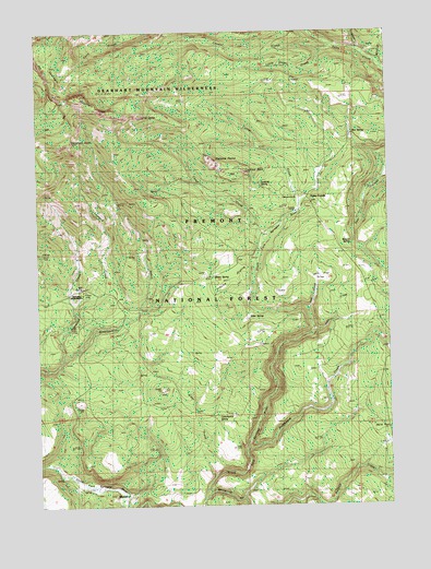
Gearhart Mountain, OR USGS Topographic Map
Click on map above to begin viewing in our Map Viewer.

This topographic map contains these locations and features:
Feature Name Type Latitude Longitude GNIS ID View Map
Alder CreekStreamN42.3829°W120.8139°1116809View Map
Bare FlatFlatN42.3938°W120.7536°1117237View Map
BlaisdellPopulated PlaceN42.3782°W120.8439°1136078View Map
Box SpringSpringN42.4726°W120.7631°1118015View Map
Buckboard CreekStreamN42.3902°W120.8014°1118221View Map
Camp CreekStreamN42.4454°W120.7944°1118498View Map
Cookes CampLocaleN42.4277°W120.7566°1160863View Map
Corral CreekStreamN42.4552°W120.7822°1119293View Map
Corral Creek Recreation SiteLocaleN42.4560°W120.7844°1160864View Map
Cottonwood SpringSpringN42.3983°W120.8124°1119347View Map
Cougar CreekStreamN42.4960°W120.7697°1119367View Map
Coykendall CabinLocaleN42.3779°W120.8453°1167637View Map
Edler SpringSpringN42.4247°W120.8013°1120398View Map
Finley CorralsLocaleN42.4560°W120.7794°1120716View Map
Grouse PrairieFlatN42.4382°W120.8047°1121465View Map
Hammond CreekStreamN42.4135°W120.8672°1121547View Map
Haystack RockSummitN42.4713°W120.8628°1121709View Map
Jack CreekStreamN42.4263°W120.7794°1122318View Map
Jack FlatFlatN42.4349°W120.7725°1122326View Map
Jade CreekStreamN42.4213°W120.7778°1122372View Map
Leonard CreekStreamN42.4282°W120.8628°1123046View Map
Little Cougar CreekStreamN42.4952°W120.7730°1123160View Map
Lookout RockPillarN42.4627°W120.8011°1123471View Map
Lookout Rock LookoutTowerN42.4626°W120.8015°2548777View Map
Lookout Rock TrailheadLocaleN42.4619°W120.8005°2548776View Map
Lookout SpringSpringN42.4600°W120.7965°1123473View Map
Mitchell MonumentParkN42.4315°W120.8611°1124267View Map
Mitchell Recreation AreaParkN42.4318°W120.8611°1638559View Map
Mitten SpringSpringN42.4360°W120.8134°1124269View Map
Palisade RocksSummitN42.4660°W120.8139°1136611View Map
Pothole CreekStreamN42.3771°W120.8166°1125607View Map
Salt SpringSpringN42.4321°W120.8601°1126530View Map
The DomeSummitN42.4774°W120.8372°1127963View Map
Trapper CreekStreamN42.4952°W120.7597°1128207View Map
Utley CabinLocaleN42.3838°W120.8647°1128487View Map
Watson SpringSpringN42.4440°W120.7643°1128738View Map
Wildcat CreekStreamN42.4910°W120.7536°1129060View Map

Note: Coordinates in the location and feature list above are referenced to NAD83 datum.


Copyright (C) 2008-2025 Ryan Niemi / Sunset Dynamics ... All Rights Reserved