TopoQuest Logo
Do you find TopoQuest useful?
Help keep TopoQuest running and adding new maps/features by donating!
Bitcoin:  19c7KJd3qBynnjoSw5npx9KScwjBe4ifkT
Litecoin:  LXs6TkuXGGXo1vDsWCkWVdjQX94eUKd6ui
Home View Maps Find Maps Find Places Resources & Links


Campbell Reservoir, Oregon Topographic Map

USGS Map Title: Campbell Reservoir, OR
USGS Map MRC: 42120D8
DRG (GeoTIFF) Download: o42120d8.tif


Neighboring USGS Topographic Map Quads:


  Rodeo Butte, OR  
42121E1
 

  Sandhill Crossing, OR  
42120E8
 

  Lee Thomas Crossing, OR  
42120E7
 

  Bly, OR  
42121D1
 

  Campbell Reservoir, OR  
42120D8
 

  Gearhart Mountain, OR  
42120D7
 

  Horsefly Mountain, OR  
42121C1
 

  Paradise Mountain, OR  
42120C8
 

  Quartz Valley, OR  
42120C7


Map MRC Location:

N43°
W121°
N43°
W120°
H8 H7 H6 H5 H4 H3 H2 H1
G8 G7 G6 G5 G4 G3 G2 G1
F8 F7 F6 F5 F4 F3 F2 F1
E8 E7 E6 E5 E4 E3 E2 E1
D8 D7 D6 D5 D4 D3 D2 D1
C8 C7 C6 C5 C4 C3 C2 C1
B8 B7 B6 B5 B4 B3 B2 B1
A8 A7 A6 A5 A4 A3 A2 A1
N42°
W121°
N42°
W120°

Campbell Reservoir, OR USGS 1:24K Topographic Map Preview:
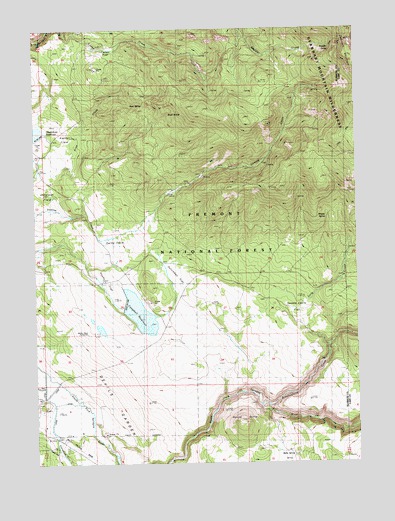
Campbell Reservoir, OR USGS Topographic Map
Click on map above to begin viewing in our Map Viewer.

This topographic map contains these locations and features:
Feature Name Type Latitude Longitude GNIS ID View Map
Anderson FieldFlatN42.4529°W120.9989°1137202View Map
Boulder SpringSpringN42.4944°W120.8856°1138494View Map
Boulder Spring TrailTrailN42.4996°W120.8816°1156412View Map
Boyd SpringSpringN42.4754°W120.9485°1138546View Map
Brownsworth CreekStreamN42.3918°W120.9133°1138694View Map
Butte SpringSpringN42.3772°W120.9012°1139063View Map
Buzz SpringSpringN42.4781°W120.9636°1139077View Map
Campbell DamDamN42.4202°W120.9661°1155534View Map
Campbell ReservoirReservoirN42.4181°W120.9607°1139287View Map
Deming Creek TrailheadLocaleN42.4593°W120.9308°2548193View Map
Dutchman FlatFlatN42.4268°W120.9453°1141440View Map
Gayheart SloughStreamN42.3957°W120.9969°1155307View Map
Gearhart MountainSummitN42.4960°W120.8766°1142597View Map
Hagerhorst MountainsRangeN42.4749°W120.9178°1153865View Map
Keddy FieldFlatN42.4707°W120.9903°1144498View Map
Long CreekStreamN42.4085°W120.8869°1145391View Map
Paddock CampParkN42.4943°W120.9553°1154118View Map
Paradise CreekStreamN42.3835°W120.9794°1147417View Map
Rocky FlatFlatN42.4296°W120.9736°1148659View Map
Round ButteSummitN42.3868°W120.9214°1148756View Map
Seven C RanchLocaleN42.3838°W120.9900°1149247View Map
Swede CabinLocaleN42.4165°W120.8978°1150771View Map
Swede Cabin FlatFlatN42.4227°W120.8983°1150773View Map
Swing FieldSwampN42.4379°W120.9700°1150787View Map
Whisky SpringSpringN42.4454°W120.8878°1152211View Map
Whisky Spring TrailTrailN42.4679°W120.8789°1152215View Map
Yaden FlatFlatN42.4940°W120.9705°1152685View Map

Note: Coordinates in the location and feature list above are referenced to NAD83 datum.


Copyright (C) 2008-2024 Ryan Niemi / Sunset Dynamics ... All Rights Reserved