TopoQuest Logo
Do you find TopoQuest useful?
Help keep TopoQuest running and adding new maps/features by donating!
Bitcoin:  19c7KJd3qBynnjoSw5npx9KScwjBe4ifkT
Litecoin:  LXs6TkuXGGXo1vDsWCkWVdjQX94eUKd6ui
Home View Maps Find Maps Find Places Resources & Links


Quartz Valley, Oregon Topographic Map

USGS Map Title: Quartz Valley, OR
USGS Map MRC: 42120C7
DRG (GeoTIFF) Download: o42120c7.tif


Neighboring USGS Topographic Map Quads:


  Campbell Reservoir, OR  
42120D8
 

  Gearhart Mountain, OR  
42120D7
 

  Coleman Point, OR  
42120D6
 

  Paradise Mountain, OR  
42120C8
 

  Quartz Valley, OR  
42120C7
 

  Cougar Peak, OR  
42120C6
 

  Barnes Valley, OR  
42120B8
 

  Arkansas Flat, OR  
42120B7
 

  Drews Reservoir, OR  
42120B6


Map MRC Location:

N43°
W121°
N43°
W120°
H8 H7 H6 H5 H4 H3 H2 H1
G8 G7 G6 G5 G4 G3 G2 G1
F8 F7 F6 F5 F4 F3 F2 F1
E8 E7 E6 E5 E4 E3 E2 E1
D8 D7 D6 D5 D4 D3 D2 D1
C8 C7 C6 C5 C4 C3 C2 C1
B8 B7 B6 B5 B4 B3 B2 B1
A8 A7 A6 A5 A4 A3 A2 A1
N42°
W121°
N42°
W120°

Quartz Valley, OR USGS 1:24K Topographic Map Preview:
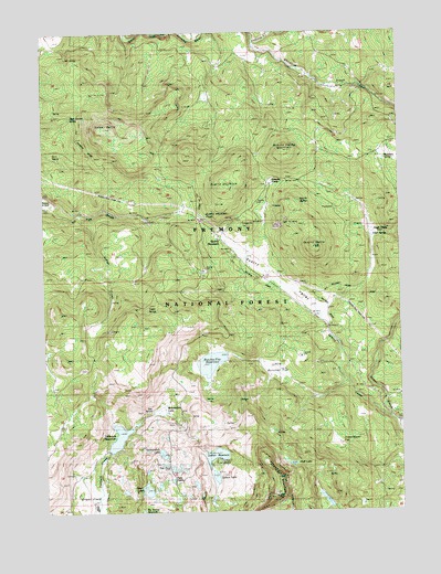
Quartz Valley, OR USGS Topographic Map
Click on map above to begin viewing in our Map Viewer.

This topographic map contains these locations and features:
Feature Name Type Latitude Longitude GNIS ID View Map
Angel CampLocaleN42.3232°W120.7608°1116946View Map
Angel SpringSpringN42.3216°W120.7607°1116948View Map
Beaverdam LakeSwampN42.2763°W120.8355°1117462View Map
Beer Garden SpringSpringN42.3528°W120.8660°1117478View Map
Bill SpringSpringN42.3684°W120.8672°1117699View Map
Buckhorn SpringSpringN42.3414°W120.7558°1118240View Map
Butcher Flat (historical)FlatN42.2929°W120.8178°1167639View Map
Butcher Flat ReservoirReservoirN42.2888°W120.8178°1161294View Map
Dallas Lake DamDamN42.2905°W120.8121°1133499View Map
Doe SpringSpringN42.2766°W120.8389°1120004View Map
Ewauna CampLocaleN42.3363°W120.7969°1120545View Map
Fern SpringSpringN42.3426°W120.8723°1133399View Map
Fishhole Guard StationLocaleN42.2602°W120.8669°1120785View Map
Fishhole MountainSummitN42.2540°W120.7955°1120786View Map
Fishhole Recreation SiteLocaleN42.2535°W120.8166°1952924View Map
Grasshopper FlatFlatN42.2679°W120.7730°1121308View Map
Heart LakeLakeN42.2557°W120.8407°1121722View Map
Heart Lake Landing Boat LaunchLocaleN42.2552°W120.8389°2700200View Map
Heart Lake Recreation SiteLocaleN42.2546°W120.8422°1952927View Map
Holbrook DamDamN42.2665°W120.8528°1131343View Map
Holbrook ReservoirReservoirN42.2694°W120.8505°1121890View Map
Holbrook Reservoir Boat LaunchLocaleN42.2657°W120.8528°2700266View Map
Holbrook Reservoir Recreation SiteLocaleN42.2721°W120.8441°1952928View Map
Indigo CreekStreamN42.3277°W120.8630°1122251View Map
Little Butcher FlatFlatN42.2877°W120.7944°1123144View Map
Lofton Campground Boat RampLocaleN42.2638°W120.8146°2700267View Map
Lofton DamDamN42.2654°W120.8189°1133592View Map
Lofton LakeLakeN42.2590°W120.8166°1123343View Map
Lofton ReservoirReservoirN42.2647°W120.8163°1123344View Map
Lofton Reservoir Recreation SiteLocaleN42.2632°W120.8164°1167638View Map
Mud LakeLakeN42.2623°W120.7894°1124459View Map
North ButteSummitN42.3310°W120.7864°1136577View Map
Ornoname 2 DamDamN42.2599°W120.8561°1163795View Map
Owen ButteSummitN42.3496°W120.8558°1125075View Map
Petes PuddleLakeN42.2582°W120.8316°1125332View Map
Quartz ButteSummitN42.3185°W120.7811°1125725View Map
Quartz CreekStreamN42.2740°W120.7544°1163215View Map
Quartz MountainSummitN42.3346°W120.8128°1125736View Map
Quartz MountainPopulated PlaceN42.3224°W120.8155°1136663View Map
Quartz Mountain PassGapN42.3263°W120.8211°1125739View Map
Quartz Mountain Post Office (historical)Post OfficeN42.3224°W120.8155°1165828View Map
Quartz Mountain Sno-ParkLocaleN42.3254°W120.8219°1952934View Map
Quartz ValleyValleyN42.3015°W120.7802°1125740View Map
Quartz Valley MountainSummitN42.3438°W120.7908°1125741View Map
Spatterdock LakeLakeN42.2651°W120.8352°1127370View Map
Tower SpringSpringN42.3023°W120.8398°1128178View Map
Tule PondLakeN42.2613°W120.8320°1128284View Map
Whitworth CreekStreamN42.3721°W120.8011°1129027View Map

Note: Coordinates in the location and feature list above are referenced to NAD83 datum.


Copyright (C) 2008-2025 Ryan Niemi / Sunset Dynamics ... All Rights Reserved