TopoQuest Logo
Do you find TopoQuest useful?
Help keep TopoQuest running and adding new maps/features by donating!
Bitcoin:  19c7KJd3qBynnjoSw5npx9KScwjBe4ifkT
Litecoin:  LXs6TkuXGGXo1vDsWCkWVdjQX94eUKd6ui
Home View Maps Find Maps Find Places Resources & Links


Genesee Valley, California Topographic Map

USGS Map Title: Genesee Valley, CA
USGS Map MRC: 40120A6
DRG (GeoTIFF) Download: o40120a6.tif


Neighboring USGS Topographic Map Quads:


  Moonlight Peak, CA  
40120B7
 

  Kettle Rock, CA  
40120B6
 

  Antelope Lake, CA  
40120B5
 

  Taylorsville, CA  
40120A7
 

  Genesee Valley, CA  
40120A6
 

  Babcock Peak, CA  
40120A5
 

  Spring Garden, CA  
39120H7
 

  Mount Ingalls, CA  
39120H6
 

  Grizzly Valley, CA  
39120H5


Map MRC Location:

N41°
W121°
N41°
W120°
H8 H7 H6 H5 H4 H3 H2 H1
G8 G7 G6 G5 G4 G3 G2 G1
F8 F7 F6 F5 F4 F3 F2 F1
E8 E7 E6 E5 E4 E3 E2 E1
D8 D7 D6 D5 D4 D3 D2 D1
C8 C7 C6 C5 C4 C3 C2 C1
B8 B7 B6 B5 B4 B3 B2 B1
A8 A7 A6 A5 A4 A3 A2 A1
N40°
W121°
N40°
W120°

Genesee Valley, CA USGS 1:24K Topographic Map Preview:
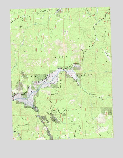
Genesee Valley, CA USGS Topographic Map
Click on map above to begin viewing in our Map Viewer.

This topographic map contains these locations and features:
Feature Name Type Latitude Longitude GNIS ID View Map
Beardsley MineMineN40.1160°W120.7116°218913View Map
Clearwater CreekStreamN40.0399°W120.6505°221200View Map
Davis CreekStreamN40.1113°W120.7116°222047View Map
Drum BridgeBridgeN40.0413°W120.6513°252018View Map
Elephants PlaygroundAreaN40.0793°W120.6316°223091View Map
Flournoy BridgeBridgeN40.0657°W120.6861°252023View Map
Franks ValleyValleyN40.1113°W120.7113°223839View Map
Green FlatFlatN40.1177°W120.7341°224541View Map
Hungry CreekStreamN40.1113°W120.6402°225769View Map
Kessler PeakSummitN40.1079°W120.7402°1658896View Map
Last Chance CreekStreamN40.0657°W120.6761°262331View Map
Middle CreekStreamN40.1188°W120.6424°228583View Map
North Branch Ward CreekStreamN40.0179°W120.7113°229610View Map
Nye CreekStreamN40.0021°W120.7033°264263View Map
Oak FlatFlatN40.0393°W120.6461°254989View Map
Peel RidgeRidgeN40.0229°W120.7419°230465View Map
Rattlesnake RavineValleyN40.0805°W120.6594°231270View Map
Red Clover CreekStreamN40.0577°W120.6688°267166View Map
Rock CreekStreamN40.0493°W120.6655°231708View Map
South Branch Ward CreekStreamN40.0179°W120.7113°267411View Map
Ward CreekStreamN40.0396°W120.7336°237224View Map
Wheeler PeakSummitN40.1032°W120.6855°1660160View Map

Note: Coordinates in the location and feature list above are referenced to NAD83 datum.


Copyright (C) 2008-2025 Ryan Niemi / Sunset Dynamics ... All Rights Reserved