TopoQuest Logo
Do you find TopoQuest useful?
Help keep TopoQuest running and adding new maps/features by donating!
Bitcoin:  19c7KJd3qBynnjoSw5npx9KScwjBe4ifkT
Litecoin:  LXs6TkuXGGXo1vDsWCkWVdjQX94eUKd6ui
Home View Maps Find Maps Find Places Resources & Links


Mount Ingalls, California Topographic Map

USGS Map Title: Mount Ingalls, CA
USGS Map MRC: 39120H6
DRG (GeoTIFF) Download: o39120h6.tif


Neighboring USGS Topographic Map Quads:


  Taylorsville, CA  
40120A7
 

  Genesee Valley, CA  
40120A6
 

  Babcock Peak, CA  
40120A5
 

  Spring Garden, CA  
39120H7
 

  Mount Ingalls, CA  
39120H6
 

  Grizzly Valley, CA  
39120H5
 

  Blue Nose Mountain, CA  
39120G7
 

  Johnsville, CA  
39120G6
 

  Blairsden, CA  
39120G5


Map MRC Location:

N40°
W121°
N40°
W120°
H8 H7 H6 H5 H4 H3 H2 H1
G8 G7 G6 G5 G4 G3 G2 G1
F8 F7 F6 F5 F4 F3 F2 F1
E8 E7 E6 E5 E4 E3 E2 E1
D8 D7 D6 D5 D4 D3 D2 D1
C8 C7 C6 C5 C4 C3 C2 C1
B8 B7 B6 B5 B4 B3 B2 B1
A8 A7 A6 A5 A4 A3 A2 A1
N39°
W121°
N39°
W120°

Mount Ingalls, CA USGS 1:24K Topographic Map Preview:
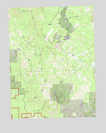
Mount Ingalls, CA USGS Topographic Map
Click on map above to begin viewing in our Map Viewer.

This topographic map contains these locations and features:
Feature Name Type Latitude Longitude GNIS ID View Map
Blakeless CreekStreamN39.9430°W120.6561°257194View Map
Bull Run CreekStreamN39.8752°W120.6544°257670View Map
Cascade CreekStreamN39.9605°W120.6972°258033View Map
Dolly CreekStreamN39.9552°W120.6847°259461View Map
Emigrant CreekStreamN39.9474°W120.6680°259905View Map
Grizzly RidgeRidgeN39.9238°W120.6891°260935View Map
Joseph CreekStreamN39.9680°W120.7102°262024View Map
Little Summit LakeLakeN39.9382°W120.6470°262736View Map
Lovejoy (historical)Populated PlaceN39.9452°W120.6583°1701378View Map
Lovejoy CreekStreamN39.9446°W120.6608°262980View Map
McDermott RavineValleyN39.8807°W120.7044°263336View Map
Middle Branch Ward CreekStreamN39.9971°W120.6999°263497View Map
Missouri GulchValleyN39.8768°W120.6313°263707View Map
Mount IngallsSummitN39.9938°W120.6274°1658822View Map
Nye MeadowsFlatN39.9874°W120.6502°264264View Map
Oliver CreekStreamN39.9852°W120.7152°264348View Map
Paradise CreekStreamN39.9430°W120.6563°264509View Map
Rock CreekStreamN39.9046°W120.7419°265474View Map
South Fork Long Valley CreekStreamN39.8755°W120.6316°267474View Map
Summit MarshSwampN39.9339°W120.6301°267936View Map
Turner RidgeRidgeN39.9941°W120.6274°253633View Map
Walker Consolidated MineMineN39.9691°W120.6894°1666681View Map
Walker MineMineN39.9660°W120.6647°268751View Map
Walker Mine Compressor (historical)LocaleN39.9924°W120.6680°1666682View Map
Walker Mine Tailings DamDamN39.9549°W120.6811°1664712View Map
Walker Mine Tailings ReservoirReservoirN39.9549°W120.6811°1664713View Map
Walkermine (historical)Populated PlaceN39.9638°W120.6677°1666683View Map

Note: Coordinates in the location and feature list above are referenced to NAD83 datum.


Copyright (C) 2008-2025 Ryan Niemi / Sunset Dynamics ... All Rights Reserved