TopoQuest Logo
Do you find TopoQuest useful?
Help keep TopoQuest running and adding new maps/features by donating!
Bitcoin:  19c7KJd3qBynnjoSw5npx9KScwjBe4ifkT
Litecoin:  LXs6TkuXGGXo1vDsWCkWVdjQX94eUKd6ui
Home View Maps Find Maps Find Places Resources & Links


Genoa, Florida Topographic Map

USGS Map Title: Genoa, FL
USGS Map MRC: 30082D7
DRG (GeoTIFF) Download: o30082d7.tif


Neighboring USGS Topographic Map Quads:


  Jasper, FL  
30082E8
 

  Cypress Creek, FL  
30082E7
 

  Fargo SW, FL  
30082E6
 

  Hillcoat, FL  
30082D8
 

  Genoa, FL  
30082D7
 

  Benton, FL  
30082D6
 

  Live Oak East, FL  
30082C8
 

  White Springs West, FL  
30082C7
 

  White Springs East, FL  
30082C6


Map MRC Location:

N31°
W83°
N31°
W82°
H8 H7 H6 H5 H4 H3 H2 H1
G8 G7 G6 G5 G4 G3 G2 G1
F8 F7 F6 F5 F4 F3 F2 F1
E8 E7 E6 E5 E4 E3 E2 E1
D8 D7 D6 D5 D4 D3 D2 D1
C8 C7 C6 C5 C4 C3 C2 C1
B8 B7 B6 B5 B4 B3 B2 B1
A8 A7 A6 A5 A4 A3 A2 A1
N30°
W83°
N30°
W82°

Genoa, FL USGS 1:24K Topographic Map Preview:
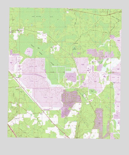
Genoa, FL USGS Topographic Map
Click on map above to begin viewing in our Map Viewer.

This topographic map contains these locations and features:
Feature Name Type Latitude Longitude GNIS ID View Map
Altmans BaySwampN30.4210°W82.7811°277824View Map
Barton CemeteryCemeteryN30.4880°W82.8710°278133View Map
BelmontPopulated PlaceN30.4983°W82.7507°294673View Map
Blacks StillPopulated PlaceN30.4669°W82.8021°294687View Map
Camp Branch ChurchChurchN30.3938°W82.8660°279879View Map
Camps StillPopulated PlaceN30.4324°W82.8671°307719View Map
Cheshire BaySwampN30.4502°W82.7708°280371View Map
Christie Lookout TowerTowerN30.4997°W82.8024°280428View Map
Friendship ChurchChurchN30.4772°W82.8726°282824View Map
GenoaPopulated PlaceN30.4005°W82.8349°294784View Map
Hamilton County Fire and Rescue Department Genoa StationBuildingN30.3940°W82.8579°2644337View Map
Hog HammockSwampN30.4605°W82.8015°284080View Map
Long PondSwampN30.4447°W82.7924°286055View Map
Occidental Railroad StationLocaleN30.3994°W82.8193°300921View Map
Occidental Wildlife Management AreaParkN30.4483°W82.7601°308572View Map
Pine IslandIslandN30.4613°W82.8435°288866View Map
Poole PondLakeN30.4492°W82.7784°289187View Map
Poole Pond CemeteryCemeteryN30.4491°W82.7762°289188View Map
Purvis StillPopulated PlaceN30.4283°W82.7604°294900View Map
Smith Creek ChurchChurchN30.3783°W82.7907°300920View Map
Spring Branch CemeteryCemeteryN30.4783°W82.8657°291523View Map
Spring Branch ChurchChurchN30.4769°W82.8743°291524View Map
Swift CreekSwampN30.4530°W82.8326°291962View Map
Swift Creek SwampSwampN30.4379°W82.8220°307371View Map

Note: Coordinates in the location and feature list above are referenced to NAD83 datum.


Copyright (C) 2008-2025 Ryan Niemi / Sunset Dynamics ... All Rights Reserved