TopoQuest Logo
Do you find TopoQuest useful?
Help keep TopoQuest running and adding new maps/features by donating!
Bitcoin:  19c7KJd3qBynnjoSw5npx9KScwjBe4ifkT
Litecoin:  LXs6TkuXGGXo1vDsWCkWVdjQX94eUKd6ui
Home View Maps Find Maps Find Places Resources & Links


White Springs East, Florida Topographic Map

USGS Map Title: White Springs East, FL
USGS Map MRC: 30082C6
DRG (GeoTIFF) Download: o30082c6.tif


Neighboring USGS Topographic Map Quads:


  Genoa, FL  
30082D7
 

  Benton, FL  
30082D6
 

  Fairview, FL  
30082D5
 

  White Springs West, FL  
30082C7
 

  White Springs East, FL  
30082C6
 

  Deep Creek, FL  
30082C5
 

  Wellborn, FL  
30082B7
 

  Lake City West, FL  
30082B6
 

  Lake City East, FL  
30082B5


Map MRC Location:

N31°
W83°
N31°
W82°
H8 H7 H6 H5 H4 H3 H2 H1
G8 G7 G6 G5 G4 G3 G2 G1
F8 F7 F6 F5 F4 F3 F2 F1
E8 E7 E6 E5 E4 E3 E2 E1
D8 D7 D6 D5 D4 D3 D2 D1
C8 C7 C6 C5 C4 C3 C2 C1
B8 B7 B6 B5 B4 B3 B2 B1
A8 A7 A6 A5 A4 A3 A2 A1
N30°
W83°
N30°
W82°

White Springs East, FL USGS 1:24K Topographic Map Preview:
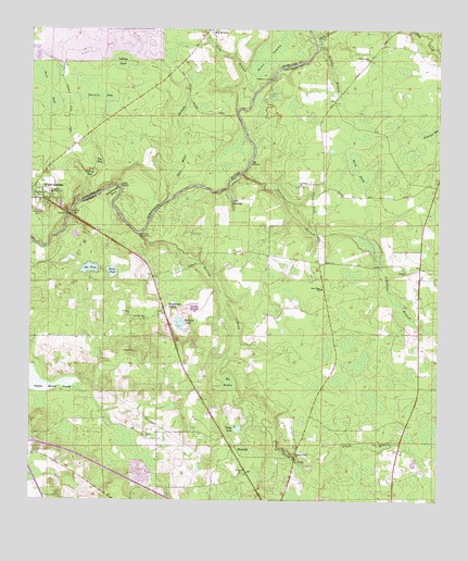
White Springs East, FL USGS Topographic Map
Click on map above to begin viewing in our Map Viewer.

This topographic map contains these locations and features:
Feature Name Type Latitude Longitude GNIS ID View Map
Barbara LakeLakeN30.2972°W82.7038°278092View Map
Bell SpringsSpringN30.3288°W82.6876°278436View Map
Big PrairieSwampN30.2815°W82.6894°278730View Map
Big ShoalsBarN30.3397°W82.6823°278742View Map
Big Shoals State ParkParkN30.3391°W82.6832°1946052View Map
Bird PondSwampN30.3394°W82.6505°278835View Map
Bottom BaySwampN30.3367°W82.7332°279274View Map
Browns BranchStreamN30.3711°W82.6607°279490View Map
Browns LandingLocaleN30.3694°W82.6615°295156View Map
Bull BaySwampN30.3604°W82.7446°279633View Map
Cabbage HeadSwampN30.3664°W82.7229°279791View Map
Carver High SchoolSchoolN30.3311°W82.7440°280096View Map
Corinth ChurchChurchN30.3097°W82.6343°280832View Map
Deep CreekStreamN30.3708°W82.6621°305560View Map
Deep Creek ChurchChurchN30.3669°W82.6462°281423View Map
Dicks LakeLakeN30.2692°W82.6860°281558View Map
Ed Scott BridgeBridgeN30.3255°W82.7382°282075View Map
Falling CreekStreamN30.2652°W82.6735°307382View Map
Falling CreekStreamN30.3205°W82.7160°282365View Map
Falling Creek ChurchChurchN30.2622°W82.6682°282366View Map
Falling Creek ChurchChurchN30.2658°W82.6426°282367View Map
Four Mile BranchStreamN30.3294°W82.7073°282738View Map
Gar PondLakeN30.3116°W82.7318°282913View Map
Horse PondLakeN30.3108°W82.7248°284283View Map
Indian Mound SwampSwampN30.2808°W82.7451°284522View Map
Little ShoalsBarN30.3327°W82.7226°285817View Map
Long BranchPopulated PlaceN30.3727°W82.6932°295416View Map
Long BranchStreamN30.3577°W82.6810°285970View Map
McAlpin LandingLocaleN30.3619°W82.6754°295438View Map
New Hope ChurchChurchN30.3008°W82.6598°301074View Map
New Hope SchoolSchoolN30.3061°W82.6604°287647View Map
New Mount Zion ChurchChurchN30.2977°W82.7140°287662View Map
Onemile BayReservoirN30.3574°W82.7288°288158View Map
Railroad BaySwampN30.3475°W82.6282°289438View Map
River SwampSwampN30.3670°W82.6802°289734View Map
Riverside CemeteryCemeteryN30.3269°W82.7479°289740View Map
Robinson CreekStreamN30.3361°W82.6854°305192View Map
Saint James ChurchChurchN30.3330°W82.6676°290190View Map
Saint Paul Missionary Baptist ChurchChurchN30.2571°W82.6839°2450161View Map
Saint Pauls ChurchChurchN30.2563°W82.6848°290352View Map
Saint Pauls ChurchChurchN30.2986°W82.7190°290353View Map
Scarborough BendBendN30.3316°W82.7235°290738View Map
Suwannee ValleyPopulated PlaceN30.2991°W82.7082°295658View Map
Suwannee Valley Volunteer Fire Department Station 42BuildingN30.2744°W82.6956°2644584View Map
Top BaySwampN30.3401°W82.7292°292368View Map
Union ChurchChurchN30.2666°W82.7143°292661View Map
Waldron LandingLocaleN30.3208°W82.7168°307370View Map
WinfieldPopulated PlaceN30.2630°W82.6860°295713View Map

Note: Coordinates in the location and feature list above are referenced to NAD83 datum.


Copyright (C) 2008-2025 Ryan Niemi / Sunset Dynamics ... All Rights Reserved