TopoQuest Logo
Do you find TopoQuest useful?
Help keep TopoQuest running and adding new maps/features by donating!
Bitcoin:  19c7KJd3qBynnjoSw5npx9KScwjBe4ifkT
Litecoin:  LXs6TkuXGGXo1vDsWCkWVdjQX94eUKd6ui
Home View Maps Find Maps Find Places Resources & Links


Gentryville, Missouri Topographic Map

USGS Map Title: Gentryville, MO
USGS Map MRC: 36092G3
DRG (GeoTIFF) Download: o36092g3.tif


Neighboring USGS Topographic Map Quads:


  Brushyknob, MO  
36092H4
 

  Vanzant, MO  
36092H3
 

  Nichols Knob, MO  
36092H2
 

  Rockbridge, MO  
36092G4
 

  Gentryville, MO  
36092G3
 

  Dora, MO  
36092G2
 

  Gainesville NW, MO  
36092F4
 

  Sycamore, MO  
36092F3
 

  Cureall NW, MO  
36092F2


Map MRC Location:

N37°
W93°
N37°
W92°
H8 H7 H6 H5 H4 H3 H2 H1
G8 G7 G6 G5 G4 G3 G2 G1
F8 F7 F6 F5 F4 F3 F2 F1
E8 E7 E6 E5 E4 E3 E2 E1
D8 D7 D6 D5 D4 D3 D2 D1
C8 C7 C6 C5 C4 C3 C2 C1
B8 B7 B6 B5 B4 B3 B2 B1
A8 A7 A6 A5 A4 A3 A2 A1
N36°
W93°
N36°
W92°

Gentryville, MO USGS 1:24K Topographic Map Preview:
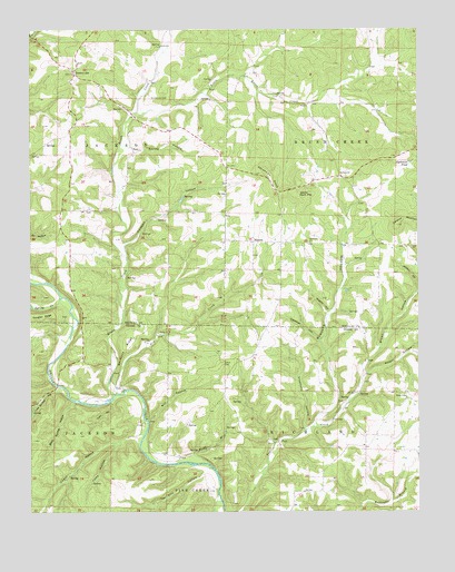
Gentryville, MO USGS Topographic Map
Click on map above to begin viewing in our Map Viewer.

This topographic map contains these locations and features:
Feature Name Type Latitude Longitude GNIS ID View Map
Abrahams KnobSummitN36.8378°W92.2988°713128View Map
Backbone RidgeRidgeN36.7923°W92.3452°713520View Map
Blackjack ChurchChurchN36.8201°W92.2852°714326View Map
Blackjack School (historical)SchoolN36.8198°W92.2857°734262View Map
BlanchePopulated PlaceN36.8201°W92.3032°714351View Map
Boat Gunnel HollowValleyN36.7787°W92.3621°714459View Map
Brown HollowValleyN36.7806°W92.2704°749042View Map
Brush CreekStreamN36.7803°W92.3488°749057View Map
Burgess HollowValleyN36.7728°W92.2840°749116View Map
Cane Bottom HollowValleyN36.7801°W92.3635°715338View Map
Cedar Tree School (historical)SchoolN36.7548°W92.2829°733798View Map
Crenshaw HollowValleyN36.7948°W92.2827°716484View Map
Devils Rock PileSummitN36.8328°W92.2902°716866View Map
Douglas RidgeRidgeN36.8009°W92.3710°717009View Map
Dry CreekStreamN36.7806°W92.3471°717084View Map
Eaton CemeteryCemeteryN36.7884°W92.3138°717371View Map
Ford HollowValleyN36.7784°W92.3490°718066View Map
GentryvillePopulated PlaceN36.8639°W92.3607°718391View Map
Hale CemeteryCemeteryN36.7801°W92.2538°718991View Map
Henderson CemeteryCemeteryN36.8573°W92.3365°719371View Map
Hickory Flat SchoolSchoolN36.8617°W92.3374°734258View Map
Little Brush CreekStreamN36.8526°W92.3413°721173View Map
Mill HollowValleyN36.7737°W92.3374°722347View Map
Muddy BranchStreamN36.7626°W92.3182°723028View Map
Owens HollowValleyN36.7695°W92.3413°723910View Map
Polepan HollowValleyN36.8189°W92.3454°724710View Map
Polepen SchoolSchoolN36.8214°W92.3399°734259View Map
Rieger HollowValleyN36.7856°W92.2674°751874View Map
Roberts HollowValleyN36.8014°W92.2799°725402View Map
Saint Johns ChurchChurchN36.8370°W92.2752°725777View Map
Sedan (historical)Populated PlaceN36.8578°W92.3093°733892View Map
Silver Shade SchoolSchoolN36.7795°W92.3132°734263View Map
Simpson MountainSummitN36.8242°W92.2571°752174View Map
Spring CreekStreamN36.8056°W92.3654°752304View Map
Spring HollowValleyN36.8448°W92.3435°726933View Map
Stephens HollowValleyN36.7717°W92.2874°727071View Map
Sycamore PondLakeN36.8405°W92.2529°727418View Map
Tar Kiln HollowValleyN36.7612°W92.3196°727461View Map
Township of Brush CreekCivilN36.8411°W92.2574°766615View Map
Township of JacksonCivilN36.8430°W92.3663°766624View Map
TrailPopulated PlaceN36.7681°W92.2957°741328View Map
Trail CemeteryCemeteryN36.7737°W92.2785°727754View Map
Trail Church (historical)ChurchN36.7748°W92.2777°734264View Map
Tuley HollowValleyN36.7676°W92.3471°727829View Map
Upper Brixey SchoolSchoolN36.7826°W92.3632°734260View Map
Whiteoak Grove School (historical)SchoolN36.8634°W92.2827°734261View Map
Wolfden HollowValleyN36.8081°W92.2507°729075View Map

Note: Coordinates in the location and feature list above are referenced to NAD83 datum.


Copyright (C) 2008-2024 Ryan Niemi / Sunset Dynamics ... All Rights Reserved