TopoQuest Logo
Do you find TopoQuest useful?
Help keep TopoQuest running and adding new maps/features by donating!
Bitcoin:  19c7KJd3qBynnjoSw5npx9KScwjBe4ifkT
Litecoin:  LXs6TkuXGGXo1vDsWCkWVdjQX94eUKd6ui
Home View Maps Find Maps Find Places Resources & Links


Brushyknob, Missouri Topographic Map

USGS Map Title: Brushyknob, MO
USGS Map MRC: 36092H4
DRG (GeoTIFF) Download: o36092h4.tif


Neighboring USGS Topographic Map Quads:


  Mansfield, MO  
37092A5
 

  Norwood, MO  
37092A4
 

  Mountain Grove South, MO  
37092A3
 

  Sweden, MO  
36092H5
 

  Brushyknob, MO  
36092H4
 

  Vanzant, MO  
36092H3
 

  Wasola, MO  
36092G5
 

  Rockbridge, MO  
36092G4
 

  Gentryville, MO  
36092G3


Map MRC Location:

N37°
W93°
N37°
W92°
H8 H7 H6 H5 H4 H3 H2 H1
G8 G7 G6 G5 G4 G3 G2 G1
F8 F7 F6 F5 F4 F3 F2 F1
E8 E7 E6 E5 E4 E3 E2 E1
D8 D7 D6 D5 D4 D3 D2 D1
C8 C7 C6 C5 C4 C3 C2 C1
B8 B7 B6 B5 B4 B3 B2 B1
A8 A7 A6 A5 A4 A3 A2 A1
N36°
W93°
N36°
W92°

Brushyknob, MO USGS 1:24K Topographic Map Preview:
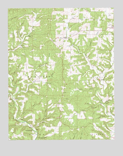
Brushyknob, MO USGS Topographic Map
Click on map above to begin viewing in our Map Viewer.

This topographic map contains these locations and features:
Feature Name Type Latitude Longitude GNIS ID View Map
Austin HollowValleyN36.8987°W92.3799°748627View Map
Banner School (historical)SchoolN36.9453°W92.4277°734242View Map
Bluegrass HollowValleyN36.9306°W92.4716°714438View Map
BrushyknobPopulated PlaceN36.9648°W92.4860°740700View Map
Brushyknob ChurchChurchN36.9556°W92.4807°714926View Map
Brushyknob Post Office (historical)Post OfficeN36.9651°W92.4863°1848182View Map
Brushyknob SchoolSchoolN36.9534°W92.4816°734238View Map
Callaway Riley SpringSpringN36.9734°W92.4766°715206View Map
Cane HollowValleyN36.8867°W92.4699°715351View Map
ChampionPopulated PlaceN36.9314°W92.3910°740734View Map
Champion School (historical)SchoolN36.9306°W92.3916°733878View Map
CheneyPopulated PlaceN36.9070°W92.4416°734239View Map
Clever CreekStreamN36.9381°W92.3877°715974View Map
Clever Creek CemeteryCemeteryN36.9634°W92.4265°715975View Map
Clever Creek Church (historical)ChurchN36.9639°W92.4268°734241View Map
Cold Springs School (historical)SchoolN36.9745°W92.4316°733877View Map
ColdspringPopulated PlaceN36.9717°W92.4304°740756View Map
Coonts HollowValleyN36.9092°W92.3916°716273View Map
Coonts RidgeRidgeN36.9217°W92.3804°716274View Map
Crane HollowValleyN36.8976°W92.3838°716464View Map
Days SpringsSpringN36.9117°W92.3918°734243View Map
Dobbs HollowValleyN36.9084°W92.3874°749669View Map
Douglas CountyCivilN36.9326°W92.4988°758488View Map
East Dogwood SchoolSchoolN36.9048°W92.4071°734240View Map
EvansPopulated PlaceN36.8959°W92.4407°740840View Map
Greasy CreekStreamN36.9520°W92.3768°750127View Map
Hunter CreekStreamN36.9170°W92.4943°720016View Map
McCratic HollowValleyN36.9223°W92.3927°735715View Map
Negro Henry HollowValleyN36.9695°W92.4832°723155View Map
New Hope CemeteryCemeteryN36.9003°W92.3829°723228View Map
New Hope Church (historical)ChurchN36.9001°W92.3824°734244View Map
Page HollowValleyN36.9359°W92.4963°723959View Map
Planer BranchStreamN36.8937°W92.4893°724462View Map
Rail HollowValleyN36.9262°W92.4918°725071View Map
Skyline SchoolSchoolN36.9689°W92.4479°726521View Map
Skyline Volunteer Fire DepartmentBuildingN36.9702°W92.4510°2621270View Map
Sweden HollowValleyN36.9084°W92.4918°735875View Map
Township of McMurtreyCivilN36.9320°W92.4719°766627View Map
Vera CruzPopulated PlaceN36.9139°W92.4935°728164View Map
Vera Cruz School (historical)SchoolN36.9178°W92.4979°733876View Map
Wilson HollowValleyN36.9192°W92.4893°728972View Map
Wolfpen HollowValleyN36.9570°W92.4091°729079View Map

Note: Coordinates in the location and feature list above are referenced to NAD83 datum.


Copyright (C) 2008-2025 Ryan Niemi / Sunset Dynamics ... All Rights Reserved