TopoQuest Logo
Do you find TopoQuest useful?
Help keep TopoQuest running and adding new maps/features by donating!
Bitcoin:  19c7KJd3qBynnjoSw5npx9KScwjBe4ifkT
Litecoin:  LXs6TkuXGGXo1vDsWCkWVdjQX94eUKd6ui
Home View Maps Find Maps Find Places Resources & Links


Gibbons School, Montana Topographic Map

USGS Map Title: Gibbons School, MT
USGS Map MRC: 45113F5
DRG (GeoTIFF) Download: o45113f5.tif


Neighboring USGS Topographic Map Quads:


  Bender Point, MT  
45113G6
 

  Mussigbrod Lake, MT  
45113G5
 

  Pintler Lake, MT  
45113G4
 

  Big Hole Battlefield, MT  
45113F6
 

  Gibbons School, MT  
45113F5
 

  Mud Lake, MT  
45113F4
 

  Isaac Meadows, MT  
45113E6
 

  Highland Ranch, MT  
45113E5
 

  Wisdom, MT  
45113E4


Map MRC Location:

N46°
W114°
N46°
W113°
H8 H7 H6 H5 H4 H3 H2 H1
G8 G7 G6 G5 G4 G3 G2 G1
F8 F7 F6 F5 F4 F3 F2 F1
E8 E7 E6 E5 E4 E3 E2 E1
D8 D7 D6 D5 D4 D3 D2 D1
C8 C7 C6 C5 C4 C3 C2 C1
B8 B7 B6 B5 B4 B3 B2 B1
A8 A7 A6 A5 A4 A3 A2 A1
N45°
W114°
N45°
W113°

Gibbons School, MT USGS 1:24K Topographic Map Preview:
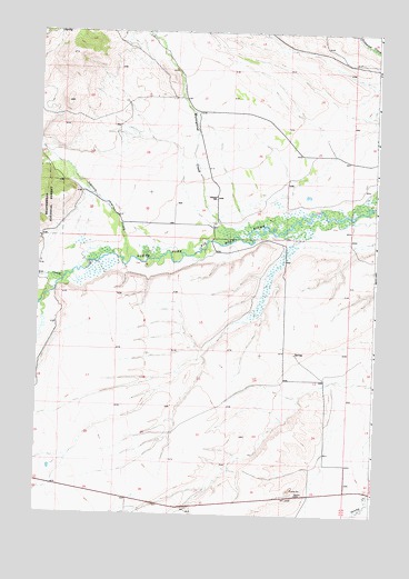
Gibbons School, MT USGS Topographic Map
Click on map above to begin viewing in our Map Viewer.

This topographic map contains these locations and features:
Feature Name Type Latitude Longitude GNIS ID View Map
01S16W16BDAD01 WellWellN45.7496°W113.5862°811650View Map
01S16W22CDAB01 WellWellN45.7291°W113.5662°811478View Map
01S16W34BCCB01 WellWellN45.7055°W113.5745°811286View Map
01S16W34DBDD01 WellWellN45.7010°W113.5612°811252View Map
02S16W07DAAD01 WellWellN45.6741°W113.6173°811034View Map
Eastern Pacific MineMineN45.6380°W113.5306°804552View Map
Fred ElseLocaleN45.6958°W113.6226°801967View Map
Gallup RanchLocaleN45.7230°W113.5195°801954View Map
GibbonsLocaleN45.6985°W113.5628°801950View Map
Gibbons Post Office (historical)Post OfficeN45.6985°W113.5628°1797237View Map
Gibbons School (historical)SchoolN45.7077°W113.5601°771755View Map
Johnson CreekStreamN45.6916°W113.5909°785524View Map
L'ElseLocaleN45.7002°W113.5584°801947View Map
M HeggelundLocaleN45.7488°W113.5876°801955View Map
Mussigbrod CreekStreamN45.6971°W113.5520°787886View Map
O HeggelundLocaleN45.7335°W113.5815°801957View Map
Parsons RanchLocaleN45.7277°W113.5637°801956View Map
Ray BaconLocaleN45.7049°W113.5981°801948View Map
RitscheLocaleN45.6746°W113.6190°801951View Map
Thompson CreekStreamN45.7458°W113.5006°792084View Map
Tie CreekStreamN45.6863°W113.6153°792161View Map
Tope RanchLocaleN45.6996°W113.5612°801949View Map

Note: Coordinates in the location and feature list above are referenced to NAD83 datum.


Copyright (C) 2008-2025 Ryan Niemi / Sunset Dynamics ... All Rights Reserved