TopoQuest Logo
Do you find TopoQuest useful?
Help keep TopoQuest running and adding new maps/features by donating!
Bitcoin:  19c7KJd3qBynnjoSw5npx9KScwjBe4ifkT
Litecoin:  LXs6TkuXGGXo1vDsWCkWVdjQX94eUKd6ui
Home View Maps Find Maps Find Places Resources & Links


Gibsonville, North Carolina Topographic Map

USGS Map Title: Gibsonville, NC
USGS Map MRC: 36079A5
DRG (GeoTIFF) Download: o36079a5.tif


Neighboring USGS Topographic Map Quads:


  Browns Summit, NC  
36079B6
 

  Ossipee, NC  
36079B5
 

  Lake Burlington, NC  
36079B4
 

  McLeansville, NC  
36079A6
 

  Gibsonville, NC  
36079A5
 

  Burlington, NC  
36079A4
 

  Climax, NC  
35079H6
 

  Kimesville, NC  
35079H5
 

  Snow Camp, NC  
35079H4


Map MRC Location:

N37°
W80°
N37°
W79°
H8 H7 H6 H5 H4 H3 H2 H1
G8 G7 G6 G5 G4 G3 G2 G1
F8 F7 F6 F5 F4 F3 F2 F1
E8 E7 E6 E5 E4 E3 E2 E1
D8 D7 D6 D5 D4 D3 D2 D1
C8 C7 C6 C5 C4 C3 C2 C1
B8 B7 B6 B5 B4 B3 B2 B1
A8 A7 A6 A5 A4 A3 A2 A1
N36°
W80°
N36°
W79°

Gibsonville, NC USGS 1:24K Topographic Map Preview:
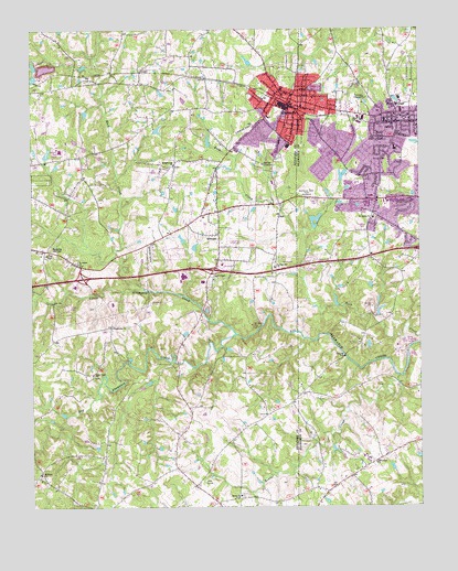
Gibsonville, NC USGS Topographic Map
Click on map above to begin viewing in our Map Viewer.

This topographic map contains these locations and features:
Feature Name Type Latitude Longitude GNIS ID View Map
Alamance Battleground Historic SiteLocaleN36.0250°W79.5194°1955468View Map
Alamance Memorial ParkCemeteryN36.0824°W79.5359°980073View Map
Alamance Regional Medical CenterHospitalN36.0612°W79.5022°2701536View Map
Allen HouseBuildingN36.0251°W79.5275°1955469View Map
Beaver CreekStreamN36.0343°W79.5056°980792View Map
Beth Schmidt ParkParkN36.0942°W79.5203°2542541View Map
Brick ChurchChurchN36.0035°W79.5581°981864View Map
Brightwood ChurchChurchN36.0896°W79.5786°981906View Map
Burlington QuarryMineN36.0531°W79.5175°2648432View Map
Clapps ChapelChurchN36.0599°W79.5664°983207View Map
Clayton Airpark (historical)AirportN36.0649°W79.5853°998021View Map
Country Club AcresPopulated PlaceN36.0907°W79.5072°1003483View Map
DeerfieldPopulated PlaceN36.0787°W79.5034°1003488View Map
Eastern High SchoolSchoolN36.0924°W79.6142°1006602View Map
ElonPopulated PlaceN36.1029°W79.5067°984756View Map
Elon Elementary SchoolSchoolN36.1029°W79.5067°1003492View Map
Elon Fire Department Station 1BuildingN36.0978°W79.5068°2638293View Map
Elon Post OfficePost OfficeN36.1001°W79.5063°2774133View Map
Elon University Campus Police DepartmentBuildingN36.1047°W79.5078°2769570View Map
Gerrards LakeReservoirN36.0988°W79.5839°1000071View Map
Gerrards Lake DamDamN36.0985°W79.5847°1000070View Map
GibsonvillePopulated PlaceN36.1057°W79.5422°985675View Map
Gibsonville Elementary SchoolSchoolN36.1090°W79.5439°1006601View Map
Gibsonville Fire Department Station 6BuildingN36.1071°W79.5400°2638460View Map
Gibsonville Police DepartmentBuildingN36.1061°W79.5430°2769564View Map
Gibsonville Post OfficePost OfficeN36.1056°W79.5404°2773839View Map
Glenwood AcresPopulated PlaceN36.0787°W79.5250°1003487View Map
Guilford County Sheriff's Office - District 2BuildingN36.0649°W79.6084°2769604View Map
Little Alamance CreekStreamN36.0454°W79.5592°988527View Map
Mark ViewPopulated PlaceN36.0740°W79.5131°1003489View Map
McEwen Estate DamDamN36.0801°W79.5247°1000031View Map
McLean Brothers AirportAirportN36.0983°W79.5556°998028View Map
Morgan Place ParkParkN36.0975°W79.5144°2542542View Map
Mount Hope ChurchChurchN36.0090°W79.6220°990418View Map
Random HillsPopulated PlaceN36.0782°W79.5195°1005496View Map
Rock CreekStreamN36.0574°W79.5889°993494View Map
Rock Creek ChurchChurchN36.0349°W79.6053°993498View Map
Saint James ChurchChurchN36.0640°W79.6100°993917View Map
SedaliaPopulated PlaceN36.0674°W79.6206°994476View Map
Sedalia Post OfficePost OfficeN36.0678°W79.6211°2780613View Map
Springdale ChurchChurchN36.0115°W79.5145°995363View Map
Springwood ChurchChurchN36.0629°W79.5464°995373View Map
Superior Stone Company LakeReservoirN36.1185°W79.6114°1000119View Map
Superior Stone Company Lake DamDamN36.1185°W79.6114°1000118View Map
The CountryPopulated PlaceN36.0462°W79.5178°1003491View Map
Town of ElonCivilN36.1008°W79.5081°2406445View Map
Town of GibsonvilleCivilN36.0990°W79.5421°2406565View Map
Town of SedaliaCivilN36.0760°W79.6207°2407307View Map
Town of WhitsettCivilN36.0784°W79.5721°2406883View Map
Township 3-Boone StationCivilN36.0984°W79.5085°1026345View Map
Township of Rock CreekCivilN36.0715°W79.5803°1026745View Map
Wadworth ChurchChurchN36.0474°W79.5986°996668View Map
WestbrookPopulated PlaceN36.0946°W79.5245°1003485View Map
Westbrook ForestPopulated PlaceN36.0971°W79.5284°1003486View Map
WestviewPopulated PlaceN36.0924°W79.5139°1003484View Map
Westview TerracePopulated PlaceN36.0693°W79.5045°1003490View Map
WhitsettPopulated PlaceN36.0712°W79.5645°1027480View Map
Whitsett Post OfficePost OfficeN36.0672°W79.5639°2773797View Map
Whitsett Volunteer Fire DepartmentBuildingN36.0702°W79.5639°2638791View Map
WSOE-FM (Elon College)TowerN36.1071°W79.5059°1018335View Map

Note: Coordinates in the location and feature list above are referenced to NAD83 datum.


Copyright (C) 2008-2025 Ryan Niemi / Sunset Dynamics ... All Rights Reserved