TopoQuest Logo
Do you find TopoQuest useful?
Help keep TopoQuest running and adding new maps/features by donating!
Bitcoin:  19c7KJd3qBynnjoSw5npx9KScwjBe4ifkT
Litecoin:  LXs6TkuXGGXo1vDsWCkWVdjQX94eUKd6ui
Home View Maps Find Maps Find Places Resources & Links


Gifford, Indiana Topographic Map

USGS Map Title: Gifford, IN
USGS Map MRC: 41087A1
DRG (GeoTIFF) Download: o41087a1.tif


Neighboring USGS Topographic Map Quads:


  DeMotte, IN  
41087B2
 

  Wheatfield, IN  
41087B1
 

  San Pierre, IN  
41086B8
 

  Parr, IN  
41087A2
 

  Gifford, IN  
41087A1
 

  Medaryville, IN  
41086A8
 

  Rensselaer, IN  
40087H2
 

  McCoysburg, IN  
40087H1
 

  Francesville, IN  
40086H8


Map MRC Location:

N42°
W88°
N42°
W87°
H8 H7 H6 H5 H4 H3 H2 H1
G8 G7 G6 G5 G4 G3 G2 G1
F8 F7 F6 F5 F4 F3 F2 F1
E8 E7 E6 E5 E4 E3 E2 E1
D8 D7 D6 D5 D4 D3 D2 D1
C8 C7 C6 C5 C4 C3 C2 C1
B8 B7 B6 B5 B4 B3 B2 B1
A8 A7 A6 A5 A4 A3 A2 A1
N41°
W88°
N41°
W87°

Gifford, IN USGS 1:24K Topographic Map Preview:
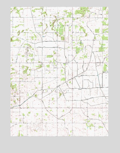
Gifford, IN USGS Topographic Map
Click on map above to begin viewing in our Map Viewer.

This topographic map contains these locations and features:
Feature Name Type Latitude Longitude GNIS ID View Map
Alley Oop AirportAirportN41.1214°W87.0013°2676961View Map
Bailey DitchCanalN41.0798°W87.0409°430406View Map
Callahan DitchCanalN41.0353°W87.0292°431964View Map
Cavendish DitchCanalN41.0461°W87.0261°432253View Map
Folger DitchCanalN41.0173°W87.0650°434627View Map
Gehring DitchCanalN41.0611°W87.0075°435003View Map
GiffordPopulated PlaceN41.0709°W87.0525°435058View Map
Gifford DitchCanalN41.0675°W87.0325°435059View Map
Grant DitchCanalN41.0814°W87.1147°435321View Map
Griggs DitchCanalN41.0714°W87.0628°435506View Map
Griggs LateralCanalN41.0656°W87.0706°435507View Map
Guild LateralCanalN41.0853°W87.0078°435549View Map
Hershman ArmCanalN41.1181°W87.0228°436065View Map
Hershman CemeteryCemeteryN41.1176°W87.0077°436066View Map
Jasper CountyCivilN41.0230°W87.1161°450494View Map
Lateral Number Seventy-sevenCanalN41.0914°W87.0556°449823View Map
LauraPopulated PlaceN41.1000°W87.0667°446692View Map
LewistonPopulated PlaceN41.0270°W87.0459°446691View Map
Moody LateralCanalN41.0086°W87.0550°439375View Map
NewlandPopulated PlaceN41.0459°W87.0342°440141View Map
Newland DitchCanalN41.0461°W87.0397°440144View Map
Oak Grove ChurchChurchN41.0898°W87.0353°440412View Map
Oliver DitchCanalN41.0442°W87.0892°440654View Map
Prater CemeteryCemeteryN41.0386°W87.1188°441565View Map
Rich Grove LateralCanalN41.0586°W87.0267°441946View Map
Ryan DitchCanalN41.0978°W87.0172°442430View Map
Stalbaum Hershman DitchCanalN41.1125°W87.0167°449828View Map
Township of BarkleyCivilN41.0246°W87.0717°453095View Map
Vernigor DitchCanalN41.0861°W87.0747°445254View Map
William Hershman LateralCanalN41.0870°W87.0286°446053View Map
Wynkoop DitchCanalN41.0917°W87.0556°449543View Map

Note: Coordinates in the location and feature list above are referenced to NAD83 datum.


Copyright (C) 2008-2024 Ryan Niemi / Sunset Dynamics ... All Rights Reserved