TopoQuest Logo
Do you find TopoQuest useful?
Help keep TopoQuest running and adding new maps/features by donating!
Bitcoin:  19c7KJd3qBynnjoSw5npx9KScwjBe4ifkT
Litecoin:  LXs6TkuXGGXo1vDsWCkWVdjQX94eUKd6ui
Home View Maps Find Maps Find Places Resources & Links


Medaryville, Indiana Topographic Map

USGS Map Title: Medaryville, IN
USGS Map MRC: 41086A8
DRG (GeoTIFF) Download: o41086a8.tif


Neighboring USGS Topographic Map Quads:


  Wheatfield, IN  
41087B1
 

  San Pierre, IN  
41086B8
 

  North Judson, IN  
41086B7
 

  Gifford, IN  
41087A1
 

  Medaryville, IN  
41086A8
 

  North Judson SE, IN  
41086A7
 

  McCoysburg, IN  
40087H1
 

  Francesville, IN  
40086H8
 

  Monon NE, IN  
40086H7


Map MRC Location:

N42°
W87°
N42°
W86°
H8 H7 H6 H5 H4 H3 H2 H1
G8 G7 G6 G5 G4 G3 G2 G1
F8 F7 F6 F5 F4 F3 F2 F1
E8 E7 E6 E5 E4 E3 E2 E1
D8 D7 D6 D5 D4 D3 D2 D1
C8 C7 C6 C5 C4 C3 C2 C1
B8 B7 B6 B5 B4 B3 B2 B1
A8 A7 A6 A5 A4 A3 A2 A1
N41°
W87°
N41°
W86°

Medaryville, IN USGS 1:24K Topographic Map Preview:
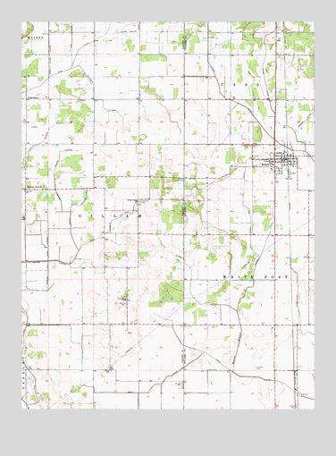
Medaryville, IN USGS Topographic Map
Click on map above to begin viewing in our Map Viewer.

This topographic map contains these locations and features:
Feature Name Type Latitude Longitude GNIS ID View Map
Antonian AirportAirportN41.1019°W86.9311°2677040View Map
Antrim DitchCanalN41.0892°W86.8950°430221View Map
AsphaltumPopulated PlaceN41.1003°W86.9981°430316View Map
Baileys CornerPopulated PlaceN41.0709°W86.9984°430411View Map
Chris Salrin LateralCanalN41.1139°W86.9881°432489View Map
Gehring and Gumz DitchCanalN41.0517°W86.9886°435004View Map
Hansell DitchCanalN41.0550°W86.8953°435699View Map
Iliff Slough LateralCanalN41.0025°W86.9989°436710View Map
Independence ChurchChurchN41.0673°W86.9497°436726View Map
Madaus DitchCanalN41.0953°W86.8759°438465View Map
Mason CemeteryCemeteryN41.0129°W86.9625°438693View Map
Meade Rayburn ArmCanalN41.0592°W86.9620°438940View Map
MedaryvillePopulated PlaceN41.0806°W86.8920°438959View Map
Medaryville Fire DepartmentBuildingN41.0809°W86.8879°2625990View Map
Mosley BranchStreamN41.0120°W86.9097°439490View Map
Mosley DitchCanalN41.0184°W86.9225°439491View Map
Record LateralCanalN41.0553°W86.9786°441814View Map
Robinson CemeteryCemeteryN41.0346°W86.9563°442174View Map
Rufus Rayburn ArmCanalN41.0667°W86.9734°442383View Map
Saint Henrys CemeteryCemeteryN41.0850°W86.9020°442544View Map
Saint Marks Lutheran CemeteryCemeteryN41.0852°W86.9027°442676View Map
Salrin and Cox DitchCanalN41.0653°W86.9039°442940View Map
Stump DitchCanalN41.1070°W86.8961°444300View Map
Stump Slough DitchCanalN41.1220°W86.9497°444302View Map
Tatertown AirportAirportN41.0851°W86.9256°2676905View Map
Town of MedaryvilleCivilN41.0804°W86.8905°2396747View Map
Township of GillamCivilN41.0541°W86.9661°453332View Map
Vanatta LateralCanalN41.0839°W86.9964°445222View Map
Washburn LateralCanalN41.0998°W86.9675°445495View Map

Note: Coordinates in the location and feature list above are referenced to NAD83 datum.


Copyright (C) 2008-2024 Ryan Niemi / Sunset Dynamics ... All Rights Reserved