TopoQuest Logo
Do you find TopoQuest useful?
Help keep TopoQuest running and adding new maps/features by donating!
Bitcoin:  19c7KJd3qBynnjoSw5npx9KScwjBe4ifkT
Litecoin:  LXs6TkuXGGXo1vDsWCkWVdjQX94eUKd6ui
Home View Maps Find Maps Find Places Resources & Links


Gila Box, Arizona Topographic Map

USGS Map Title: Gila Box, AZ
USGS Map MRC: 32109H4
DRG (GeoTIFF) Download: o32109h4.tif


Neighboring USGS Topographic Map Quads:


  Bonita Spring, AZ  
33109A5
 

  Copperplate Gulch, AZ  
33109A4
 

  Clifton, AZ  
33109A3
 

  Lone Star Mountain, AZ  
32109H5
 

  Gila Box, AZ  
32109H4
 

  Guthrie, AZ  
32109H3
 

  San Jose, AZ  
32109G5
 

  Tollgate Tank, AZ  
32109G4
 

  Ash Peak, AZ  
32109G3


Map MRC Location:

N33°
W110°
N33°
W109°
H8 H7 H6 H5 H4 H3 H2 H1
G8 G7 G6 G5 G4 G3 G2 G1
F8 F7 F6 F5 F4 F3 F2 F1
E8 E7 E6 E5 E4 E3 E2 E1
D8 D7 D6 D5 D4 D3 D2 D1
C8 C7 C6 C5 C4 C3 C2 C1
B8 B7 B6 B5 B4 B3 B2 B1
A8 A7 A6 A5 A4 A3 A2 A1
N32°
W110°
N32°
W109°

Gila Box, AZ USGS 1:24K Topographic Map Preview:
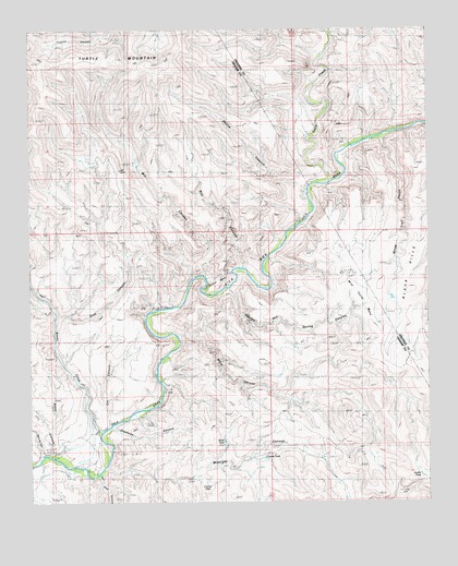
Gila Box, AZ USGS Topographic Map
Click on map above to begin viewing in our Map Viewer.

This topographic map contains these locations and features:
Feature Name Type Latitude Longitude GNIS ID View Map
Baker CanyonValleyN32.8887°W109.4942°959View Map
Bill CanyonValleyN32.9378°W109.4459°1409View Map
Black CanyonValleyN32.9192°W109.4540°1481View Map
Bonita CreekStreamN32.8934°W109.4784°1816View Map
Camel BackBendN32.9331°W109.4423°2387View Map
Camelsback LakeReservoirN32.9334°W109.4506°23962View Map
Cat CanyonValleyN32.8956°W109.4759°2550View Map
Corner TankReservoirN32.8798°W109.4455°3274View Map
Coyote TankReservoirN32.8867°W109.4272°3510View Map
Deadman CanyonValleyN32.8948°W109.4748°3762View Map
Eagle CreekStreamN32.9601°W109.4062°28720View Map
East Fork Potato Patch DrawValleyN32.9606°W109.4062°28763View Map
George Hill Spring CanyonValleyN32.9315°W109.4379°4978View Map
Gila BoxValleyN32.8898°W109.4779°5015View Map
Goat CanyonValleyN32.9242°W109.4904°5078View Map
Midnight CanyonValleyN32.8840°W109.4767°8026View Map
Phillip CanyonValleyN32.9556°W109.4148°9367View Map
Rail End CanyonValleyN32.8820°W109.4787°9906View Map
River TankReservoirN32.8912°W109.4400°10325View Map
Roy CanyonValleyN32.9381°W109.4345°10566View Map
Spring CanyonValleyN32.8878°W109.4970°11695View Map
White Trail GulchValleyN32.9715°W109.3904°22728View Map
White Trail GulchValleyN32.9703°W109.3901°13688View Map
Wire Corral MesaSummitN32.9253°W109.3926°13941View Map
Zorilla TankReservoirN32.8823°W109.3783°14139View Map

Note: Coordinates in the location and feature list above are referenced to NAD83 datum.


Copyright (C) 2008-2025 Ryan Niemi / Sunset Dynamics ... All Rights Reserved