TopoQuest Logo
Do you find TopoQuest useful?
Help keep TopoQuest running and adding new maps/features by donating!
Bitcoin:  19c7KJd3qBynnjoSw5npx9KScwjBe4ifkT
Litecoin:  LXs6TkuXGGXo1vDsWCkWVdjQX94eUKd6ui
Home View Maps Find Maps Find Places Resources & Links


Copperplate Gulch, Arizona Topographic Map

USGS Map Title: Copperplate Gulch, AZ
USGS Map MRC: 33109A4
DRG (GeoTIFF) Download: o33109a4.tif


Neighboring USGS Topographic Map Quads:


  Elevator Mountain, AZ  
33109B5
 

  Coronado Mountain, AZ  
33109B4
 

  Mitchell Peak, AZ  
33109B3
 

  Bonita Spring, AZ  
33109A5
 

  Copperplate Gulch, AZ  
33109A4
 

  Clifton, AZ  
33109A3
 

  Lone Star Mountain, AZ  
32109H5
 

  Gila Box, AZ  
32109H4
 

  Guthrie, AZ  
32109H3


Map MRC Location:

N34°
W110°
N34°
W109°
H8 H7 H6 H5 H4 H3 H2 H1
G8 G7 G6 G5 G4 G3 G2 G1
F8 F7 F6 F5 F4 F3 F2 F1
E8 E7 E6 E5 E4 E3 E2 E1
D8 D7 D6 D5 D4 D3 D2 D1
C8 C7 C6 C5 C4 C3 C2 C1
B8 B7 B6 B5 B4 B3 B2 B1
A8 A7 A6 A5 A4 A3 A2 A1
N33°
W110°
N33°
W109°

Copperplate Gulch, AZ USGS 1:24K Topographic Map Preview:
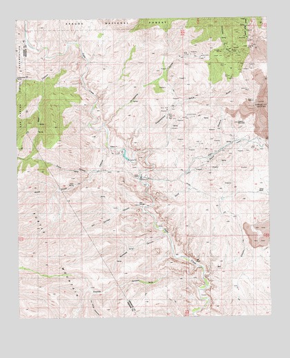
Copperplate Gulch, AZ USGS Topographic Map
Click on map above to begin viewing in our Map Viewer.

This topographic map contains these locations and features:
Feature Name Type Latitude Longitude GNIS ID View Map
Bat CanyonValleyN33.0181°W109.4065°26030View Map
Bear CanyonValleyN33.1137°W109.4734°26065View Map
Copper MountainSummitN33.0812°W109.3909°27926View Map
Copperplate GulchValleyN33.0701°W109.4431°27939View Map
CoronadoLocaleN33.1167°W109.3854°40478View Map
Coronado GulchValleyN33.1092°W109.3845°27966View Map
Coronado InclineSlopeN33.1145°W109.4005°40475View Map
Coronado MineMineN33.1056°W109.4020°39954View Map
Eagle Creek Pumping StationLocaleN33.0581°W109.4390°28721View Map
Garcia SpringSpringN33.1186°W109.4700°1853696View Map
Gold GulchValleyN33.0501°W109.4320°29382View Map
Guswert CanyonValleyN33.0345°W109.4276°29635View Map
Horseshoe CanyonValleyN33.0817°W109.4562°30187View Map
Horseshoe GulchValleyN33.0817°W109.4567°40002View Map
Hot SpringsSpringN33.0480°W109.4410°30227View Map
Hot Springs CanyonValleyN33.0465°W109.4404°30228View Map
La Jolla CanyonValleyN33.0098°W109.4640°30828View Map
Pinkard GulchValleyN33.0698°W109.3992°40557View Map
Pinkhead GulchValleyN33.0712°W109.3995°32999View Map
Poor Farm SpringSpringN33.1042°W109.4536°1853695View Map
Santa Rosa GulchValleyN33.1153°W109.3820°34077View Map
Seneca CorralLocaleN33.0970°W109.4365°1853694View Map
Silver BasinBasinN33.0553°W109.3781°34424View Map
Smith SpringSpringN33.0559°W109.4724°34562View Map
South Smith CanyonValleyN33.0715°W109.4534°34683View Map
Stove CanyonValleyN33.0609°W109.4659°34880View Map
Trujillo CanyonValleyN33.0201°W109.4123°35481View Map

Note: Coordinates in the location and feature list above are referenced to NAD83 datum.


Copyright (C) 2008-2024 Ryan Niemi / Sunset Dynamics ... All Rights Reserved