TopoQuest Logo
Do you find TopoQuest useful?
Help keep TopoQuest running and adding new maps/features by donating!
Bitcoin:  19c7KJd3qBynnjoSw5npx9KScwjBe4ifkT
Litecoin:  LXs6TkuXGGXo1vDsWCkWVdjQX94eUKd6ui
Home View Maps Find Maps Find Places Resources & Links


Gila Peak, Arizona Topographic Map

USGS Map Title: Gila Peak, AZ
USGS Map MRC: 33109B8
DRG (GeoTIFF) Download: o33109b8.tif


Neighboring USGS Topographic Map Quads:


  Ash Creek Ranch, AZ  
33110C1
 

  Tule Tubs, AZ  
33109C8
 

  Point of Pines West, AZ  
33109C7
 

  Bylas, AZ  
33110B1
 

  Gila Peak, AZ  
33109B8
 

  Bonita Tank, AZ  
33109B7
 

  Geronimo, AZ  
33110A1
 

  Fort Thomas, AZ  
33109A8
 

  Markham Creek, AZ  
33109A7


Map MRC Location:

N34°
W110°
N34°
W109°
H8 H7 H6 H5 H4 H3 H2 H1
G8 G7 G6 G5 G4 G3 G2 G1
F8 F7 F6 F5 F4 F3 F2 F1
E8 E7 E6 E5 E4 E3 E2 E1
D8 D7 D6 D5 D4 D3 D2 D1
C8 C7 C6 C5 C4 C3 C2 C1
B8 B7 B6 B5 B4 B3 B2 B1
A8 A7 A6 A5 A4 A3 A2 A1
N33°
W110°
N33°
W109°

Gila Peak, AZ USGS 1:24K Topographic Map Preview:
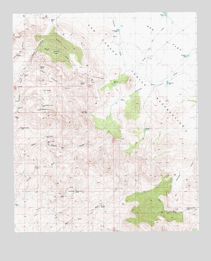
Gila Peak, AZ USGS Topographic Map
Click on map above to begin viewing in our Map Viewer.

This topographic map contains these locations and features:
Feature Name Type Latitude Longitude GNIS ID View Map
Arsenic TankReservoirN33.2490°W109.8963°819View Map
Burdette DamDamN33.1951°W109.9006°22433View Map
Coyote SpringSpringN33.2099°W109.9541°3489View Map
Day Mine WindmillLocaleN33.1406°W109.9412°3739View Map
Dutch Pasture TankReservoirN33.1800°W109.9784°4210View Map
Dutch Pasture WellWellN33.1764°W109.9776°4211View Map
Fishhook SpringsSpringN33.2190°W109.9820°4633View Map
Fishhook WellWellN33.2142°W109.9929°4634View Map
Fishhooks WildernessReserveN33.2179°W109.9826°2035120View Map
Gila PeakSummitN33.1931°W109.9520°5025View Map
Head-of-Day Mine TanksReservoirN33.1374°W109.8843°5669View Map
Hole in the WallValleyN33.2120°W109.9368°5882View Map
Hooker GapGapN33.2451°W109.9745°5920View Map
Lower Fishhook CanyonValleyN33.2173°W109.9890°7463View Map
Lower Fishhook Tank Number OneReservoirN33.1974°W109.9807°7464View Map
Lower Fishhook Tank Number TwoReservoirN33.1951°W109.9838°7465View Map
McKinney DamDamN33.1959°W109.9968°7846View Map
Middle Fishhook CanyonValleyN33.2312°W109.9812°7977View Map
Mormon Spring TankReservoirN33.1848°W109.9955°8299View Map
Natural Corral SpringSpringN33.1484°W109.9590°8518View Map
Nine Mile DamDamN33.2403°W109.9270°22580View Map
Ninemile TankReservoirN33.2398°W109.9286°8662View Map
Pablano TankReservoirN33.1909°W109.9964°9078View Map
Porter WashStreamN33.1251°W109.9387°9666View Map
Seven Mile DamDamN33.2117°W109.8937°22652View Map
Sevenmile TankReservoirN33.2098°W109.8953°11119View Map
Tom SpringSpringN33.1484°W109.9584°12587View Map
Upper Fishhook CanyonValleyN33.2173°W109.9890°13085View Map

Note: Coordinates in the location and feature list above are referenced to NAD83 datum.


Copyright (C) 2008-2025 Ryan Niemi / Sunset Dynamics ... All Rights Reserved