TopoQuest Logo
Do you find TopoQuest useful?
Help keep TopoQuest running and adding new maps/features by donating!
Bitcoin:  19c7KJd3qBynnjoSw5npx9KScwjBe4ifkT
Litecoin:  LXs6TkuXGGXo1vDsWCkWVdjQX94eUKd6ui
Home View Maps Find Maps Find Places Resources & Links


Fort Thomas, Arizona Topographic Map

USGS Map Title: Fort Thomas, AZ
USGS Map MRC: 33109A8
DRG (GeoTIFF) Download: o33109a8.tif


Neighboring USGS Topographic Map Quads:


  Bylas, AZ  
33110B1
 

  Gila Peak, AZ  
33109B8
 

  Bonita Tank, AZ  
33109B7
 

  Geronimo, AZ  
33110A1
 

  Fort Thomas, AZ  
33109A8
 

  Markham Creek, AZ  
33109A7
 

  Telegraph Wash, AZ  
32110H1
 

  Eden, AZ  
32109H8
 

  Pima, AZ  
32109H7


Map MRC Location:

N34°
W110°
N34°
W109°
H8 H7 H6 H5 H4 H3 H2 H1
G8 G7 G6 G5 G4 G3 G2 G1
F8 F7 F6 F5 F4 F3 F2 F1
E8 E7 E6 E5 E4 E3 E2 E1
D8 D7 D6 D5 D4 D3 D2 D1
C8 C7 C6 C5 C4 C3 C2 C1
B8 B7 B6 B5 B4 B3 B2 B1
A8 A7 A6 A5 A4 A3 A2 A1
N33°
W110°
N33°
W109°

Fort Thomas, AZ USGS 1:24K Topographic Map Preview:
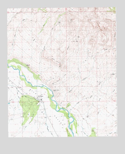
Fort Thomas, AZ USGS Topographic Map
Click on map above to begin viewing in our Map Viewer.

This topographic map contains these locations and features:
Feature Name Type Latitude Longitude GNIS ID View Map
Black HillsSummitN33.0731°W109.9451°1530View Map
Black Hills ArchArchN33.0811°W109.9328°2629413View Map
Black Rock WashStreamN33.0384°W109.9509°1615View Map
Box CanyonValleyN33.0523°W109.9559°1896View Map
Burton WashStreamN33.0570°W109.9662°2284View Map
Camp TankReservoirN33.0299°W109.9083°22442View Map
Charley Thompson SpringsSpringN33.0457°W109.9479°2764View Map
Clay Mine WashStreamN33.0509°W109.9487°2985View Map
Cold SpringsSpringN33.0068°W109.9032°3112View Map
Colvin-Jones CanalCanalN33.0595°W109.9706°3140View Map
Day Mine WashStreamN33.0720°W109.9981°3738View Map
Fine WashStreamN33.0617°W109.9873°4600View Map
Fort ThomasPopulated PlaceN33.0370°W109.9654°4754View Map
Fort Thomas CanalCanalN33.0373°W109.9723°4755View Map
Fort Thomas Census Designated PlaceCensusN33.0222°W109.9665°2582785View Map
Fort Thomas Elementary SchoolSchoolN33.0341°W109.9646°22492View Map
Fort Thomas High SchoolSchoolN33.0365°W109.9621°22493View Map
Fort Thomas Post OfficePost OfficeN33.0369°W109.9637°44934View Map
George CanyonValleyN33.0323°W109.9381°4977View Map
McEuen CemeteryCemeteryN33.0043°W109.9143°7829View Map
Midway Retention DamDamN33.0334°W109.9973°22572View Map
Old Fort Thomas CemeteryCemeteryN33.0360°W109.9766°8946View Map
Oliver Spring CanyonValleyN33.0167°W109.9034°8981View Map
Red HillsSummitN33.1126°W109.9279°10060View Map
Regeneration AirportAirportN33.0350°W109.9875°2650995View Map
Teague SpringSpringN33.0599°W109.8799°12208View Map
Teague Spring CanyonValleyN33.0278°W109.9254°12209View Map
Tom Niece SpringSpringN33.0695°W109.9785°12585View Map

Note: Coordinates in the location and feature list above are referenced to NAD83 datum.


Copyright (C) 2008-2024 Ryan Niemi / Sunset Dynamics ... All Rights Reserved