TopoQuest Logo
Do you find TopoQuest useful?
Help keep TopoQuest running and adding new maps/features by donating!
Bitcoin:  19c7KJd3qBynnjoSw5npx9KScwjBe4ifkT
Litecoin:  LXs6TkuXGGXo1vDsWCkWVdjQX94eUKd6ui
Home View Maps Find Maps Find Places Resources & Links


Gillespie Mountain, New Mexico Topographic Map

USGS Map Title: Gillespie Mountain, NM
USGS Map MRC: 31108F6
DRG (GeoTIFF) Download: o31108f6.tif


Neighboring USGS Topographic Map Quads:


  Tank Mountain, NM  
31108G7
 

  Whitmire Pass, NM  
31108G6
 

  Playas Lake South, NM  
31108G5
 

  Animas Peak NE, NM  
31108F7
 

  Gillespie Mountain, NM  
31108F6
 

  Walnut Wells NE, NM  
31108F5
 

  Animas Peak, NM  
31108E7
 

  Center Peak, NM  
31108E6
 

  Horse Mountain, NM  
31108E5


Map MRC Location:

N32°
W109°
N32°
W108°
H8 H7 H6 H5 H4 H3 H2 H1
G8 G7 G6 G5 G4 G3 G2 G1
F8 F7 F6 F5 F4 F3 F2 F1
E8 E7 E6 E5 E4 E3 E2 E1
D8 D7 D6 D5 D4 D3 D2 D1
C8 C7 C6 C5 C4 C3 C2 C1
B8 B7 B6 B5 B4 B3 B2 B1
A8 A7 A6 A5 A4 A3 A2 A1
N31°
W109°
N31°
W108°

Gillespie Mountain, NM USGS 1:24K Topographic Map Preview:
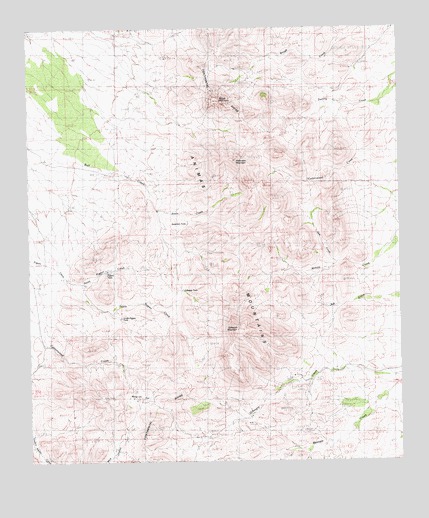
Gillespie Mountain, NM USGS Topographic Map
Click on map above to begin viewing in our Map Viewer.

This topographic map contains these locations and features:
Feature Name Type Latitude Longitude GNIS ID View Map
Anderson MountainSummitN31.7120°W108.6809°901113View Map
Anderson TankReservoirN31.6939°W108.6970°901112View Map
Athena MineMineN31.6251°W108.6534°915218View Map
Athena Prospect Number 2MineN31.6251°W108.6534°915219View Map
Basin TankStreamN31.6976°W108.7070°901072View Map
Bennett Ranch (historical)LocaleN31.6401°W108.6381°886216View Map
Cottonwood CreekStreamN31.6804°W108.7498°887908View Map
Gillespie MineMineN31.6365°W108.6781°889412View Map
Gillespie MountainSummitN31.6634°W108.6806°920601View Map
Gillespie SpringSpringN31.6462°W108.6737°889414View Map
Gillespie TankReservoirN31.6745°W108.6992°901153View Map
Godfrey RanchLocaleN31.6534°W108.7192°889463View Map
Juniper SpringSpringN31.6804°W108.6892°890612View Map
Maverick FlatFlatN31.6437°W108.7114°891687View Map
North Pigpen CreekStreamN31.6768°W108.7317°900890View Map
Oak CreekStreamN31.6829°W108.6470°892791View Map
Pigpen CreekStreamN31.6857°W108.7489°893265View Map
Pigpen TankReservoirN31.6802°W108.7241°900730View Map
Ridge ClaimsMineN31.7418°W108.7089°915011View Map
Rough MountainSummitN31.7290°W108.6873°900701View Map
South Hidalgo DivisionCivilN31.6273°W108.6418°1937597View Map
South Pigpen CreekStreamN31.6768°W108.7375°895103View Map
South Pigpen TankReservoirN31.6666°W108.7201°900731View Map
Upshaw PlaceLocaleN31.6987°W108.7067°899974View Map
West Pigpen CreekStreamN31.6770°W108.7370°896401View Map
Winkler RanchLocaleN31.6518°W108.6478°896717View Map
Yarbrough PlaceLocaleN31.6823°W108.7178°900001View Map

Note: Coordinates in the location and feature list above are referenced to NAD83 datum.


Copyright (C) 2008-2025 Ryan Niemi / Sunset Dynamics ... All Rights Reserved