TopoQuest Logo
Do you find TopoQuest useful?
Help keep TopoQuest running and adding new maps/features by donating!
Bitcoin:  19c7KJd3qBynnjoSw5npx9KScwjBe4ifkT
Litecoin:  LXs6TkuXGGXo1vDsWCkWVdjQX94eUKd6ui
Home View Maps Find Maps Find Places Resources & Links


Animas Peak NE, New Mexico Topographic Map

USGS Map Title: Animas Peak NE, NM
USGS Map MRC: 31108F7
DRG (GeoTIFF) Download: o31108f7.tif


Neighboring USGS Topographic Map Quads:


  Indian Peak, NM  
31108G8
 

  Tank Mountain, NM  
31108G7
 

  Whitmire Pass, NM  
31108G6
 

  Mount Baldy, NM  
31108F8
 

  Animas Peak NE, NM  
31108F7
 

  Gillespie Mountain, NM  
31108F6
 

  Clanton Draw, NM  
31108E8
 

  Animas Peak, NM  
31108E7
 

  Center Peak, NM  
31108E6


Map MRC Location:

N32°
W109°
N32°
W108°
H8 H7 H6 H5 H4 H3 H2 H1
G8 G7 G6 G5 G4 G3 G2 G1
F8 F7 F6 F5 F4 F3 F2 F1
E8 E7 E6 E5 E4 E3 E2 E1
D8 D7 D6 D5 D4 D3 D2 D1
C8 C7 C6 C5 C4 C3 C2 C1
B8 B7 B6 B5 B4 B3 B2 B1
A8 A7 A6 A5 A4 A3 A2 A1
N31°
W109°
N31°
W108°

Animas Peak NE, NM USGS 1:24K Topographic Map Preview:
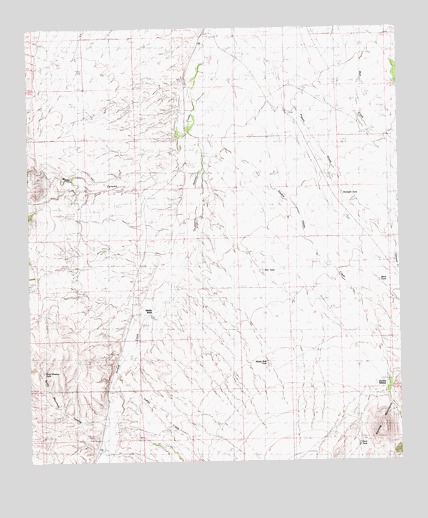
Animas Peak NE, NM USGS Topographic Map
Click on map above to begin viewing in our Map Viewer.

This topographic map contains these locations and features:
Feature Name Type Latitude Longitude GNIS ID View Map
Abe YarbroughPopulated PlaceN31.6520°W108.8456°899492View Map
Baldy Mountain CanyonValleyN31.6361°W108.8511°2568242View Map
Bene DunaganPopulated PlaceN31.7140°W108.8228°899523View Map
BirchfieldPopulated PlaceN31.6309°W108.8520°899528View Map
Black tankReservoirN31.6769°W108.7573°901070View Map
Boyd Maddox TankReservoirN31.6512°W108.8692°901069View Map
Buck TankReservoirN31.6301°W108.7647°901071View Map
Bull CreekStreamN31.7237°W108.7609°886879View Map
Deep WindmillLocaleN31.7348°W108.7706°915939View Map
Double Adobe CreekStreamN31.7190°W108.8189°888471View Map
Double Adobe Creek Historic SiteLocaleN31.6451°W108.7559°942057View Map
Double AdobesPopulated PlaceN31.6451°W108.7559°898542View Map
Dunagan TankReservoirN31.7021°W108.7696°901123View Map
EakinsPopulated PlaceN31.7209°W108.8248°899617View Map
Joe YarbroughPopulated PlaceN31.6662°W108.8323°899687View Map
LA 54021LocaleN31.6450°W108.7553°935883View Map
Maddox SchoolSchoolN31.7476°W108.8064°891528View Map
Middle Well TankReservoirN31.6536°W108.7955°900700View Map
Middle WellsPopulated PlaceN31.6698°W108.8342°898572View Map
Miner CanyonValleyN31.7114°W108.8233°2568223View Map
Rock CabinPopulated PlaceN31.7232°W108.8701°899878View Map
SpearsPopulated PlaceN31.7298°W108.8176°899923View Map
Sten TankReservoirN31.6798°W108.7972°900771View Map
Steve DunaganLocaleN31.7112°W108.8209°895337View Map
The SeepStreamN31.6356°W108.8478°2568244View Map
Walter DunaganLocaleN31.6743°W108.8362°896238View Map
Walter DunaganLocaleN31.6865°W108.8287°896239View Map
X T RanchLocaleN31.7484°W108.8109°896793View Map

Note: Coordinates in the location and feature list above are referenced to NAD83 datum.


Copyright (C) 2008-2024 Ryan Niemi / Sunset Dynamics ... All Rights Reserved