TopoQuest Logo
Do you find TopoQuest useful?
Help keep TopoQuest running and adding new maps/features by donating!
Bitcoin:  19c7KJd3qBynnjoSw5npx9KScwjBe4ifkT
Litecoin:  LXs6TkuXGGXo1vDsWCkWVdjQX94eUKd6ui
Home View Maps Find Maps Find Places Resources & Links


Gilman, Illinois Topographic Map

USGS Map Title: Gilman, IL
USGS Map MRC: 40087G8
DRG (GeoTIFF) Download: o40087g8.tif


Neighboring USGS Topographic Map Quads:


  Piper City NE, IL  
40088H1
 

  Clifton, IL  
40087H8
 

  L'Erable, IL  
40087H7
 

  La Hogue, IL  
40088G1
 

  Gilman, IL  
40087G8
 

  Crescent City, IL  
40087G7
 

  Onarga West, IL  
40088F1
 

  Onarga East, IL  
40087F8
 

  Woodworth, IL  
40087F7


Map MRC Location:

N41°
W88°
N41°
W87°
H8 H7 H6 H5 H4 H3 H2 H1
G8 G7 G6 G5 G4 G3 G2 G1
F8 F7 F6 F5 F4 F3 F2 F1
E8 E7 E6 E5 E4 E3 E2 E1
D8 D7 D6 D5 D4 D3 D2 D1
C8 C7 C6 C5 C4 C3 C2 C1
B8 B7 B6 B5 B4 B3 B2 B1
A8 A7 A6 A5 A4 A3 A2 A1
N40°
W88°
N40°
W87°

Gilman, IL USGS 1:24K Topographic Map Preview:
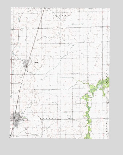
Gilman, IL USGS Topographic Map
Click on map above to begin viewing in our Map Viewer.

This topographic map contains these locations and features:
Feature Name Type Latitude Longitude GNIS ID View Map
Bardon CemeteryCemeteryN40.8022°W87.9014°403895View Map
Beland School (historical)SchoolN40.8417°W87.9025°404111View Map
Benjamin School (historical)SchoolN40.8125°W87.9025°404172View Map
Brayton School (historical)SchoolN40.8723°W87.9031°404807View Map
Brooke School (historical)SchoolN40.7539°W87.9573°404905View Map
Brumback School (historical)SchoolN40.7973°W87.9775°405003View Map
Centennial School (historical)SchoolN40.7834°W87.9059°405778View Map
City of GilmanCivilN40.7528°W87.9975°2394898View Map
DanforthPopulated PlaceN40.8203°W87.9778°406939View Map
Danforth CemeteryCemeteryN40.8252°W87.9659°2755399View Map
Danforth Fire Protection DistrictBuildingN40.8249°W87.9863°2681933View Map
Danforth Post OfficePost OfficeN40.8208°W87.9789°1815556View Map
Danforth Reformed ChurchChurchN40.8250°W87.9814°2043879View Map
Finegan FarmLocaleN40.8558°W87.9122°2740930View Map
First Church of the NazareneChurchN40.7659°W87.9925°2043881View Map
Fish LakeSwampN40.8006°W87.8760°408391View Map
GilmanPopulated PlaceN40.7667°W87.9923°409026View Map
Gilman Community Fire Protection DistrictBuildingN40.7674°W87.9913°2682340View Map
Gilman Post OfficePost OfficeN40.7686°W87.9932°1815555View Map
Gilman United Methodist ChurchChurchN40.7681°W87.9912°2043882View Map
Gilman Water Treatment PlantLocaleN40.7661°W87.9889°2740888View Map
Grob School (historical)SchoolN40.7548°W87.9192°409526View Map
Immaculate Conception ChurchChurchN40.7695°W87.9998°2043883View Map
Iroquois Memorial Hospital AmbulanceBuildingN40.7670°W87.9914°2673796View Map
Iroquois West Elementary School-DanforthSchoolN40.8234°W87.9750°1815568View Map
Iroquois West Elementary School-GilmanSchoolN40.7689°W87.9906°1815569View Map
Iroquois West High SchoolSchoolN40.7695°W87.9853°1815571View Map
Kirby CemeteryCemeteryN40.8059°W87.8834°411539View Map
Lenz School (historical)SchoolN40.8117°W87.9412°411947View Map
LeonardPopulated PlaceN40.7686°W87.9220°422908View Map
Lubben FarmsLocaleN40.7619°W87.9197°2740926View Map
Merkle School (historical)SchoolN40.8406°W87.9403°413432View Map
North School (historical)SchoolN40.8398°W87.9787°414662View Map
Prairie CreekStreamN40.8717°W87.9081°416118View Map
Raymond Classen Memorial AirportAirportN40.8125°W87.9884°427197View Map
Ross Farm School (historical)SchoolN40.8700°W87.9992°416974View Map
Saint Johns Lutheran ChurchChurchN40.8245°W87.9784°2043880View Map
Saint Paul Lutheran ChurchChurchN40.7678°W87.9906°2043884View Map
Village of DanforthCivilN40.8220°W87.9779°2398678View Map
Wenger CemeteryCemeteryN40.7845°W87.9890°420749View Map
West Cleveland School (historical)SchoolN40.7831°W87.9392°420810View Map
Zion United Church of ChristChurchN40.7725°W87.9920°2043885View Map

Note: Coordinates in the location and feature list above are referenced to NAD83 datum.


Copyright (C) 2008-2025 Ryan Niemi / Sunset Dynamics ... All Rights Reserved