TopoQuest Logo
Do you find TopoQuest useful?
Help keep TopoQuest running and adding new maps/features by donating!
Bitcoin:  19c7KJd3qBynnjoSw5npx9KScwjBe4ifkT
Litecoin:  LXs6TkuXGGXo1vDsWCkWVdjQX94eUKd6ui
Home View Maps Find Maps Find Places Resources & Links


L'Erable, Illinois Topographic Map

USGS Map Title: L'Erable, IL
USGS Map MRC: 40087H7
DRG (GeoTIFF) Download: o40087h7.tif


Neighboring USGS Topographic Map Quads:


  West Kankakee, IL  
41087A8
 

  Kankakee, IL  
41087A7
 

  Saint Anne, IL  
41087A6
 

  Clifton, IL  
40087H8
 

  L'Erable, IL  
40087H7
 

  Beaverville, IL  
40087H6
 

  Gilman, IL  
40087G8
 

  Crescent City, IL  
40087G7
 

  Watseka, IL  
40087G6


Map MRC Location:

N41°
W88°
N41°
W87°
H8 H7 H6 H5 H4 H3 H2 H1
G8 G7 G6 G5 G4 G3 G2 G1
F8 F7 F6 F5 F4 F3 F2 F1
E8 E7 E6 E5 E4 E3 E2 E1
D8 D7 D6 D5 D4 D3 D2 D1
C8 C7 C6 C5 C4 C3 C2 C1
B8 B7 B6 B5 B4 B3 B2 B1
A8 A7 A6 A5 A4 A3 A2 A1
N40°
W88°
N40°
W87°

L'Erable, IL USGS 1:24K Topographic Map Preview:
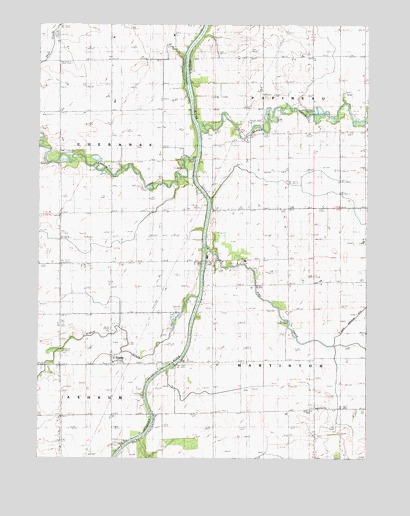
L'Erable, IL USGS Topographic Map
Click on map above to begin viewing in our Map Viewer.

This topographic map contains these locations and features:
Feature Name Type Latitude Longitude GNIS ID View Map
Baron School (historical)SchoolN40.9653°W87.7506°403922View Map
Beaver CreekStreamN40.9698°W87.8139°404056View Map
Brault School (historical)SchoolN40.9331°W87.8273°404804View Map
Clabby School (historical)SchoolN40.9620°W87.8278°406137View Map
College Corner School (historical)SchoolN40.8892°W87.8084°406367View Map
Dodsonville School (historical)SchoolN40.9756°W87.8678°407279View Map
Dutour School (historical)SchoolN40.9025°W87.8667°407546View Map
Hubb School (historical)SchoolN40.9928°W87.7523°410636View Map
Jones CemeteryCemeteryN40.9728°W87.7832°406155View Map
Jones School (historical)SchoolN40.9645°W87.7942°411227View Map
L'ErablePopulated PlaceN40.9034°W87.8470°411634View Map
L'Erable BridgeBridgeN40.9023°W87.8234°425084View Map
L'Erable Catholic CemeteryCemeteryN40.9026°W87.8432°1951725View Map
Langan CreekStreamN40.9620°W87.8159°411808View Map
Liberty School (historical)SchoolN40.9267°W87.7898°412032View Map
North Martinton DitchCanalN40.9084°W87.7628°414628View Map
Nottke Airport (historical)AirportN40.9742°W87.8236°427169View Map
Old Burg CemeteryCemeteryN40.8908°W87.7701°1951861View Map
Old Burg School (historical)SchoolN40.8909°W87.7686°414995View Map
Perry BridgeBridgeN40.9328°W87.8061°425322View Map
Pike CreekStreamN40.9373°W87.8111°415664View Map
Prairie CreekStreamN40.9553°W87.8231°416128View Map
Switzer School (historical)SchoolN40.9906°W87.7914°419493View Map
Teege CemeteryCemeteryN40.9278°W87.7699°419579View Map
Vanderporten School (historical)SchoolN40.9311°W87.8675°420231View Map

Note: Coordinates in the location and feature list above are referenced to NAD83 datum.


Copyright (C) 2008-2025 Ryan Niemi / Sunset Dynamics ... All Rights Reserved