TopoQuest Logo
Do you find TopoQuest useful?
Help keep TopoQuest running and adding new maps/features by donating!
Bitcoin:  19c7KJd3qBynnjoSw5npx9KScwjBe4ifkT
Litecoin:  LXs6TkuXGGXo1vDsWCkWVdjQX94eUKd6ui
Home View Maps Find Maps Find Places Resources & Links


Gilman City East, Missouri Topographic Map

USGS Map Title: Gilman City East, MO
USGS Map MRC: 40093B7
DRG (GeoTIFF) Download: o40093b7.tif


Neighboring USGS Topographic Map Quads:


  Gardner, MO  
40093C8
 

  Mount Moriah, MO  
40093C7
 

  Modena, MO  
40093C6
 

  Gilman City West, MO  
40093B8
 

  Gilman City East, MO  
40093B7
 

  Brimson, MO  
40093B6
 

  Jameson, MO  
40093A8
 

  Bancroft, MO  
40093A7
 

  Trenton West, MO  
40093A6


Map MRC Location:

N41°
W94°
N41°
W93°
H8 H7 H6 H5 H4 H3 H2 H1
G8 G7 G6 G5 G4 G3 G2 G1
F8 F7 F6 F5 F4 F3 F2 F1
E8 E7 E6 E5 E4 E3 E2 E1
D8 D7 D6 D5 D4 D3 D2 D1
C8 C7 C6 C5 C4 C3 C2 C1
B8 B7 B6 B5 B4 B3 B2 B1
A8 A7 A6 A5 A4 A3 A2 A1
N40°
W94°
N40°
W93°

Gilman City East, MO USGS 1:24K Topographic Map Preview:
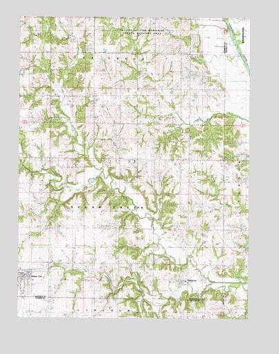
Gilman City East, MO USGS Topographic Map
Click on map above to begin viewing in our Map Viewer.

This topographic map contains these locations and features:
Feature Name Type Latitude Longitude GNIS ID View Map
BoltonPopulated PlaceN40.2253°W93.8352°740188View Map
Bolton Post OfficePost OfficeN40.2253°W93.8352°759651View Map
Bolton School (historical)SchoolN40.2264°W93.8341°714505View Map
Cat Creek CemeteryCemeteryN40.2033°W93.7874°1782129View Map
City of Gilman CityCivilN40.1312°W93.8739°2394901View Map
Cole School (historical)SchoolN40.1264°W93.7513°716104View Map
Fox CreekStreamN40.1858°W93.8299°718144View Map
Gilman CemeteryCemeteryN40.1450°W93.8555°718459View Map
Gilman CityPopulated PlaceN40.1417°W93.8724°718460View Map
Gilman City Elementary SchoolSchoolN40.1349°W93.8728°2545335View Map
Gilman City Fire Protection DistrictBuildingN40.1431°W93.8709°2621469View Map
Gilman City High SchoolSchoolN40.1349°W93.8731°2545318View Map
Gilman City Post OfficePost OfficeN40.1426°W93.8716°2782575View Map
Lake Church (historical)ChurchN40.2206°W93.7713°720744View Map
Lake School (historical)SchoolN40.2292°W93.7572°720754View Map
Little CreekStreamN40.1329°W93.8072°721208View Map
Long BranchStreamN40.1311°W93.7962°721523View Map
MelbournePopulated PlaceN40.1417°W93.7877°722205View Map
Metcalf School (historical)SchoolN40.1920°W93.7930°722250View Map
Mitchell CemeteryCemeteryN40.1367°W93.8002°1782130View Map
Mitchell Church (historical)ChurchN40.1370°W93.7997°722491View Map
Ratliff LakeReservoirN40.1973°W93.8234°762712View Map
Ratliff Lake DamDamN40.1983°W93.8236°762711View Map
Rock Island SchoolSchoolN40.1617°W93.7922°725464View Map
Spring Hill School (historical)SchoolN40.1922°W93.8208°726930View Map
Springer ChapelChurchN40.2389°W93.8011°726963View Map
Springer Chapel CemeteryCemeteryN40.2389°W93.8022°1782131View Map
Stephen SchoolSchoolN40.2214°W93.7916°727065View Map
Theusen Lake DamDamN40.2167°W93.7802°762713View Map
Tombstone CreekStreamN40.1406°W93.7699°727711View Map
Township of Fox CreekCivilN40.2495°W93.8211°766720View Map
Township of Sugar CreekCivilN40.1696°W93.8209°766728View Map
Union ChurchChurchN40.1881°W93.8541°728003View Map
Wayne Helton Memorial State Wildlife AreaParkN40.2458°W93.8044°732622View Map
Woodworth Lake DamDamN40.1250°W93.7652°760478View Map
Wynne Lake DamDamN40.1633°W93.7552°762710View Map

Note: Coordinates in the location and feature list above are referenced to NAD83 datum.


Copyright (C) 2008-2025 Ryan Niemi / Sunset Dynamics ... All Rights Reserved