TopoQuest Logo
Do you find TopoQuest useful?
Help keep TopoQuest running and adding new maps/features by donating!
Bitcoin:  19c7KJd3qBynnjoSw5npx9KScwjBe4ifkT
Litecoin:  LXs6TkuXGGXo1vDsWCkWVdjQX94eUKd6ui
Home View Maps Find Maps Find Places Resources & Links


Glendora, Mississippi Topographic Map

USGS Map Title: Glendora, MS
USGS Map MRC: 33090G3
DRG (GeoTIFF) Download: o33090g3.tif


Neighboring USGS Topographic Map Quads:


  Rome, MS  
33090H4
 

  Webb, MS  
33090H3
 

  Tippo, MS  
33090H2
 

  Brooks, MS  
33090G4
 

  Glendora, MS  
33090G3
 

  Philipp, MS  
33090G2
 

  Rattlesnake Bayou, MS  
33090F4
 

  Schlater, MS  
33090F3
 

  Money, MS  
33090F2


Map MRC Location:

N34°
W91°
N34°
W90°
H8 H7 H6 H5 H4 H3 H2 H1
G8 G7 G6 G5 G4 G3 G2 G1
F8 F7 F6 F5 F4 F3 F2 F1
E8 E7 E6 E5 E4 E3 E2 E1
D8 D7 D6 D5 D4 D3 D2 D1
C8 C7 C6 C5 C4 C3 C2 C1
B8 B7 B6 B5 B4 B3 B2 B1
A8 A7 A6 A5 A4 A3 A2 A1
N33°
W91°
N33°
W90°

Glendora, MS USGS 1:24K Topographic Map Preview:
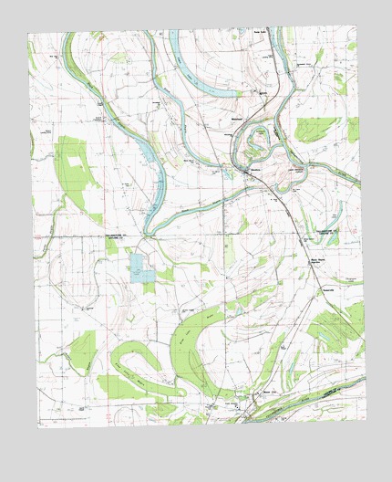
Glendora, MS USGS Topographic Map
Click on map above to begin viewing in our Map Viewer.

This topographic map contains these locations and features:
Feature Name Type Latitude Longitude GNIS ID View Map
Arthur (historical)LocaleN33.7759°W90.2515°706471View Map
Bee LakeLakeN33.8137°W90.2598°666751View Map
Bethlehem ChurchChurchN33.8543°W90.2876°667018View Map
Black BayouPopulated PlaceN33.8187°W90.2787°708121View Map
Black Bayou Elementary SchoolSchoolN33.8326°W90.3112°711554View Map
Black Bayou JunctionPopulated PlaceN33.7990°W90.2693°691707View Map
Black Bayou LandingLocaleN33.8223°W90.2795°708122View Map
Blue Lake BayouSwampN33.7698°W90.3431°667312View Map
Blue Lake BrakeSwampN33.7740°W90.3168°667313View Map
Bonnett LakeLakeN33.8371°W90.2884°667431View Map
Bonnett Lake LandingLocaleN33.8354°W90.2776°708124View Map
Browns Store LandingLocaleN33.8493°W90.2793°708125View Map
Buford PlantationLocaleN33.8465°W90.3487°686842View Map
Catfish Hatchery Ponds DamDamN33.8051°W90.3368°682347View Map
Craigs LandingLocaleN33.8657°W90.2776°708133View Map
Due West Plantation (historical)LocaleN33.8293°W90.3334°708135View Map
Equen Lake DamDamN33.8134°W90.3334°682352View Map
Flautt AirportAirportN33.8652°W90.2814°680410View Map
Frank Streaters SchoolSchoolN33.7551°W90.2993°684156View Map
GlendoraPopulated PlaceN33.8293°W90.2931°670435View Map
Glendora LandingLocaleN33.8323°W90.2765°708137View Map
Glendora Post OfficePost OfficeN33.8302°W90.2974°2768634View Map
Graball LandingLocaleN33.8598°W90.2759°708138View Map
Gracen ChapelChurchN33.8304°W90.2926°686852View Map
Holy God ChurchChurchN33.7576°W90.3284°671370View Map
Hopewell ChurchChurchN33.7879°W90.3554°671434View Map
Jacobs ChapelChurchN33.7826°W90.3184°671795View Map
Jacobs Chapel CemeteryCemeteryN33.7862°W90.3142°684185View Map
Jerusalem ChurchChurchN33.8509°W90.3251°671860View Map
Jones Grove CemeteryCemeteryN33.8079°W90.2729°684192View Map
Jones Grove ChurchChurchN33.8079°W90.2723°671999View Map
Lower Glendora Cut-OffBendN33.8284°W90.2740°672915View Map
McCalebs LandingLocaleN33.8309°W90.2631°708145View Map
Minter CityPopulated PlaceN33.7534°W90.2945°673683View Map
Minter City JunctionLocaleN33.7696°W90.2845°684209View Map
New Zion ChurchChurchN33.8684°W90.3620°674893View Map
Palestine ChurchChurchN33.7915°W90.3590°675400View Map
Persimmon Grove ChurchChurchN33.8623°W90.2734°677811View Map
Pleasant (historical)LocaleN33.7796°W90.2754°706526View Map
Powell ChapelChurchN33.8529°W90.3479°676289View Map
Rolling Waters School (historical)SchoolN33.7848°W90.2668°684238View Map
Ryall ChapelChurchN33.7746°W90.2806°676980View Map
Saint Andes ChurchChurchN33.8193°W90.3026°677004View Map
Saint Clare CemeteryCemeteryN33.8234°W90.2767°686871View Map
Saint Marys CemeteryCemeteryN33.8304°W90.3079°686878View Map
Saint Peter CemeteryCemeteryN33.8254°W90.3387°686879View Map
Saint Peter ChurchChurchN33.8257°W90.3373°677235View Map
Smith ChapelChurchN33.7562°W90.3551°677915View Map
SomervillePopulated PlaceN33.7921°W90.2656°677973View Map
Staten LandingLocaleN33.8690°W90.2790°708156View Map
Sturdivant (historical)Populated PlaceN33.8298°W90.3293°708157View Map
Swan LakePopulated PlaceN33.8748°W90.2834°678451View Map
Swan LakeLakeN33.8613°W90.3149°678455View Map
Swan Lake Ferry (historical)CrossingN33.8573°W90.2748°708159View Map
Swan Lake LandingLocaleN33.8726°W90.2823°708160View Map
Swan Lake Post OfficePost OfficeN33.8746°W90.2834°712652View Map
T Y Fleming Elementary SchoolSchoolN33.7562°W90.3079°711578View Map
Townes Switch (historical)LocaleN33.7751°W90.2784°706562View Map
Twilight LandingLocaleN33.8559°W90.2740°708167View Map
Upper Glendora Cut-OffBendN33.8415°W90.2818°679149View Map
Village of GlendoraCivilN33.8276°W90.2927°2407465View Map
WhiteheadPopulated PlaceN33.8487°W90.2987°692317View Map
Whitehead ChurchChurchN33.8404°W90.2965°679623View Map
Whitehead LandingLocaleN33.8459°W90.2823°708170View Map

Note: Coordinates in the location and feature list above are referenced to NAD83 datum.


Copyright (C) 2008-2025 Ryan Niemi / Sunset Dynamics ... All Rights Reserved