TopoQuest Logo
Do you find TopoQuest useful?
Help keep TopoQuest running and adding new maps/features by donating!
Bitcoin:  19c7KJd3qBynnjoSw5npx9KScwjBe4ifkT
Litecoin:  LXs6TkuXGGXo1vDsWCkWVdjQX94eUKd6ui
Home View Maps Find Maps Find Places Resources & Links


Rattlesnake Bayou, Mississippi Topographic Map

USGS Map Title: Rattlesnake Bayou, MS
USGS Map MRC: 33090F4
DRG (GeoTIFF) Download: o33090f4.tif


Neighboring USGS Topographic Map Quads:


  Drew, MS  
33090G5
 

  Brooks, MS  
33090G4
 

  Glendora, MS  
33090G3
 

  Ruleville, MS  
33090F5
 

  Rattlesnake Bayou, MS  
33090F4
 

  Schlater, MS  
33090F3
 

  Sunflower, MS  
33090E5
 

  Bear Gut Bayou, MS  
33090E4
 

  Shellmound, MS  
33090E3


Map MRC Location:

N34°
W91°
N34°
W90°
H8 H7 H6 H5 H4 H3 H2 H1
G8 G7 G6 G5 G4 G3 G2 G1
F8 F7 F6 F5 F4 F3 F2 F1
E8 E7 E6 E5 E4 E3 E2 E1
D8 D7 D6 D5 D4 D3 D2 D1
C8 C7 C6 C5 C4 C3 C2 C1
B8 B7 B6 B5 B4 B3 B2 B1
A8 A7 A6 A5 A4 A3 A2 A1
N33°
W91°
N33°
W90°

Rattlesnake Bayou, MS USGS 1:24K Topographic Map Preview:
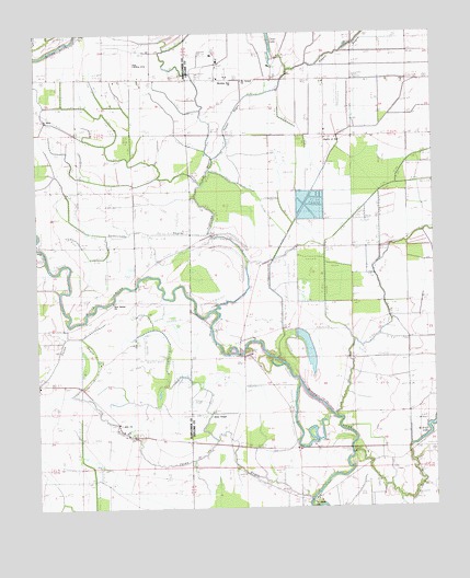
Rattlesnake Bayou, MS USGS Topographic Map
Click on map above to begin viewing in our Map Viewer.

This topographic map contains these locations and features:
Feature Name Type Latitude Longitude GNIS ID View Map
Church of GodChurchN33.7193°W90.4093°668471View Map
Dugan BayouStreamN33.7168°W90.4445°669486View Map
Fighting BayouStreamN33.6773°W90.4434°669958View Map
Gidwitz School (historical)SchoolN33.6262°W90.4145°684160View Map
Harts Church (historical)ChurchN33.6726°W90.4190°684176View Map
Hugh Aarant Ponds DamDamN33.7018°W90.4134°682302View Map
I John ChurchChurchN33.6468°W90.4751°671650View Map
Jones ChapelChurchN33.6501°W90.4454°684191View Map
McNutt CemeteryCemeteryN33.6460°W90.3764°673423View Map
Morning Star ChurchChurchN33.7373°W90.4379°673837View Map
Mount Vernon ChurchChurchN33.7371°W90.4345°674307View Map
Naird Church (historical)ChurchN33.7459°W90.4912°686558View Map
New Bethel ChurchChurchN33.6787°W90.4754°674583View Map
Pecan BayouStreamN33.6273°W90.4145°675560View Map
Peedee Plantation LakeDamN33.6701°W90.4184°682288View Map
Peters Rock Church (historical)ChurchN33.6651°W90.4384°684226View Map
Rattlesnake BayouStreamN33.6968°W90.4454°676481View Map
Saint Marks ChurchChurchN33.6271°W90.4123°677134View Map
Saint Mary ChurchChurchN33.7273°W90.4981°690613View Map
Truevine ChurchChurchN33.6523°W90.4179°678905View Map
Union Grove ChurchChurchN33.7373°W90.3776°679083View Map
Williams Chapel (historical)ChurchN33.7387°W90.4801°686625View Map

Note: Coordinates in the location and feature list above are referenced to NAD83 datum.


Copyright (C) 2008-2025 Ryan Niemi / Sunset Dynamics ... All Rights Reserved