TopoQuest Logo
Do you find TopoQuest useful?
Help keep TopoQuest running and adding new maps/features by donating!
Bitcoin:  19c7KJd3qBynnjoSw5npx9KScwjBe4ifkT
Litecoin:  LXs6TkuXGGXo1vDsWCkWVdjQX94eUKd6ui
Home View Maps Find Maps Find Places Resources & Links


Glengarry, Montana Topographic Map

USGS Map Title: Glengarry, MT
USGS Map MRC: 47109A5
DRG (GeoTIFF) Download: o47109a5.tif


Neighboring USGS Topographic Map Quads:


  Danvers, MT  
47109B6
 

  Spring Creek Junction, MT  
47109B5
 

  Brooks, MT  
47109B4
 

  Ross Fork, MT  
47109A6
 

  Glengarry, MT  
47109A5
 

  Lewistown, MT  
47109A4
 

  Moore, MT  
46109H6
 

  West Fork Beaver Creek, MT  
46109H5
 

  Castle Butte, MT  
46109H4


Map MRC Location:

N48°
W110°
N48°
W109°
H8 H7 H6 H5 H4 H3 H2 H1
G8 G7 G6 G5 G4 G3 G2 G1
F8 F7 F6 F5 F4 F3 F2 F1
E8 E7 E6 E5 E4 E3 E2 E1
D8 D7 D6 D5 D4 D3 D2 D1
C8 C7 C6 C5 C4 C3 C2 C1
B8 B7 B6 B5 B4 B3 B2 B1
A8 A7 A6 A5 A4 A3 A2 A1
N47°
W110°
N47°
W109°

Glengarry, MT USGS 1:24K Topographic Map Preview:
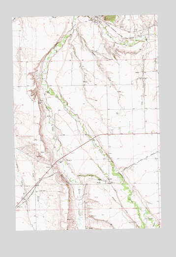
Glengarry, MT USGS Topographic Map
Click on map above to begin viewing in our Map Viewer.

This topographic map contains these locations and features:
Feature Name Type Latitude Longitude GNIS ID View Map
14N21E03BCB_01 WellWellN47.0055°W109.5105°820097View Map
15N17E02CDC_01 WellWellN47.0847°W109.5377°820646View Map
15N17E13CDCD01 WellWellN47.0561°W109.5169°820454View Map
15N17E14CDA_01 WellWellN47.0586°W109.5349°820489View Map
15N17E17DBB_01 WellWellN47.0627°W109.5952°820510View Map
15N17E20AAC_01 WellWellN47.0536°W109.5919°820430View Map
15N17E32BBD_01 WellWellN47.0233°W109.6041°820224View Map
15N18E30CBB_01 WellWellN47.0339°W109.5021°820310View Map
15N30E21CA__11 WellWellN47.0466°W109.5785°820385View Map
15N30E21CA__12 WellWellN47.0466°W109.5785°820386View Map
16N17E25CCBA01 WellWellN47.1175°W109.5221°820851View Map
16N17E25CDDA01 WellWellN47.1158°W109.5144°820839View Map
16N17E25DCAD01 WellWellN47.1164°W109.5088°820846View Map
16N17E27ACBB01 WellWellN47.1244°W109.5555°820890View Map
16N17E28ADCC01 WellWellN47.1216°W109.5680°820876View Map
16N17E29CBD_01 WellWellN47.1183°W109.6060°820852View Map
16N17E36ABAA01 WellWellN47.1128°W109.5091°820816View Map
16N17E36ACA_01 WellWellN47.1091°W109.5091°820800View Map
16N18E30CBBC01 WellWellN47.1197°W109.5030°820867View Map
Beaver CreekStreamN47.0853°W109.5971°779609View Map
Beaver Creek BridgeBridgeN47.0527°W109.5894°1722934View Map
CottonwoodPopulated PlaceN47.0058°W109.5135°770137View Map
Cottonwood Post Office (historical)Post OfficeN47.0058°W109.5135°1722796View Map
Coyote CreekStreamN47.1189°W109.5713°770255View Map
Crow CouleeValleyN47.0314°W109.5738°770334View Map
GlengarryPopulated PlaceN47.0269°W109.5480°771805View Map
GlengarryLocaleN47.0283°W109.5485°1722841View Map
Glengarry Post Office (historical)Post OfficeN47.0269°W109.5480°1722842View Map
Glengarry School (historical)SchoolN47.0269°W109.5474°1722840View Map
HanoverPopulated PlaceN47.1214°W109.5546°772121View Map
Hanover (historical)LocaleN47.1214°W109.5546°1722836View Map
Hanover Post Office (historical)Post OfficeN47.1214°W109.5546°1722835View Map
Hruska Fishing Access SiteLocaleN47.1111°W109.5057°1744366View Map
Indian RockPillarN47.0747°W109.6049°772698View Map
Jenni School (historical)SchoolN47.0555°W109.5763°1722662View Map
Lone Pine CreekStreamN47.1119°W109.5130°773575View Map
McDonnell (historical)LocaleN47.1116°W109.5188°1722966View Map
Presbyterian ChurchChurchN47.0272°W109.5477°1722839View Map
Scott School (historical)SchoolN47.1194°W109.5127°1722663View Map
The GapGapN47.0375°W109.5944°777507View Map
The PointCapeN47.0808°W109.5974°777530View Map
Wachusett (historical)LocaleN47.1130°W109.5135°1722960View Map

Note: Coordinates in the location and feature list above are referenced to NAD83 datum.


Copyright (C) 2008-2025 Ryan Niemi / Sunset Dynamics ... All Rights Reserved