TopoQuest Logo
Do you find TopoQuest useful?
Help keep TopoQuest running and adding new maps/features by donating!
Bitcoin:  19c7KJd3qBynnjoSw5npx9KScwjBe4ifkT
Litecoin:  LXs6TkuXGGXo1vDsWCkWVdjQX94eUKd6ui
Home View Maps Find Maps Find Places Resources & Links


Brooks, Montana Topographic Map

USGS Map Title: Brooks, MT
USGS Map MRC: 47109B4
DRG (GeoTIFF) Download: o47109b4.tif


Neighboring USGS Topographic Map Quads:


  Seventytwo Hills, MT  
47109C5
 

  Kendall, MT  
47109C4
 

  Hilger, MT  
47109C3
 

  Spring Creek Junction, MT  
47109B5
 

  Brooks, MT  
47109B4
 

  New Year, MT  
47109B3
 

  Glengarry, MT  
47109A5
 

  Lewistown, MT  
47109A4
 

  Pike Creek, MT  
47109A3


Map MRC Location:

N48°
W110°
N48°
W109°
H8 H7 H6 H5 H4 H3 H2 H1
G8 G7 G6 G5 G4 G3 G2 G1
F8 F7 F6 F5 F4 F3 F2 F1
E8 E7 E6 E5 E4 E3 E2 E1
D8 D7 D6 D5 D4 D3 D2 D1
C8 C7 C6 C5 C4 C3 C2 C1
B8 B7 B6 B5 B4 B3 B2 B1
A8 A7 A6 A5 A4 A3 A2 A1
N47°
W110°
N47°
W109°

Brooks, MT USGS 1:24K Topographic Map Preview:
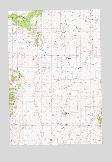
Brooks, MT USGS Topographic Map
Click on map above to begin viewing in our Map Viewer.

This topographic map contains these locations and features:
Feature Name Type Latitude Longitude GNIS ID View Map
16N18E08CAA_01 WellWellN47.1622°W109.4710°821150View Map
16N18E08CAB_01 WellWellN47.1650°W109.4752°821177View Map
16N18E13DBB_01 WellWellN47.1489°W109.3852°821027View Map
16N18E15ACCB01 WellWellN47.1522°W109.4288°821066View Map
16N18E15BDBB01 WellWellN47.1500°W109.4299°821039View Map
17N17E24ACC_01 WellWellN47.2225°W109.4960°821531View Map
17N17E25AACC01 WellWellN47.2103°W109.4913°821462View Map
17N18E19DBC_01 SpringSpringN47.2200°W109.4742°821510View Map
17N18E19DBCA01 SpringSpringN47.2191°W109.4741°821506View Map
17N18E23ADB_01 WellWellN47.2236°W109.3846°821550View Map
17N18E27CBD_01 WellWellN47.2041°W109.4188°821418View Map
17N18E30CAC_01 WellWellN47.2039°W109.4791°821417View Map
17N18E33ADC_01 WellWellN47.1925°W109.4266°821344View Map
17N18E34ACA_01 WellWellN47.1939°W109.4077°821359View Map
BaxterPopulated PlaceN47.1505°W109.4396°802014View Map
Baxter (historical)LocaleN47.1505°W109.4396°1722782View Map
BrooksPopulated PlaceN47.2041°W109.4213°802062View Map
Brooks (historical)LocaleN47.2061°W109.4210°1722827View Map
Brooks Post Office (historical)Post OfficeN47.2061°W109.4210°1722828View Map
Brooks School (historical)SchoolN47.2055°W109.4202°1722829View Map
Carters PondReservoirN47.1430°W109.4269°805780View Map
Colver DamDamN47.1783°W109.4291°797881View Map
Fish CreekStreamN47.2344°W109.4255°805779View Map
Last Chance CreekStreamN47.2364°W109.4230°773240View Map
Lower Carter Pond DamDamN47.1350°W109.4324°796070View Map
Lower Carter Pond Fishing Access SiteLocaleN47.1419°W109.4296°1744357View Map
Lucier School (historical)SchoolN47.1572°W109.3866°773754View Map
Lyle SpringSpringN47.2430°W109.4857°805782View Map
Maidens Gold Historical MarkerParkN47.2000°W109.3985°1722515View Map
Moccasin CreekStreamN47.2128°W109.4571°774311View Map
North Fork Bull CreekStreamN47.2425°W109.3891°805819View Map
Philips School (historical)SchoolN47.1622°W109.4669°775193View Map
Rocky ButteSummitN47.1833°W109.4927°775877View Map
Sunset Memorial GardensCemeteryN47.1528°W109.4293°1722758View Map
Upper Carter Pond DamDamN47.1483°W109.4257°796071View Map
Upper Carter Pond Fishing Access SiteLocaleN47.1550°W109.4277°1744353View Map
Upper Carters PondReservoirN47.1524°W109.4266°805781View Map
Warm SpringSpringN47.2194°W109.4738°778110View Map

Note: Coordinates in the location and feature list above are referenced to NAD83 datum.


Copyright (C) 2008-2025 Ryan Niemi / Sunset Dynamics ... All Rights Reserved