TopoQuest Logo
Do you find TopoQuest useful?
Help keep TopoQuest running and adding new maps/features by donating!
Bitcoin:  19c7KJd3qBynnjoSw5npx9KScwjBe4ifkT
Litecoin:  LXs6TkuXGGXo1vDsWCkWVdjQX94eUKd6ui
Home View Maps Find Maps Find Places Resources & Links


Glennville, Georgia Topographic Map

USGS Map Title: Glennville, GA
USGS Map MRC: 31081H8
DRG (GeoTIFF) Download: o31081h8.tif


Neighboring USGS Topographic Map Quads:


  Reidsville East, GA  
32082A1
 

  Deans Crossing, GA  
32081A8
 

  Glissons Millpond, GA  
32081A7
 

  Tison, GA  
31082H1
 

  Glennville, GA  
31081H8
 

  Glennville NE, GA  
31081H7
 

  Altamaha SE, GA  
31082G1
 

  Glennville SW, GA  
31081G8
 

  Glennville SE, GA  
31081G7


Map MRC Location:

N32°
W82°
N32°
W81°
H8 H7 H6 H5 H4 H3 H2 H1
G8 G7 G6 G5 G4 G3 G2 G1
F8 F7 F6 F5 F4 F3 F2 F1
E8 E7 E6 E5 E4 E3 E2 E1
D8 D7 D6 D5 D4 D3 D2 D1
C8 C7 C6 C5 C4 C3 C2 C1
B8 B7 B6 B5 B4 B3 B2 B1
A8 A7 A6 A5 A4 A3 A2 A1
N31°
W82°
N31°
W81°

Glennville, GA USGS 1:24K Topographic Map Preview:
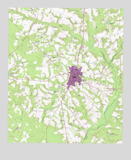
Glennville, GA USGS Topographic Map
Click on map above to begin viewing in our Map Viewer.

This topographic map contains these locations and features:
Feature Name Type Latitude Longitude GNIS ID View Map
Alton (historical)Populated PlaceN31.8971°W81.9093°347377View Map
Appleton School (historical)SchoolN31.8796°W81.9929°347378View Map
Bacon PondLakeN31.9808°W81.9652°310707View Map
Banards FordCrossingN31.9127°W81.8851°347379View Map
Beards Creek School (historical)SchoolN31.9844°W81.8787°347380View Map
Berea ChurchChurchN31.9802°W81.8907°354551View Map
Big BranchStreamN31.9930°W81.8982°347383View Map
Big BranchStreamN31.9308°W81.8829°311310View Map
Birdford (historical)Populated PlaceN31.9755°W81.8940°347386View Map
Blocker CreekStreamN31.9752°W81.9079°354770View Map
Bradley - Anderson CemeteryCemeteryN31.9105°W81.9901°347388View Map
Brewton MillpondReservoirN31.9872°W81.8911°311763View Map
Brickyard BranchStreamN31.8860°W81.9126°311780View Map
Browns PondReservoirN31.9213°W81.9495°311902View Map
Buck Branch School (historical)SchoolN31.9102°W81.8990°347390View Map
Center of Life Fellowship ChurchChurchN31.9493°W81.9305°2502794View Map
Chapel CreekStreamN31.9649°W81.9104°355115View Map
City of GlennvilleCivilN31.9381°W81.9304°2403703View Map
Ditch BranchStreamN31.8880°W81.9862°313488View Map
Edwards MillpondReservoirN31.9278°W81.9416°355647View Map
Ella Grove ChurchChurchN31.9396°W81.8976°355672View Map
Ella Grove School (historical)SchoolN31.9391°W81.8979°347402View Map
Eunice School (historical)SchoolN31.9916°W81.9321°347404View Map
Faith ChurchChurchN31.9058°W81.9326°347405View Map
First Baptist ChurchChurchN31.9363°W81.9293°1705466View Map
First Christian ChurchChurchN31.9541°W81.9554°347406View Map
Flat FordCrossingN31.9527°W81.8940°347407View Map
Flat Ford BridgeBridgeN31.9527°W81.8940°347408View Map
GlennvillePopulated PlaceN31.9366°W81.9285°331820View Map
Glennville Christian AcademySchoolN31.9260°W81.9249°2453146View Map
Glennville City HallBuildingN31.9352°W81.9297°2502433View Map
Glennville DivisionCivilN31.9482°W81.9797°1936287View Map
Glennville Elementary SchoolSchoolN31.9435°W81.9341°2453101View Map
Glennville Fire DepartmentBuildingN31.9354°W81.9304°2603701View Map
Glennville Methodist ChurchChurchN31.9352°W81.9279°1705467View Map
Glennville Middle SchoolSchoolN31.9433°W81.9340°347410View Map
Glennville Middle SchoolSchoolN31.9326°W81.9198°314642View Map
Glennville Police DepartmentBuildingN31.9353°W81.9305°2733486View Map
Glennville Post OfficePost OfficeN31.9352°W81.9296°2502481View Map
Glennville Water Treatment PlantLocaleN31.9081°W81.9212°2502472View Map
Glenvue Nursing HomeBuildingN31.9452°W81.9248°2502560View Map
Greater Zachariah ChurchChurchN31.9497°W81.9525°2502900View Map
Halls BridgeBridgeN31.8844°W81.9129°347411View Map
Hawkins-Scott Mill (historical)LocaleN31.8849°W81.8904°348160View Map
Jones FordCrossingN31.9408°W81.8832°347418View Map
Kennedy School (historical)SchoolN31.8816°W81.9323°347419View Map
Kicklighter (historical)Populated PlaceN31.9516°W81.9451°347420View Map
Kicklighter Pond (historical)ReservoirN31.9669°W81.8762°347421View Map
Kicklighters PondReservoirN31.9389°W81.9981°316406View Map
Kicklighters PondReservoirN31.9545°W81.9525°316407View Map
Kicklighters PondReservoirN31.9674°W81.9680°316408View Map
Kicks PlaylandParkN31.9516°W81.9515°316409View Map
Long Point BridgeBridgeN31.9246°W81.8823°317377View Map
Long Point FordCrossingN31.9241°W81.8818°347422View Map
Love ChurchChurchN31.9816°W81.9498°317438View Map
LynnPopulated PlaceN31.9727°W81.9618°332291View Map
Maggies LakeReservoirN31.8837°W81.8899°326128View Map
Matlock School (historical)SchoolN31.9246°W81.9671°347425View Map
MendesPopulated PlaceN31.9988°W81.9740°332372View Map
Mendes Census Designated PlaceCensusN31.9953°W81.9709°2587039View Map
Mendes Missionary Baptist ChurchChurchN31.9960°W81.9701°347426View Map
Mount Zion Outreach CenterChurchN31.9468°W81.9263°2502901View Map
Northside Baptist ChurchChurchN31.9423°W81.9259°2502902View Map
Old Halltown CemeteryCemeteryN31.8860°W81.9229°319985View Map
Padgett Pond (historical)ReservoirN31.9291°W81.9996°347429View Map
Pigeon FordCrossingN31.9724°W81.9073°347431View Map
Seckinger Primary SchoolSchoolN31.9333°W81.9262°347437View Map
Slades BranchStreamN31.9494°W81.8893°323066View Map
Smith State PrisonBuildingN31.9724°W81.9167°2502326View Map
Spring BranchStreamN31.8880°W81.9104°323366View Map
Strickland Pond DamDamN31.9652°W81.9198°341355View Map
Stricklands PondReservoirN31.9643°W81.9196°341356View Map
Surrency CemeteryCemeteryN31.9855°W81.9712°323782View Map
Vance School (historical)SchoolN31.9608°W81.9665°347446View Map
White Pines ChurchChurchN31.9585°W81.9610°347447View Map
WKIG-AM (Glennville)TowerN31.9330°W81.9232°352451View Map
Zaraigh ChurchChurchN31.8955°W81.9401°325655View Map
Zaraigh School (historical)SchoolN31.8958°W81.9404°347448View Map

Note: Coordinates in the location and feature list above are referenced to NAD83 datum.


Copyright (C) 2008-2024 Ryan Niemi / Sunset Dynamics ... All Rights Reserved