TopoQuest Logo
Do you find TopoQuest useful?
Help keep TopoQuest running and adding new maps/features by donating!
Bitcoin:  19c7KJd3qBynnjoSw5npx9KScwjBe4ifkT
Litecoin:  LXs6TkuXGGXo1vDsWCkWVdjQX94eUKd6ui
Home View Maps Find Maps Find Places Resources & Links


Glissons Millpond, Georgia Topographic Map

USGS Map Title: Glissons Millpond, GA
USGS Map MRC: 32081A7
DRG (GeoTIFF) Download: o32081a7.tif


Neighboring USGS Topographic Map Quads:


  Claxton, GA  
32081B8
 

  Daisy, GA  
32081B7
 

  Groveland, GA  
32081B6
 

  Deans Crossing, GA  
32081A8
 

  Glissons Millpond, GA  
32081A7
 

  Willie, GA  
32081A6
 

  Glennville, GA  
31081H8
 

  Glennville NE, GA  
31081H7
 

  Taylors Creek, GA  
31081H6


Map MRC Location:

N33°
W82°
N33°
W81°
H8 H7 H6 H5 H4 H3 H2 H1
G8 G7 G6 G5 G4 G3 G2 G1
F8 F7 F6 F5 F4 F3 F2 F1
E8 E7 E6 E5 E4 E3 E2 E1
D8 D7 D6 D5 D4 D3 D2 D1
C8 C7 C6 C5 C4 C3 C2 C1
B8 B7 B6 B5 B4 B3 B2 B1
A8 A7 A6 A5 A4 A3 A2 A1
N32°
W82°
N32°
W81°

Glissons Millpond, GA USGS 1:24K Topographic Map Preview:
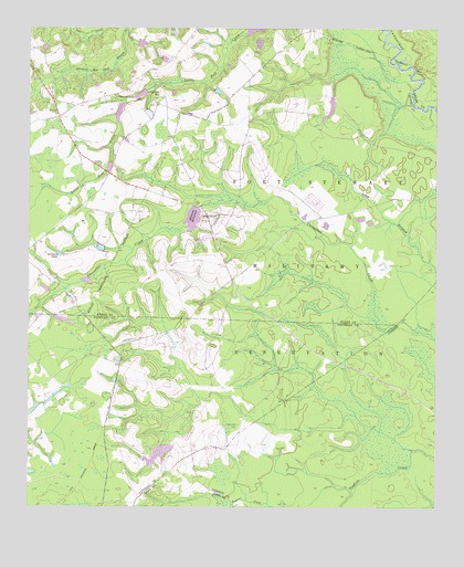
Glissons Millpond, GA USGS Topographic Map
Click on map above to begin viewing in our Map Viewer.

This topographic map contains these locations and features:
Feature Name Type Latitude Longitude GNIS ID View Map
Antioch CemeteryCemeteryN32.1057°W81.8365°345891View Map
Antioch Missionary Baptist ChurchChurchN32.1052°W81.8357°345892View Map
Antioch SchoolSchoolN32.1069°W81.8354°310592View Map
Barnard CemeteryCemeteryN32.1027°W81.8668°310803View Map
Camp OliverLocaleN32.0763°W81.8162°312246View Map
Cavender DamDamN32.1052°W81.8465°340272View Map
Cavender LakeReservoirN32.1035°W81.8472°340273View Map
Cherry Grove Missionary Baptist Church (historical)ChurchN32.0421°W81.8218°347393View Map
Cherry Grove School (historical)SchoolN32.0424°W81.8215°347394View Map
Claxton DivisionCivilN32.1151°W81.8696°1936181View Map
Durrence PondReservoirN32.0666°W81.8661°313743View Map
Easterling (historical)Populated PlaceN32.0191°W81.8512°347401View Map
Glisson Pond (historical)ReservoirN32.0844°W81.8326°345928View Map
Glissons MillpondReservoirN32.0762°W81.8241°314646View Map
Grice CreekStreamN32.0505°W81.8740°314894View Map
Hampton School (historical)SchoolN32.0127°W81.8262°348159View Map
Hay Grove School (historical)SchoolN32.0310°W81.7990°347412View Map
Hays Grove School (historical)SchoolN32.0138°W81.8109°357086View Map
Hillview School (historical)SchoolN32.0788°W81.8584°345937View Map
Liberia School (historical)SchoolN32.0519°W81.8373°345939View Map
Long Branch School (historical)SchoolN32.0799°W81.7676°345940View Map
Moodys Crossing (historical)Populated PlaceN32.0335°W81.8673°347427View Map
Park View School (historical)SchoolN32.0655°W81.8148°345945View Map
Pine View Lake DamDamN32.0335°W81.8665°338554View Map
Rogers Pond (historical)ReservoirN32.1155°W81.8490°345948View Map
Rogers School (historical)SchoolN32.1071°W81.8607°345949View Map
Sand Hill CemeteryCemeteryN32.0216°W81.8101°322420View Map
Tippins DamDamN32.1080°W81.8404°340274View Map
Tippins LakeReservoirN32.1080°W81.8404°324194View Map
Todd - Tippins Mill (historical)LocaleN32.1094°W81.8387°345959View Map

Note: Coordinates in the location and feature list above are referenced to NAD83 datum.


Copyright (C) 2008-2025 Ryan Niemi / Sunset Dynamics ... All Rights Reserved