TopoQuest Logo
Do you find TopoQuest useful?
Help keep TopoQuest running and adding new maps/features by donating!
Bitcoin:  19c7KJd3qBynnjoSw5npx9KScwjBe4ifkT
Litecoin:  LXs6TkuXGGXo1vDsWCkWVdjQX94eUKd6ui
Home View Maps Find Maps Find Places Resources & Links


Gogebic, Michigan Topographic Map

USGS Map Title: Gogebic, MI
USGS Map MRC: 46089C5
DRG (GeoTIFF) Download: o46089c5.tif


Neighboring USGS Topographic Map Quads:


  Marenisco, MI  
46089D6
 

  Marshall Creek, MI  
46089D5


  Stateline Lake, MI  
46089C6
 

  Gogebic, MI  
46089C5


  Presque Isle, WI  
46089B6
 

  Tenderfoot Lake, WI  
46089B5
 

  Thousand Island Lake, MI  
46089B4


Map MRC Location:

N47°
W90°
N47°
W89°
H8 H7 H6 H5 H4 H3 H2 H1
G8 G7 G6 G5 G4 G3 G2 G1
F8 F7 F6 F5 F4 F3 F2 F1
E8 E7 E6 E5 E4 E3 E2 E1
D8 D7 D6 D5 D4 D3 D2 D1
C8 C7 C6 C5 C4 C3 C2 C1
B8 B7 B6 B5 B4 B3 B2 B1
A8 A7 A6 A5 A4 A3 A2 A1
N46°
W90°
N46°
W89°

Gogebic, MI USGS 1:24K Topographic Map Preview:
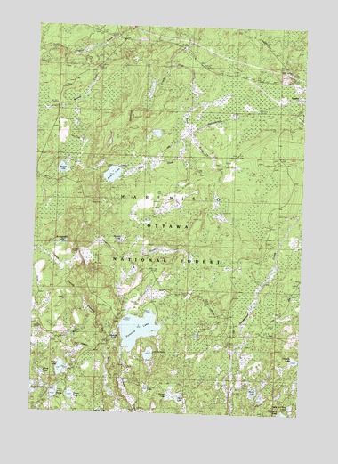
Gogebic, MI USGS Topographic Map
Click on map above to begin viewing in our Map Viewer.

This topographic map contains these locations and features:
Feature Name Type Latitude Longitude GNIS ID View Map
Banner CreekStreamN46.3661°W89.6046°1619085View Map
Banner LakeLakeN46.3288°W89.6127°620560View Map
Barb LakeLakeN46.3271°W89.5892°1619089View Map
Bluebill CreekStreamN46.3008°W89.5813°621650View Map
Bluegill PondLakeN46.2759°W89.5865°1619262View Map
Cornelia LakeLakeN46.2677°W89.5025°623839View Map
Dawn LakeLakeN46.2556°W89.6065°1625080View Map
Down LakeLakeN46.2549°W89.6065°1619755View Map
GogebicPopulated PlaceN46.3524°W89.5026°1620032View Map
Gogebic Post Office (historical)Post OfficeN46.3525°W89.5028°2126080View Map
Gogebic Post Office (historical)Post OfficeN46.3524°W89.5026°1926640View Map
Gogebic Station (historical)LocaleN46.3525°W89.5025°2126079View Map
Gypo CreekStreamN46.3333°W89.5574°627562View Map
Holly CreekStreamN46.2841°W89.6010°1620226View Map
Holly LakeLakeN46.2642°W89.6112°628445View Map
Honk LakeLakeN46.2560°W89.5562°1620239View Map
Little Pomeroy LakeLakeN46.2692°W89.5706°630738View Map
Monk LakeLakeN46.2628°W89.6202°1620879View Map
Morris LakeLakeN46.2574°W89.5213°632713View Map
Orchard CreekStreamN46.2708°W89.5824°1621116View Map
Orchard LakeLakeN46.2579°W89.5713°634088View Map
Peter and Paul LakesLakeN46.2529°W89.5038°634695View Map
Pomeroy CreekStreamN46.2977°W89.6071°1621281View Map
Pomeroy LakeLakeN46.2772°W89.5756°635214View Map
Pomeroy Lake CampgroundLocaleN46.2816°W89.5738°1622292View Map
Quack LakeLakeN46.2558°W89.5610°1621324View Map
Range LakeLakeN46.2560°W89.6141°635633View Map
Raspberry LakeLakeN46.2502°W89.5066°1621346View Map
Saint Augustine LakeLakeN46.3046°W89.6124°636558View Map
Santa Fe CreekStreamN46.3424°W89.5557°1621518View Map
Snowshoe LakeLakeN46.2501°W89.5845°1621665View Map
Sparkling CreekStreamN46.3624°W89.5638°1621715View Map
Spruce LakeLakeN46.3061°W89.5840°638645View Map
State River ParkParkN46.3680°W89.5565°1621766View Map
Tenderfoot CreekStreamN46.3069°W89.5089°1621879View Map

Note: Coordinates in the location and feature list above are referenced to NAD83 datum.


Copyright (C) 2008-2024 Ryan Niemi / Sunset Dynamics ... All Rights Reserved