TopoQuest Logo
Do you find TopoQuest useful?
Help keep TopoQuest running and adding new maps/features by donating!
Bitcoin:  19c7KJd3qBynnjoSw5npx9KScwjBe4ifkT
Litecoin:  LXs6TkuXGGXo1vDsWCkWVdjQX94eUKd6ui
Home View Maps Find Maps Find Places Resources & Links


Gold Beach, Oregon Topographic Map

USGS Map Title: Gold Beach, OR
USGS Map MRC: 42124D4
DRG (GeoTIFF) Download: o42124d4.tif


Neighboring USGS Topographic Map Quads:


  Ophir, OR  
42124E4
 

  Brushy Bald Mountain, OR  
42124E3


  Gold Beach, OR  
42124D4
 

  Signal Buttes, OR  
42124D3


  Cape Sebastian, OR  
42124C4
 

  Sundown Mountain, OR  
42124C3


Map MRC Location:

N43°
W125°
N43°
W124°
H8 H7 H6 H5 H4 H3 H2 H1
G8 G7 G6 G5 G4 G3 G2 G1
F8 F7 F6 F5 F4 F3 F2 F1
E8 E7 E6 E5 E4 E3 E2 E1
D8 D7 D6 D5 D4 D3 D2 D1
C8 C7 C6 C5 C4 C3 C2 C1
B8 B7 B6 B5 B4 B3 B2 B1
A8 A7 A6 A5 A4 A3 A2 A1
N42°
W125°
N42°
W124°

Gold Beach, OR USGS 1:24K Topographic Map Preview:
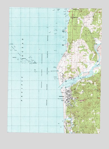
Gold Beach, OR USGS Topographic Map
Click on map above to begin viewing in our Map Viewer.

This topographic map contains these locations and features:
Feature Name Type Latitude Longitude GNIS ID View Map
Agate BeachBeachN42.4707°W124.4221°1154893View Map
Antone CreekStreamN42.3957°W124.4262°1154876View Map
Barley BeachBeachN42.4568°W124.4221°1154890View Map
Big PrairieAreaN42.4165°W124.4012°1134134View Map
Buena Vista State ParkParkN42.3787°W124.4232°1138880View Map
City of Gold BeachCivilN42.3773°W124.4141°2410609View Map
Collier H Buffington Memorial ParkParkN42.4143°W124.4173°2058292View Map
Cummins CreekStreamN42.4901°W124.4193°1154895View Map
Cunniff CreekStreamN42.4040°W124.4262°1154879View Map
Curry County CourthouseBuildingN42.4169°W124.4193°2661038View Map
Curry County Fairgrounds Outdoor StageLocaleN42.4076°W124.4227°2661498View Map
Curry County Outdoor ArenaLocaleN42.4077°W124.4240°2661424View Map
Curry County Public Health DepartmentBuildingN42.4173°W124.4186°2697254View Map
Curry County Rodeo and FairgroundsLocaleN42.4059°W124.4235°1134133View Map
Curry County Sheriff's OfficeBuildingN42.4167°W124.4189°2737816View Map
Curry General HospitalHospitalN42.4113°W124.4185°2610858View Map
Curry Historical Society MuseumBuildingN42.4056°W124.4208°2661396View Map
Curry Public Library DistrictBuildingN42.4133°W124.4151°2661238View Map
Dean CreekStreamN42.4159°W124.4248°1140763View Map
Double RockIslandN42.4493°W124.4904°1141205View Map
Doyle PointCapeN42.4276°W124.4262°1154887View Map
Doyle RockBarN42.4268°W124.4243°1134135View Map
East Fork Cunniff CreekStreamN42.4040°W124.4151°1154878View Map
Edson CreekStreamN42.4704°W124.3857°1141687View Map
Elephant RockBarN42.4476°W124.3795°1134136View Map
Ferry Hole BarBarN42.4596°W124.3790°1154883View Map
Flood CreekStreamN42.4359°W124.3790°1154862View Map
Fort Miner (historical)LocaleN42.4512°W124.4234°1162603View Map
Geisel CemeteryCemeteryN42.4914°W124.4156°2357509View Map
Geisel Monument State ParkParkN42.4907°W124.4158°1142601View Map
Gold BeachPopulated PlaceN42.4073°W124.4218°1142804View Map
Gold Beach Boat LaunchLocaleN42.4212°W124.4201°1155920View Map
Gold Beach City HallBuildingN42.4105°W124.4210°2661358View Map
Gold Beach DivisionCivilN42.4951°W124.4109°1938019View Map
Gold Beach High SchoolSchoolN42.4079°W124.4218°2416614View Map
Gold Beach Municipal AirportAirportN42.4185°W124.4241°1154058View Map
Gold Beach Municipal CourtBuildingN42.4105°W124.4210°2661359View Map
Gold Beach Police DepartmentBuildingN42.4105°W124.4210°2737665View Map
Gold Beach Post OfficePost OfficeN42.4197°W124.4203°1165322View Map
Gold Beach Public WorksBuildingN42.4093°W124.4234°2661524View Map
Gold Beach Sewage Treatment PlantLocaleN42.4092°W124.4232°2660780View Map
Gold Beach Volunteer Fire DepartmentBuildingN42.4105°W124.4210°2576632View Map
Hubbard MoundSummitN42.4769°W124.4245°1143865View Map
Hunter CreekStreamN42.3865°W124.4257°1143931View Map
Hunter CreekPopulated PlaceN42.3873°W124.4179°1154874View Map
Indian CreekStreamN42.4282°W124.4048°1144037View Map
Indian Creek CampgroundLocaleN42.4276°W124.4026°1155918View Map
Johns HoleChannelN42.4582°W124.3832°1134137View Map
Jot's ResortHarborN42.4286°W124.4160°2668343View Map
Jot's Resort Boat RampLocaleN42.4289°W124.4154°2668231View Map
Knox RockIslandN42.4312°W124.4359°1637964View Map
Knoxville (historical)Populated PlaceN42.4318°W124.4290°1154888View Map
Krambeal CreekStreamN42.4359°W124.3776°1154861View Map
Lynch CreekStreamN42.4304°W124.3873°1154863View Map
Middle Fork Riley CreekStreamN42.4068°W124.4096°1154885View Map
Miller CreekStreamN42.4707°W124.3873°1154882View Map
Needle RockIslandN42.4479°W124.4837°1146752View Map
NeedlesIslandN42.4290°W124.4512°1154889View Map
North Fork Riley CreekStreamN42.4082°W124.4109°1154886View Map
Northwest RockIslandN42.4623°W124.4990°1146720View Map
Otter PointCapeN42.4628°W124.4261°1147293View Map
Otter Point State ParkParkN42.4623°W124.4234°1154891View Map
Pioneer CemeteryCemeteryN42.4128°W124.4217°1154880View Map
Pocket ParkParkN42.4185°W124.4200°2058293View Map
Port of Gold Beach Boat RampLocaleN42.4199°W124.4227°2668421View Map
Pyramid RockIslandN42.4437°W124.4696°1148068View Map
Racetrack HillSummitN42.4553°W124.3856°1134138View Map
Riley CreekStreamN42.4096°W124.4254°1148450View Map
Riley Creek Elementary SchoolSchoolN42.4099°W124.4143°2416615View Map
Rogue CemeteryCemeteryN42.3928°W124.4204°1134132View Map
Rogue Playhouse TheatreBuildingN42.4174°W124.4203°2661562View Map
Rogue RiverStreamN42.4226°W124.4293°1148698View Map
Rogue River ReefBarN42.4529°W124.4823°1148700View Map
Rogue River Siskiyou National Forest Law Enforcement Gold Beach Ranger DistrictBuildingN42.4021°W124.4213°1155919View Map
Saint Charles Catholic ChurchChurchN42.4153°W124.4156°2508107View Map
Saunders CreekStreamN42.4379°W124.3812°1149081View Map
Scott CreekStreamN42.4693°W124.4221°1154892View Map
Seventh Day Adventist ChurchChurchN42.4128°W124.4197°2508128View Map
Smith Family CemeteryCemeteryN42.3831°W124.4153°1134140View Map
Snag PatchBendN42.4643°W124.3832°1134139View Map
South Beach ParkParkN42.4012°W124.4234°2058294View Map
South Fork Riley CreekStreamN42.4068°W124.4082°1154884View Map
Tomcat HillSummitN42.4193°W124.4123°1154864View Map
Turner CreekStreamN42.3887°W124.4151°1154875View Map
Wakeman BeachBeachN42.4873°W124.4207°1154894View Map
WedderburnPopulated PlaceN42.4296°W124.4151°1151991View Map
Wedderburn Post OfficePost OfficeN42.4302°W124.4132°1166140View Map
Wedderburn Sanitary District Wastewater Treatment PlantLocaleN42.4292°W124.4303°2660753View Map
West Fork Cunniff CreekStreamN42.3998°W124.4262°1154877View Map

Note: Coordinates in the location and feature list above are referenced to NAD83 datum.


Copyright (C) 2008-2025 Ryan Niemi / Sunset Dynamics ... All Rights Reserved