TopoQuest Logo
Do you find TopoQuest useful?
Help keep TopoQuest running and adding new maps/features by donating!
Bitcoin:  19c7KJd3qBynnjoSw5npx9KScwjBe4ifkT
Litecoin:  LXs6TkuXGGXo1vDsWCkWVdjQX94eUKd6ui
Home View Maps Find Maps Find Places Resources & Links


Cape Sebastian, Oregon Topographic Map

USGS Map Title: Cape Sebastian, OR
USGS Map MRC: 42124C4
DRG (GeoTIFF) Download: o42124c4.tif


Neighboring USGS Topographic Map Quads:


  Gold Beach, OR  
42124D4
 

  Signal Buttes, OR  
42124D3


  Cape Sebastian, OR  
42124C4
 

  Sundown Mountain, OR  
42124C3


  Mack Point, OR  
42124B4
 

  Carpenterville, OR  
42124B3


Map MRC Location:

N43°
W125°
N43°
W124°
H8 H7 H6 H5 H4 H3 H2 H1
G8 G7 G6 G5 G4 G3 G2 G1
F8 F7 F6 F5 F4 F3 F2 F1
E8 E7 E6 E5 E4 E3 E2 E1
D8 D7 D6 D5 D4 D3 D2 D1
C8 C7 C6 C5 C4 C3 C2 C1
B8 B7 B6 B5 B4 B3 B2 B1
A8 A7 A6 A5 A4 A3 A2 A1
N42°
W125°
N42°
W124°

Cape Sebastian, OR USGS 1:24K Topographic Map Preview:
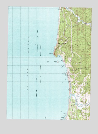
Cape Sebastian, OR USGS Topographic Map
Click on map above to begin viewing in our Map Viewer.

This topographic map contains these locations and features:
Feature Name Type Latitude Longitude GNIS ID View Map
Black RockIslandN42.3162°W124.4193°1138213View Map
Cape SebastianCapeN42.3240°W124.4329°1139357View Map
Cape Sebastian State ParkParkN42.3323°W124.4279°1139358View Map
Cave RockIslandN42.3096°W124.4171°1139476View Map
Crook CreekStreamN42.2754°W124.3982°1140458View Map
Crook PointCapeN42.2518°W124.4134°1140460View Map
Crossen CreekStreamN42.3573°W124.3890°1155360View Map
Curry County Public WorksBuildingN42.3621°W124.3945°2661475View Map
Daniels CreekStreamN42.3401°W124.4290°1154869View Map
Egans CreekStreamN42.3151°W124.4151°1154868View Map
Evans Log PondsReservoirN42.3742°W124.4146°1157168View Map
Henry RockPillarN42.2919°W124.4074°1157169View Map
Hidden CreekStreamN42.2512°W124.4068°1154447View Map
Hunters CoveBayN42.3201°W124.4240°1143945View Map
Hunters IslandIslandN42.3134°W124.4262°1143947View Map
Long HollowValleyN42.2518°W124.4021°1162574View Map
McKinley CreekStreamN42.2915°W124.4068°1154866View Map
Myers CreekStreamN42.3071°W124.4107°1146706View Map
North Fork Myers CreekStreamN42.3054°W124.3957°1154867View Map
Oregon State Police Department Gold Beach WorksiteBuildingN42.3724°W124.4127°2737839View Map
Pistol RiverPopulated PlaceN42.2771°W124.3948°1147776View Map
Pistol RiverStreamN42.2796°W124.4076°1147777View Map
Pistol River CemeteryCemeteryN42.2907°W124.3988°1154881View Map
Pistol River Census Designated PlaceCensusN42.2839°W124.3991°2611773View Map
Pistol River Log PondReservoirN42.2676°W124.3985°1157167View Map
Pistol River Post OfficePost OfficeN42.2768°W124.3950°1165793View Map
Pistol River Rural Fire Protection DistrictBuildingN42.2768°W124.3950°2576889View Map
Pistol River State ParkParkN42.2748°W124.4054°1154865View Map
Saddle RockIslandN42.2501°W124.4157°1148912View Map
Sand CreekStreamN42.2501°W124.4157°1154446View Map
Smith CreekStreamN42.3596°W124.3901°1154871View Map
Taylor CreekStreamN42.3734°W124.4151°1154873View Map
Yorke CreekStreamN42.3693°W124.4040°1154872View Map

Note: Coordinates in the location and feature list above are referenced to NAD83 datum.


Copyright (C) 2008-2024 Ryan Niemi / Sunset Dynamics ... All Rights Reserved