TopoQuest Logo
Do you find TopoQuest useful?
Help keep TopoQuest running and adding new maps/features by donating!
Bitcoin:  19c7KJd3qBynnjoSw5npx9KScwjBe4ifkT
Litecoin:  LXs6TkuXGGXo1vDsWCkWVdjQX94eUKd6ui
Home View Maps Find Maps Find Places Resources & Links


Golden Falls, Oregon Topographic Map

USGS Map Title: Golden Falls, OR
USGS Map MRC: 43123D8
DRG (GeoTIFF) Download: o43123d8.tif


Neighboring USGS Topographic Map Quads:


  Trail Butte, OR  
43124E1
 

  Elk Peak, OR  
43123E8
 

  Loon Lake, OR  
43123E7
 

  Allegany, OR  
43124D1
 

  Golden Falls, OR  
43123D8
 

  Ivers Peak, OR  
43123D7
 

  Daniels Creek, OR  
43124C1
 

  Coos Mountain, OR  
43123C8
 

  Tioga, OR  
43123C7


Map MRC Location:

N44°
W124°
N44°
W123°
H8 H7 H6 H5 H4 H3 H2 H1
G8 G7 G6 G5 G4 G3 G2 G1
F8 F7 F6 F5 F4 F3 F2 F1
E8 E7 E6 E5 E4 E3 E2 E1
D8 D7 D6 D5 D4 D3 D2 D1
C8 C7 C6 C5 C4 C3 C2 C1
B8 B7 B6 B5 B4 B3 B2 B1
A8 A7 A6 A5 A4 A3 A2 A1
N43°
W124°
N43°
W123°

Golden Falls, OR USGS 1:24K Topographic Map Preview:
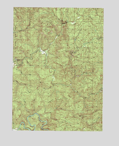
Golden Falls, OR USGS Topographic Map
Click on map above to begin viewing in our Map Viewer.

This topographic map contains these locations and features:
Feature Name Type Latitude Longitude GNIS ID View Map
Big CreekStreamN43.3909°W123.9640°1117599View Map
Conklin CreekStreamN43.4593°W123.9109°1119202View Map
Coos River Fish HatcheryLocaleN43.3757°W123.9918°1119259View Map
Darius CreekStreamN43.4707°W123.9395°1119686View Map
East CreekStreamN43.3909°W123.9720°1120289View Map
Eastside DivisionCivilN43.3850°W123.9719°1938007View Map
Fox CreekStreamN43.4209°W123.9423°1161372View Map
Frog CreekStreamN43.4865°W123.9243°1121004View Map
Glenn CreekStreamN43.4546°W123.9562°1121166View Map
Golden and Silver Falls State ParkParkN43.4846°W123.9323°1121216View Map
Golden FallsFallsN43.4851°W123.9279°1121219View Map
Hewett FallsFallsN43.4554°W123.9195°1157232View Map
Hodges CreekStreamN43.4409°W123.9934°1121863View Map
Little Matson CreekStreamN43.4304°W123.9123°1123227View Map
Matson CreekStreamN43.4223°W123.9204°1123842View Map
McKnight CreekStreamN43.3754°W123.9982°1123997View Map
Millicoma Myrtle Grove State ParkParkN43.4457°W123.9951°1124216View Map
Millicoma River Rearing PondReservoirN43.4379°W123.9490°1133610View Map
Millicoma River Rearing Pond DamDamN43.4382°W123.9479°1133609View Map
Nesika County ParkParkN43.4401°W123.9954°1124654View Map
Rodine CreekStreamN43.4476°W123.9845°1126257View Map
Salmon CreekStreamN43.3768°W123.9912°1126512View Map
Schoolhouse CreekStreamN43.4996°W123.9087°1126660View Map
Silver CreekStreamN43.4815°W123.9309°1126961View Map
Silver FallsFallsN43.4884°W123.9345°1126968View Map
South Fork Matson CreekStreamN43.4698°W123.8782°1638438View Map
Taylor ButteSummitN43.4237°W123.9612°1161542View Map
Vaughn PointSummitN43.3905°W123.9030°1161572View Map
West CreekStreamN43.3901°W123.9732°1128821View Map
West Fork Silver CreekStreamN43.4854°W123.9340°1128867View Map

Note: Coordinates in the location and feature list above are referenced to NAD83 datum.


Copyright (C) 2008-2024 Ryan Niemi / Sunset Dynamics ... All Rights Reserved