TopoQuest Logo
Do you find TopoQuest useful?
Help keep TopoQuest running and adding new maps/features by donating!
Bitcoin:  19c7KJd3qBynnjoSw5npx9KScwjBe4ifkT
Litecoin:  LXs6TkuXGGXo1vDsWCkWVdjQX94eUKd6ui
Home View Maps Find Maps Find Places Resources & Links


Loon Lake, Oregon Topographic Map

USGS Map Title: Loon Lake, OR
USGS Map MRC: 43123E7
DRG (GeoTIFF) Download: o43123e7.tif


Neighboring USGS Topographic Map Quads:


  Deer Head Point, OR  
43123F8
 

  Scottsburg, OR  
43123F7
 

  Devils Graveyard, OR  
43123F6
 

  Elk Peak, OR  
43123E8
 

  Loon Lake, OR  
43123E7
 

  Old Blue, OR  
43123E6
 

  Golden Falls, OR  
43123D8
 

  Ivers Peak, OR  
43123D7
 

  Kelly Butte, OR  
43123D6


Map MRC Location:

N44°
W124°
N44°
W123°
H8 H7 H6 H5 H4 H3 H2 H1
G8 G7 G6 G5 G4 G3 G2 G1
F8 F7 F6 F5 F4 F3 F2 F1
E8 E7 E6 E5 E4 E3 E2 E1
D8 D7 D6 D5 D4 D3 D2 D1
C8 C7 C6 C5 C4 C3 C2 C1
B8 B7 B6 B5 B4 B3 B2 B1
A8 A7 A6 A5 A4 A3 A2 A1
N43°
W124°
N43°
W123°

Loon Lake, OR USGS 1:24K Topographic Map Preview:
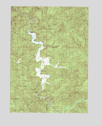
Loon Lake, OR USGS Topographic Map
Click on map above to begin viewing in our Map Viewer.

This topographic map contains these locations and features:
Feature Name Type Latitude Longitude GNIS ID View Map
AshPopulated PlaceN43.5523°W123.8218°1117060View Map
Ash Post Office (historical)Post OfficeN43.5523°W123.8218°1164862View Map
Ash ValleyValleyN43.5743°W123.8268°1117064View Map
Baker CreekStreamN43.5554°W123.8484°1133067View Map
Beehive RockPillarN43.5943°W123.8407°1134835View Map
Bickford CreekStreamN43.5641°W123.8305°1132215View Map
Buck CreekStreamN43.6082°W123.7845°1133057View Map
Bureau of Land Management Loon Lake Recreation Park Field OfficeBuildingN43.5969°W123.8464°2737745View Map
Camp CreekStreamN43.6096°W123.8357°1118507View Map
Craig CreekStreamN43.5332°W123.8234°1133063View Map
Double Barrel CreekStreamN43.6165°W123.8609°1133070View Map
East Shore Recreation SiteParkN43.5922°W123.8344°1162534View Map
Kelly CreekStreamN43.6026°W123.8470°1133069View Map
Lake CreekStreamN43.5784°W123.8254°1122893View Map
Little Salander CreekStreamN43.5857°W123.8423°1134838View Map
Loon LakeLakeN43.5868°W123.8371°1123474View Map
Loon Lake East Shore Boat RampLocaleN43.5921°W123.8357°2668456View Map
Loon Lake Recreation AreaParkN43.5975°W123.8459°1162535View Map
Loon Lake Resort Boat RampLocaleN43.5958°W123.8472°2668130View Map
Michigan PassGapN43.5280°W123.8349°1134837View Map
Michigan Pass CreekStreamN43.5332°W123.8318°1133062View Map
North Fork Soup CreekStreamN43.5540°W123.8068°1133061View Map
Platinum FallsFallsN43.5554°W123.8484°2747257View Map
Pucket CreekStreamN43.6234°W123.8693°1132214View Map
Saint Patricks RockPillarN43.5843°W123.8426°1134836View Map
Salander CreekStreamN43.5829°W123.8420°1126503View Map
Slideout CreekStreamN43.5526°W123.7679°1133064View Map
Sock CreekStreamN43.6051°W123.8362°1127184View Map
Soup CreekStreamN43.5598°W123.8218°1127218View Map
Surprise CreekStreamN43.5248°W123.8582°1133060View Map
Tom Fool CreekStreamN43.5707°W123.8315°1158995View Map
Upton CreekStreamN43.5832°W123.8262°1133068View Map
West Fork Lake CreekStreamN43.5187°W123.8326°1128856View Map

Note: Coordinates in the location and feature list above are referenced to NAD83 datum.


Copyright (C) 2008-2024 Ryan Niemi / Sunset Dynamics ... All Rights Reserved