TopoQuest Logo
Do you find TopoQuest useful?
Help keep TopoQuest running and adding new maps/features by donating!
Bitcoin:  19c7KJd3qBynnjoSw5npx9KScwjBe4ifkT
Litecoin:  LXs6TkuXGGXo1vDsWCkWVdjQX94eUKd6ui
Home View Maps Find Maps Find Places Resources & Links


Elk Peak, Oregon Topographic Map

USGS Map Title: Elk Peak, OR
USGS Map MRC: 43123E8
DRG (GeoTIFF) Download: o43123e8.tif


Neighboring USGS Topographic Map Quads:


  Reedsport, OR  
43124F1
 

  Deer Head Point, OR  
43123F8
 

  Scottsburg, OR  
43123F7
 

  Trail Butte, OR  
43124E1
 

  Elk Peak, OR  
43123E8
 

  Loon Lake, OR  
43123E7
 

  Allegany, OR  
43124D1
 

  Golden Falls, OR  
43123D8
 

  Ivers Peak, OR  
43123D7


Map MRC Location:

N44°
W124°
N44°
W123°
H8 H7 H6 H5 H4 H3 H2 H1
G8 G7 G6 G5 G4 G3 G2 G1
F8 F7 F6 F5 F4 F3 F2 F1
E8 E7 E6 E5 E4 E3 E2 E1
D8 D7 D6 D5 D4 D3 D2 D1
C8 C7 C6 C5 C4 C3 C2 C1
B8 B7 B6 B5 B4 B3 B2 B1
A8 A7 A6 A5 A4 A3 A2 A1
N43°
W124°
N43°
W123°

Elk Peak, OR USGS 1:24K Topographic Map Preview:
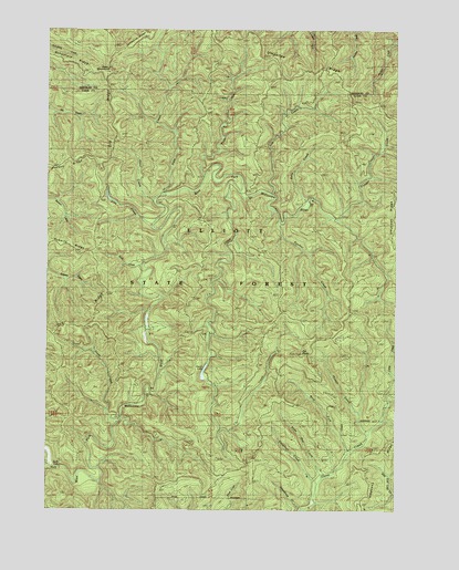
Elk Peak, OR USGS Topographic Map
Click on map above to begin viewing in our Map Viewer.

This topographic map contains these locations and features:
Feature Name Type Latitude Longitude GNIS ID View Map
Buck CreekStreamN43.5634°W123.9676°1118180View Map
Cedar CreekStreamN43.5273°W123.8782°1118723View Map
Cleighton CreekStreamN43.5062°W123.9034°1119010View Map
Dear MountainSummitN43.6146°W123.9795°1119774View Map
Deer CreekStreamN43.5815°W123.9615°1119810View Map
Elk CreekStreamN43.5829°W123.9315°1120437View Map
Elk PeakSummitN43.5405°W123.9100°1120460View Map
Elliott State ForestForestN43.5732°W123.9532°1141834View Map
Fish CreekStreamN43.5821°W123.9201°1120755View Map
Gould LakeLakeN43.5369°W123.9444°1120456View Map
Howell CreekStreamN43.5196°W123.8845°1122085View Map
Joes CreekStreamN43.5732°W123.9634°1122441View Map
Kelly CreekStreamN43.5809°W123.9070°1122667View Map
Knife CreekStreamN43.5871°W123.9448°1122813View Map
Loon Lake LookoutLocaleN43.5971°W123.8970°1133058View Map
Otter CreekStreamN43.5804°W123.9634°1125061View Map
Panther CreekStreamN43.5746°W123.9179°1125158View Map
Scholfield RidgeRidgeN43.6139°W123.9836°2678495View Map
Slide Out CreekStreamN43.5076°W123.9026°1127080View Map
Stulls FallsFallsN43.5109°W123.9957°1127675View Map
Trout CreekStreamN43.5223°W123.9762°1128237View Map
Umpcoos RidgeRidgeN43.6060°W123.8931°1128404View Map
West Fork Glenn CreekStreamN43.5137°W123.8932°1128850View Map

Note: Coordinates in the location and feature list above are referenced to NAD83 datum.


Copyright (C) 2008-2024 Ryan Niemi / Sunset Dynamics ... All Rights Reserved