TopoQuest Logo
Do you find TopoQuest useful?
Help keep TopoQuest running and adding new maps/features by donating!
Bitcoin:  19c7KJd3qBynnjoSw5npx9KScwjBe4ifkT
Litecoin:  LXs6TkuXGGXo1vDsWCkWVdjQX94eUKd6ui
Home View Maps Find Maps Find Places Resources & Links


Atkinson, Illinois Topographic Map

USGS Map Title: Atkinson, IL
USGS Map MRC: 41090D1
DRG (GeoTIFF) Download: o41090d1.tif


Neighboring USGS Topographic Map Quads:


  Hillsdale, IL  
41090E2
 

  Spring Hill, IL  
41090E1
 

  Hooppole, IL  
41089E8
 

  Geneseo, IL  
41090D2
 

  Atkinson, IL  
41090D1
 

  Annawan, IL  
41089D8
 

  Cambridge, IL  
41090C2
 

  German Corner, IL  
41090C1
 

  Kewanee North, IL  
41089C8


Map MRC Location:

N42°
W91°
N42°
W90°
H8 H7 H6 H5 H4 H3 H2 H1
G8 G7 G6 G5 G4 G3 G2 G1
F8 F7 F6 F5 F4 F3 F2 F1
E8 E7 E6 E5 E4 E3 E2 E1
D8 D7 D6 D5 D4 D3 D2 D1
C8 C7 C6 C5 C4 C3 C2 C1
B8 B7 B6 B5 B4 B3 B2 B1
A8 A7 A6 A5 A4 A3 A2 A1
N41°
W91°
N41°
W90°

Atkinson, IL USGS 1:24K Topographic Map Preview:
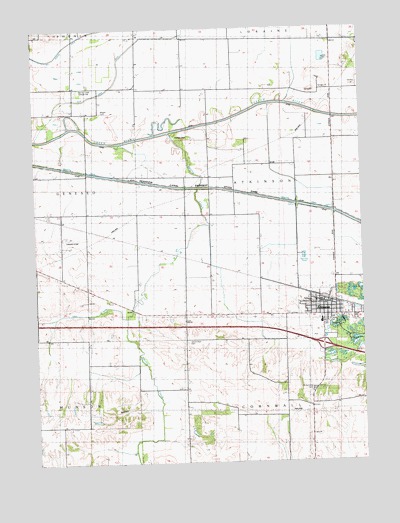
Atkinson, IL USGS Topographic Map
Click on map above to begin viewing in our Map Viewer.

This topographic map contains these locations and features:
Feature Name Type Latitude Longitude GNIS ID View Map
AtkinsonPopulated PlaceN41.4209°W90.0151°403699View Map
Atkinson Fire Protection DistrictBuildingN41.4202°W90.0162°2640546View Map
Atkinson Grade SchoolSchoolN41.4159°W90.0159°1812533View Map
Atkinson Post OfficePost OfficeN41.4207°W90.0147°1812534View Map
Atkinson United Church of ChristChurchN41.4192°W90.0173°1984838View Map
Bass School (historical)SchoolN41.4567°W90.0109°1747347View Map
Blue Joint DitchCanalN41.4948°W90.0879°422382View Map
Bluff Road School (historical)SchoolN41.4281°W90.1154°1747349View Map
Doctor Merry Post LightBuildingN41.4292°W90.0014°2680948View Map
Gen-AirparkAirportN41.4402°W90.1133°427307View Map
Grand View CemeteryCemeteryN41.4097°W90.0673°409271View Map
Grand View School (historical)SchoolN41.4181°W90.0676°1747379View Map
Grove School (historical)SchoolN41.3878°W90.0204°424048View Map
Hartman MineMineN41.4128°W90.0590°1984832View Map
Indian HillSummitN41.4684°W90.0690°410862View Map
Interchange 27CrossingN41.4086°W90.0157°1812576View Map
Jackson School (historical)SchoolN41.4836°W90.1104°1747384View Map
Mizpan CemeteryCemeteryN41.4764°W90.0998°413691View Map
Mount Hope School (historical)SchoolN41.4828°W90.0634°424075View Map
Mount Sunny School (historical)SchoolN41.4895°W90.0115°424076View Map
Oak CreekStreamN41.4167°W90.0907°414757View Map
Saint Anthony CemeteryCemeteryN41.3956°W90.0198°417170View Map
Saint Anthonys Catholic ChurchChurchN41.4211°W90.0182°1984839View Map
Spring CreekStreamN41.4703°W90.0740°418948View Map
Spring Creek CemeteryCemeteryN41.4603°W90.0587°1952040View Map
Spring Creek Grange HallBuildingN41.4828°W90.1071°428379View Map
Spring Creek MineMineN41.3856°W90.0873°1984834View Map
Spring Creek School (historical)SchoolN41.4570°W90.0579°1747424View Map
Town of AtkinsonCivilN41.4154°W90.0082°2397442View Map
Township of AtkinsonCivilN41.4534°W90.0291°428615View Map

Note: Coordinates in the location and feature list above are referenced to NAD83 datum.


Copyright (C) 2008-2025 Ryan Niemi / Sunset Dynamics ... All Rights Reserved