TopoQuest Logo
Do you find TopoQuest useful?
Help keep TopoQuest running and adding new maps/features by donating!
Bitcoin:  19c7KJd3qBynnjoSw5npx9KScwjBe4ifkT
Litecoin:  LXs6TkuXGGXo1vDsWCkWVdjQX94eUKd6ui
Home View Maps Find Maps Find Places Resources & Links


Hooppole, Illinois Topographic Map

USGS Map Title: Hooppole, IL
USGS Map MRC: 41089E8
DRG (GeoTIFF) Download: o41089e8.tif


Neighboring USGS Topographic Map Quads:


  Erie, IL  
41090F1
 

  Prophetstown, IL  
41089F8
 

  Tampico, IL  
41089F7
 

  Spring Hill, IL  
41090E1
 

  Hooppole, IL  
41089E8
 

  Yorktown, IL  
41089E7
 

  Atkinson, IL  
41090D1
 

  Annawan, IL  
41089D8
 

  Mineral, IL  
41089D7


Map MRC Location:

N42°
W90°
N42°
W89°
H8 H7 H6 H5 H4 H3 H2 H1
G8 G7 G6 G5 G4 G3 G2 G1
F8 F7 F6 F5 F4 F3 F2 F1
E8 E7 E6 E5 E4 E3 E2 E1
D8 D7 D6 D5 D4 D3 D2 D1
C8 C7 C6 C5 C4 C3 C2 C1
B8 B7 B6 B5 B4 B3 B2 B1
A8 A7 A6 A5 A4 A3 A2 A1
N41°
W90°
N41°
W89°

Hooppole, IL USGS 1:24K Topographic Map Preview:
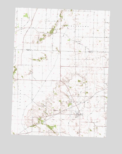
Hooppole, IL USGS Topographic Map
Click on map above to begin viewing in our Map Viewer.

This topographic map contains these locations and features:
Feature Name Type Latitude Longitude GNIS ID View Map
AlicevillePopulated PlaceN41.5523°W89.8796°422397View Map
Brown School (historical)SchoolN41.5409°W89.8798°404962View Map
Centerville School (historical)SchoolN41.6242°W89.9015°405850View Map
Central Special DitchCanalN41.5428°W89.9109°405908View Map
HooppolePopulated PlaceN41.5223°W89.9098°410495View Map
Hooppole CemeteryCemeteryN41.5224°W89.9179°1952051View Map
Hooppole Grove School (historical)SchoolN41.5111°W89.9540°410496View Map
Jefferson CornersPopulated PlaceN41.6053°W89.9807°1824044View Map
Jefferson Corners School (historical)SchoolN41.6053°W89.9798°411049View Map
Keefer BranchStreamN41.5486°W89.9607°411339View Map
Lane School (historical)SchoolN41.5764°W89.8768°411801View Map
Leon CornersPopulated PlaceN41.5942°W89.9204°411949View Map
Leon Methodist CemeteryCemeteryN41.5917°W89.9159°1954894View Map
Leon School (historical)SchoolN41.5936°W89.8954°411950View Map
Leon United Methodist ChurchChurchN41.5923°W89.9173°1824049View Map
Main Union Special DitchCanalN41.5611°W89.9515°412865View Map
Oberle School (historical)SchoolN41.5506°W89.9937°414946View Map
Prophetstown Fire Protection District Hooppole StationBuildingN41.5228°W89.9100°2640910View Map
Ringel School (historical)SchoolN41.5120°W89.8759°416684View Map
Saint Marys CemeteryCemeteryN41.5247°W89.9443°417571View Map
Saint Marys ChurchChurchN41.5295°W89.9596°417596View Map
Sanders School (historical)SchoolN41.5403°W89.9173°417970View Map
Specht School (historical)SchoolN41.5728°W89.9746°418889View Map
Stowell School (historical)SchoolN41.5659°W89.9182°419199View Map
Township of YorktownCivilN41.5401°W89.9170°429971View Map
Village of HooppoleCivilN41.5216°W89.9140°2398539View Map
Wildcat DitchCanalN41.5370°W89.8840°421151View Map
Woodward Bluff School (historical)SchoolN41.6025°W89.9446°421494View Map

Note: Coordinates in the location and feature list above are referenced to NAD83 datum.


Copyright (C) 2008-2025 Ryan Niemi / Sunset Dynamics ... All Rights Reserved