TopoQuest Logo
Do you find TopoQuest useful?
Help keep TopoQuest running and adding new maps/features by donating!
Bitcoin:  19c7KJd3qBynnjoSw5npx9KScwjBe4ifkT
Litecoin:  LXs6TkuXGGXo1vDsWCkWVdjQX94eUKd6ui
Home View Maps Find Maps Find Places Resources & Links


Goldstone Pass, Montana Topographic Map

USGS Map Title: Goldstone Pass, MT
USGS Map MRC: 45113B5
DRG (GeoTIFF) Download: o45113b5.tif


Neighboring USGS Topographic Map Quads:


  Homer Youngs Peak, MT  
45113C6
 

  Lower Miner Lakes, MT  
45113C5
 

  Jackson, MT  
45113C4
 

  Bohannon Spring, ID  
45113B6
 

  Goldstone Pass, MT  
45113B5
 

  Selway Mountain, MT  
45113B4
 

  Baker, ID  
45113A6
 

  Goldstone Mountain, ID  
45113A5
 

  Kitty Creek, MT  
45113A4


Map MRC Location:

N46°
W114°
N46°
W113°
H8 H7 H6 H5 H4 H3 H2 H1
G8 G7 G6 G5 G4 G3 G2 G1
F8 F7 F6 F5 F4 F3 F2 F1
E8 E7 E6 E5 E4 E3 E2 E1
D8 D7 D6 D5 D4 D3 D2 D1
C8 C7 C6 C5 C4 C3 C2 C1
B8 B7 B6 B5 B4 B3 B2 B1
A8 A7 A6 A5 A4 A3 A2 A1
N45°
W114°
N45°
W113°

Goldstone Pass, MT USGS 1:24K Topographic Map Preview:
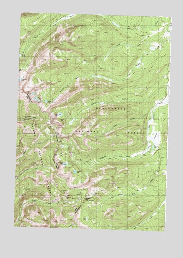
Goldstone Pass, MT USGS Topographic Map
Click on map above to begin viewing in our Map Viewer.

This topographic map contains these locations and features:
Feature Name Type Latitude Longitude GNIS ID View Map
Alpine LakeLakeN45.1599°W113.5775°778979View Map
Berry MeadowsFlatN45.2483°W113.5845°779731View Map
Blind CanyonValleyN45.1941°W113.5131°780105View Map
Copper Queen MineMineN45.2305°W113.5903°802510View Map
Cowbone LakeLakeN45.1582°W113.5761°781797View Map
Darkhorse CreekStreamN45.1799°W113.5142°782087View Map
Darkhorse LakeLakeN45.1624°W113.5841°782088View Map
Darkhorse MineMineN45.1675°W113.5894°802522View Map
Goldstone LakeLakeN45.1459°W113.5608°784087View Map
Goldstone MineMineN45.1427°W113.5826°382423View Map
Goldstone PassGapN45.1433°W113.5673°382425View Map
Highup LakeLakeN45.2001°W113.6095°784875View Map
HRS Claim MineMineN45.1833°W113.5898°802521View Map
Jahnke MineMineN45.1894°W113.5887°785412View Map
Jahnke MineMineN45.1891°W113.5878°802509View Map
Janhke LakeLakeN45.1912°W113.5898°785418View Map
Moose MeadowFlatN45.2249°W113.6237°787656View Map
North Fork Pioneer CreekStreamN45.2321°W113.5153°788224View Map
Pioneer LakeLakeN45.1987°W113.6014°788935View Map
Skinner LakeLakeN45.1742°W113.5123°790597View Map
Skinner MeadowsFlatN45.1777°W113.5151°790598View Map
Skytop LakeLakeN45.1999°W113.6110°790629View Map
Swift LakeLakeN45.1311°W113.5649°791821View Map
Timberline LakeLakeN45.2107°W113.6244°792201View Map

Note: Coordinates in the location and feature list above are referenced to NAD83 datum.


Copyright (C) 2008-2025 Ryan Niemi / Sunset Dynamics ... All Rights Reserved