TopoQuest Logo
Do you find TopoQuest useful?
Help keep TopoQuest running and adding new maps/features by donating!
Bitcoin:  19c7KJd3qBynnjoSw5npx9KScwjBe4ifkT
Litecoin:  LXs6TkuXGGXo1vDsWCkWVdjQX94eUKd6ui
Home View Maps Find Maps Find Places Resources & Links


Good Luck Creek, Montana Topographic Map

USGS Map Title: Good Luck Creek, MT
USGS Map MRC: 45107C4
DRG (GeoTIFF) Download: o45107c4.tif


Neighboring USGS Topographic Map Quads:


  Saint Xavier NE, MT  
45107D5
 

  Benteen, MT  
45107D4
 

  Lodge Grass NE, MT  
45107D3
 

  Shick Ranch, MT  
45107C5
 

  Good Luck Creek, MT  
45107C4
 

  Lodge Grass, MT  
45107C3
 

  Willow Creek Dam, MT  
45107B5
 

  Wyola, MT  
45107B4
 

  Wyola NE, MT  
45107B3


Map MRC Location:

N46°
W108°
N46°
W107°
H8 H7 H6 H5 H4 H3 H2 H1
G8 G7 G6 G5 G4 G3 G2 G1
F8 F7 F6 F5 F4 F3 F2 F1
E8 E7 E6 E5 E4 E3 E2 E1
D8 D7 D6 D5 D4 D3 D2 D1
C8 C7 C6 C5 C4 C3 C2 C1
B8 B7 B6 B5 B4 B3 B2 B1
A8 A7 A6 A5 A4 A3 A2 A1
N45°
W108°
N45°
W107°

Good Luck Creek, MT USGS 1:24K Topographic Map Preview:
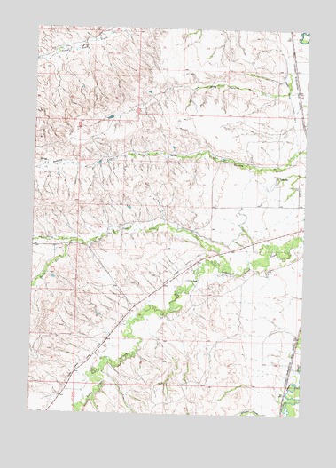
Good Luck Creek, MT USGS Topographic Map
Click on map above to begin viewing in our Map Viewer.

This topographic map contains these locations and features:
Feature Name Type Latitude Longitude GNIS ID View Map
05S35E27BA__01 WellWellN45.3730°W107.3831°809158View Map
05S35E27BADC01 WellWellN45.3730°W107.3809°809157View Map
05S35E27BB__01 WellWellN45.3730°W107.3884°809159View Map
05S35E27BB__02 WellWellN45.3730°W107.3884°809160View Map
05S35E27BB__03 WellWellN45.3730°W107.3884°809161View Map
05S35E27BB__04 WellWellN45.3730°W107.3884°809162View Map
05S35E27BB__05 WellWellN45.3730°W107.3884°809163View Map
05S35E27BD__01 WellWellN45.3694°W107.3831°809138View Map
05S35E27CCDC01 WellWellN45.3619°W107.3854°809094View Map
05S35E27CD__01 WellWellN45.3622°W107.3831°809095View Map
05S35E27DB__01 WellWellN45.3658°W107.3779°809113View Map
05S35E34ABBB01 WellWellN45.3611°W107.3784°809089View Map
05S35E34BBBD01 WellWellN45.3597°W107.3870°809084View Map
05S35E34BD__01 WellWellN45.3550°W107.3831°809066View Map
05S35E34CD__01 WellWellN45.3477°W107.3831°809039View Map
05S35E34DB__01 WellWellN45.3514°W107.3779°809053View Map
05S35E34DBBB01 WellWellN45.3539°W107.3801°809061View Map
05S35E34DC__01 WellWellN45.3477°W107.3779°809038View Map
06S35E01BC__01 WellWellN45.3414°W107.3759°809012View Map
06S35E01CB__01 WellWellN45.3377°W107.3759°808995View Map
06S35E01CBCD01 WellWellN45.3364°W107.3770°808986View Map
06S35E10DC__01 WellWellN45.3197°W107.4062°808911View Map
06S35E11ACBB01 WellWellN45.3277°W107.3884°808951View Map
06S35E11ACBB02 WellWellN45.3280°W107.3887°808952View Map
06S35E11CABC01 WellWellN45.3241°W107.3934°808935View Map
06S35E11CD__01 WellWellN45.3197°W107.3909°808910View Map
06S35E11DA__01 WellWellN45.3233°W107.3809°808931View Map
06S35E11DD__01 WellWellN45.3197°W107.3809°808909View Map
06S35E12CBCC01 WellWellN45.3222°W107.3781°808928View Map
06S35E13CB__01 WellWellN45.3089°W107.3759°808846View Map
06S35E14AA__01 WellWellN45.3161°W107.3809°808898View Map
06S35E14BC__01 WellWellN45.3125°W107.3959°808874View Map
06S35E14CA__01 WellWellN45.3089°W107.3909°808849View Map
06S35E14DA__01 WellWellN45.3089°W107.3809°808847View Map
06S35E14DB__01 WellWellN45.3089°W107.3859°808848View Map
06S35E14DCAA01 WellWellN45.3075°W107.3837°808840View Map
06S35E21DB__01 WellWellN45.2941°W107.4262°808773View Map
06S35E22AB__01 WellWellN45.3014°W107.4062°808810View Map
06S35E22ABCC01 WellWellN45.2997°W107.4093°808806View Map
06S35E22BDDD01 WellWellN45.2991°W107.4137°808802View Map
06S35E23BDAD01 WellWellN45.2958°W107.3920°808785View Map
06S35E23CABB01 WellWellN45.2958°W107.3937°808786View Map
06S35E23CDCD01 WellWellN45.2980°W107.3887°808796View Map
06S35E29AB__01 WellWellN45.2869°W107.4465°808729View Map
06S35E29BABB01 WellWellN45.2858°W107.4465°808727View Map
06S35E29CBDC01 WellWellN45.2786°W107.4568°808698View Map
06S35E31ACCA01 WellWellN45.2683°W107.4673°808657View Map
06S35E31CBCB01 WellWellN45.2639°W107.4793°808637View Map
06S35E35DDAB01 WellWellN45.2650°W107.3795°808641View Map
06S35E35DDBC01 WellWellN45.2625°W107.3820°808635View Map
06S35E35DDBC02 WellWellN45.2622°W107.3823°808633View Map
06S35E36BCBC02 WellWellN45.2697°W107.3762°808661View Map
07S35E06BADC01 WellWellN45.2577°W107.4720°808612View Map
07S35E06BCA_01 WellWellN45.2547°W107.4748°808598View Map
Albright School (historical)SchoolN45.2564°W107.4873°1716403View Map
Alligator CreekStreamN45.2514°W107.3823°768212View Map
Good Luck CreekStreamN45.2980°W107.4095°771851View Map
Good Luck School (historical)SchoolN45.3041°W107.4818°1716422View Map
Ionia (historical)LocaleN45.3652°W107.3823°1716516View Map
Little Horn (historical)LocaleN45.2750°W107.3776°1716512View Map
Lodge Grass Canal Number OneCanalN45.3561°W107.3837°773533View Map
Lodge Grass Canal Number TwoCanalN45.2591°W107.4834°773534View Map
Lodge Grass CemeteryCemeteryN45.3228°W107.3781°773536View Map
North Fork Good Luck CreekStreamN45.3055°W107.4801°774759View Map
South Fork Good Luck CreekStreamN45.3058°W107.4801°776829View Map

Note: Coordinates in the location and feature list above are referenced to NAD83 datum.


Copyright (C) 2008-2025 Ryan Niemi / Sunset Dynamics ... All Rights Reserved