TopoQuest Logo
Do you find TopoQuest useful?
Help keep TopoQuest running and adding new maps/features by donating!
Bitcoin:  19c7KJd3qBynnjoSw5npx9KScwjBe4ifkT
Litecoin:  LXs6TkuXGGXo1vDsWCkWVdjQX94eUKd6ui
Home View Maps Find Maps Find Places Resources & Links


Good Sight Peak NE, New Mexico Topographic Map

USGS Map Title: Good Sight Peak NE, NM
USGS Map MRC: 32107D3
DRG (GeoTIFF) Download: o32107d3.tif


Neighboring USGS Topographic Map Quads:


  Nutt, NM  
32107E4
 

  Hockett, NM  
32107E3
 

  Souse Springs, NM  
32107E2
 

  Good Sight Peak, NM  
32107D4
 

  Good Sight Peak NE, NM  
32107D3
 

  Magdalena Peak, NM  
32107D2
 

  Myndus, NM  
32107C4
 

  Lazy E Ranch, NM  
32107C3
 

  Magdalena Gap, NM  
32107C2


Map MRC Location:

N33°
W108°
N33°
W107°
H8 H7 H6 H5 H4 H3 H2 H1
G8 G7 G6 G5 G4 G3 G2 G1
F8 F7 F6 F5 F4 F3 F2 F1
E8 E7 E6 E5 E4 E3 E2 E1
D8 D7 D6 D5 D4 D3 D2 D1
C8 C7 C6 C5 C4 C3 C2 C1
B8 B7 B6 B5 B4 B3 B2 B1
A8 A7 A6 A5 A4 A3 A2 A1
N32°
W108°
N32°
W107°

Good Sight Peak NE, NM USGS 1:24K Topographic Map Preview:
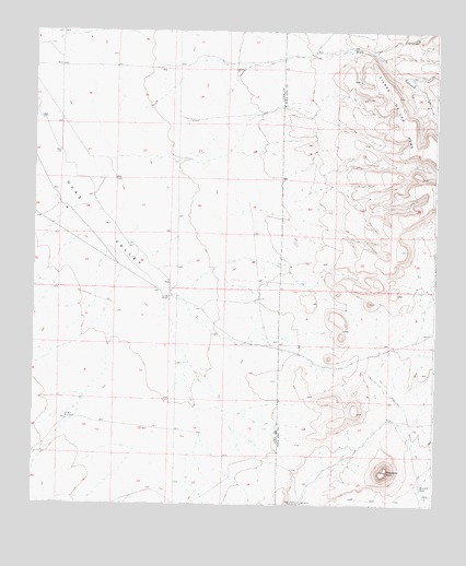
Good Sight Peak NE, NM USGS Topographic Map
Click on map above to begin viewing in our Map Viewer.

This topographic map contains these locations and features:
Feature Name Type Latitude Longitude GNIS ID View Map
01202 Water WellWellN32.3970°W107.3645°923299View Map
05001 Water WellWellN32.4759°W107.3706°923304View Map
05002 Water WellWellN32.4681°W107.3542°930150View Map
05003 Water WellWellN32.4487°W107.3517°923302View Map
05012 Water WellWellN32.4576°W107.3545°925470View Map
10016 Water WellWellN32.4909°W107.3675°922452View Map
10018 Water WellWellN32.4668°W107.3672°930149View Map
10019 Water WellWellN32.4543°W107.3672°922457View Map
10020 Water WellWellN32.4434°W107.3420°930158View Map
10021 Water WellWellN32.4334°W107.3331°923301View Map
10460 Water WellWellN32.4965°W107.3672°925479View Map
10461 Water WellWellN32.4898°W107.3589°930143View Map
10462 Water WellWellN32.4909°W107.3556°922451View Map
10463 Water WellWellN32.4929°W107.3503°930146View Map
10464 Water WellWellN32.4768°W107.3272°923305View Map
10465 Water WellWellN32.4612°W107.3500°922461View Map
10466 Water WellWellN32.4579°W107.3695°922459View Map
10467 Water WellWellN32.4365°W107.3375°930155View Map
10475 Water WellWellN32.4754°W107.3247°930152View Map
Howard TankReservoirN32.3800°W107.2542°890222View Map
Massacre PeakSummitN32.3837°W107.2647°891672View Map
NH 54 Water WellWellN32.4898°W107.3361°923307View Map
NH 59 5 Water WellWellN32.4579°W107.3692°922458View Map
Number 1201 Water WellWellN32.4290°W107.3328°923300View Map
Pine CanyonValleyN32.4923°W107.3228°893278View Map
Pole M RanchLocaleN32.4295°W107.3331°893385View Map
Weldon Burris HomesteadLocaleN32.3756°W107.2920°896311View Map
Wright WindmillLocaleN32.3970°W107.3645°896783View Map

Note: Coordinates in the location and feature list above are referenced to NAD83 datum.


Copyright (C) 2008-2024 Ryan Niemi / Sunset Dynamics ... All Rights Reserved