TopoQuest Logo
Do you find TopoQuest useful?
Help keep TopoQuest running and adding new maps/features by donating!
Bitcoin:  19c7KJd3qBynnjoSw5npx9KScwjBe4ifkT
Litecoin:  LXs6TkuXGGXo1vDsWCkWVdjQX94eUKd6ui
Home View Maps Find Maps Find Places Resources & Links


Magdalena Peak, New Mexico Topographic Map

USGS Map Title: Magdalena Peak, NM
USGS Map MRC: 32107D2
DRG (GeoTIFF) Download: o32107d2.tif


Neighboring USGS Topographic Map Quads:


  Hockett, NM  
32107E3
 

  Souse Springs, NM  
32107E2
 

  Sierra Alta, NM  
32107E1
 

  Good Sight Peak NE, NM  
32107D3
 

  Magdalena Peak, NM  
32107D2
 

  Rough and Ready Hills, NM  
32107D1
 

  Lazy E Ranch, NM  
32107C3
 

  Magdalena Gap, NM  
32107C2
 

  Sleeping Lady Hills, NM  
32107C1


Map MRC Location:

N33°
W108°
N33°
W107°
H8 H7 H6 H5 H4 H3 H2 H1
G8 G7 G6 G5 G4 G3 G2 G1
F8 F7 F6 F5 F4 F3 F2 F1
E8 E7 E6 E5 E4 E3 E2 E1
D8 D7 D6 D5 D4 D3 D2 D1
C8 C7 C6 C5 C4 C3 C2 C1
B8 B7 B6 B5 B4 B3 B2 B1
A8 A7 A6 A5 A4 A3 A2 A1
N32°
W108°
N32°
W107°

Magdalena Peak, NM USGS 1:24K Topographic Map Preview:
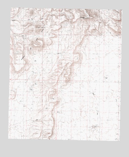
Magdalena Peak, NM USGS Topographic Map
Click on map above to begin viewing in our Map Viewer.

This topographic map contains these locations and features:
Feature Name Type Latitude Longitude GNIS ID View Map
Cahoon TankReservoirN32.4373°W107.1442°887068View Map
Carter TankReservoirN32.4048°W107.2088°887232View Map
East TankReservoirN32.4495°W107.2222°888707View Map
Kerr TankReservoirN32.4274°W107.2223°890678View Map
Little Mills WellsWellN32.3887°W107.1567°891158View Map
Lone Tree TankReservoirN32.4886°W107.2484°891278View Map
Magdalena PeakSummitN32.4918°W107.1675°920638View Map
Manuel TankReservoirN32.4225°W107.2268°891584View Map
Martin TankReservoirN32.3930°W107.2194°891640View Map
Mesa AzurSummitN32.4954°W107.1642°899773View Map
Miguel TanksReservoirN32.4734°W107.2378°892031View Map
Monterey WellWellN32.4126°W107.2384°892172View Map
New TankReservoirN32.4898°W107.2243°892467View Map
Shorty Swope TankReservoirN32.4245°W107.1934°894815View Map
Sierra de las UvasRangeN32.4818°W107.1992°920704View Map
Swope TankReservoirN32.4129°W107.2031°895462View Map
Tajanio Pinto TankReservoirN32.4571°W107.1972°895491View Map
The Saddle MountainSummitN32.4826°W107.2164°899951View Map
Twin Hills TankReservoirN32.4884°W107.2181°895945View Map
Upper Swope TankReservoirN32.4540°W107.1884°896041View Map
Vail TankReservoirN32.4017°W107.1936°896068View Map

Note: Coordinates in the location and feature list above are referenced to NAD83 datum.


Copyright (C) 2008-2025 Ryan Niemi / Sunset Dynamics ... All Rights Reserved