TopoQuest Logo
Do you find TopoQuest useful?
Help keep TopoQuest running and adding new maps/features by donating!
Bitcoin:  19c7KJd3qBynnjoSw5npx9KScwjBe4ifkT
Litecoin:  LXs6TkuXGGXo1vDsWCkWVdjQX94eUKd6ui
Home View Maps Find Maps Find Places Resources & Links


Goodman, Wisconsin Topographic Map

USGS Map Title: Goodman, WI
USGS Map MRC: 45088F3
DRG (GeoTIFF) Download: o45088f3.tif


Neighboring USGS Topographic Map Quads:


  Florence SW, WI  
45088G4
 

  Florence SE, WI  
45088G3
 

  Iron Mountain SW, WI  
45088G2
 

  Armstrong Creek, WI  
45088F4
 

  Goodman, WI  
45088F3
 

  Dunbar, WI  
45088F2
 

  Goodman SW, WI  
45088E4
 

  Coleman Lake, WI  
45088E3
 

  Twelvefoot Falls, WI  
45088E2


Map MRC Location:

N46°
W89°
N46°
W88°
H8 H7 H6 H5 H4 H3 H2 H1
G8 G7 G6 G5 G4 G3 G2 G1
F8 F7 F6 F5 F4 F3 F2 F1
E8 E7 E6 E5 E4 E3 E2 E1
D8 D7 D6 D5 D4 D3 D2 D1
C8 C7 C6 C5 C4 C3 C2 C1
B8 B7 B6 B5 B4 B3 B2 B1
A8 A7 A6 A5 A4 A3 A2 A1
N45°
W89°
N45°
W88°

Goodman, WI USGS 1:24K Topographic Map Preview:
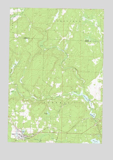
Goodman, WI USGS Topographic Map
Click on map above to begin viewing in our Map Viewer.

This topographic map contains these locations and features:
Feature Name Type Latitude Longitude GNIS ID View Map
Camp D CreekStreamN45.6680°W88.3426°1562595View Map
Clark LakeLakeN45.6351°W88.3545°1563117View Map
Dunbar Barrens State Natural AreaParkN45.6741°W88.2532°2057509View Map
Fishers CreekStreamN45.6291°W88.3304°1565024View Map
Glenwood CemeteryCemeteryN45.6319°W88.3426°1565583View Map
GoodmanPopulated PlaceN45.6313°W88.3535°1565631View Map
Goodman - Armstrong Elementary SchoolSchoolN45.6307°W88.3576°1845567View Map
Goodman - Armstrong Rescue SquadBuildingN45.6317°W88.3578°2698305View Map
Goodman DamDamN45.6316°W88.3618°1792188View Map
Goodman High SchoolSchoolN45.6264°W88.3582°1845568View Map
Goodman MillpondLakeN45.6331°W88.3636°1565633View Map
Goodman Volunteer Fire DepartmentBuildingN45.6317°W88.3578°2696939View Map
Hatchery DamDamN45.6633°W88.2668°1792184View Map
Hobachee LakeLakeN45.6526°W88.3222°1566494View Map
Kirton DamDamN45.6483°W88.2618°1792861View Map
Lost LakeLakeN45.6725°W88.2896°1568666View Map
Macintire CreekStreamN45.6716°W88.2773°1568863View Map
Middle DamDamN45.6583°W88.2651°1792186View Map
Moon LakeLakeN45.6269°W88.2589°1569696View Map
North PondReservoirN45.6676°W88.2737°1570483View Map
North Pond 20ReservoirN45.6633°W88.2668°1792185View Map
Railroad PondReservoirN45.6509°W88.2630°1792862View Map
Scott DamDamN45.6580°W88.2651°1573839View Map
Scott Pond 30ReservoirN45.6583°W88.2651°1792187View Map
Shinns BranchStreamN45.6705°W88.2907°1574053View Map
Sidney CreekStreamN45.6697°W88.2835°1580404View Map
Springdale BranchStreamN45.6744°W88.3635°1574717View Map
Town of GoodmanCivilN45.6347°W88.3330°1583289View Map

Note: Coordinates in the location and feature list above are referenced to NAD83 datum.


Copyright (C) 2008-2025 Ryan Niemi / Sunset Dynamics ... All Rights Reserved