TopoQuest Logo
Do you find TopoQuest useful?
Help keep TopoQuest running and adding new maps/features by donating!
Bitcoin:  19c7KJd3qBynnjoSw5npx9KScwjBe4ifkT
Litecoin:  LXs6TkuXGGXo1vDsWCkWVdjQX94eUKd6ui
Home View Maps Find Maps Find Places Resources & Links


Florence SE, Wisconsin Topographic Map

USGS Map Title: Florence SE, WI
USGS Map MRC: 45088G3
DRG (GeoTIFF) Download: o45088g3.tif


Neighboring USGS Topographic Map Quads:


  Naults, MI  
45088H4
 

  Florence West, WI  
45088H3
 

  Florence East, WI  
45088H2
 

  Florence SW, WI  
45088G4
 

  Florence SE, WI  
45088G3
 

  Iron Mountain SW, WI  
45088G2
 

  Armstrong Creek, WI  
45088F4
 

  Goodman, WI  
45088F3
 

  Dunbar, WI  
45088F2


Map MRC Location:

N46°
W89°
N46°
W88°
H8 H7 H6 H5 H4 H3 H2 H1
G8 G7 G6 G5 G4 G3 G2 G1
F8 F7 F6 F5 F4 F3 F2 F1
E8 E7 E6 E5 E4 E3 E2 E1
D8 D7 D6 D5 D4 D3 D2 D1
C8 C7 C6 C5 C4 C3 C2 C1
B8 B7 B6 B5 B4 B3 B2 B1
A8 A7 A6 A5 A4 A3 A2 A1
N45°
W89°
N45°
W88°

Florence SE, WI USGS 1:24K Topographic Map Preview:
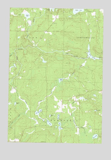
Florence SE, WI USGS Topographic Map
Click on map above to begin viewing in our Map Viewer.

This topographic map contains these locations and features:
Feature Name Type Latitude Longitude GNIS ID View Map
Bass LakeLakeN45.7682°W88.3202°1561257View Map
Bass Lake Lookout TowerTowerN45.7508°W88.3265°1845367View Map
Buckskin LakeLakeN45.7859°W88.3660°1562341View Map
Bush LakeLakeN45.7656°W88.3058°1562460View Map
Emily LakeLakeN45.8745°W88.2834°1564621View Map
Halls CreekStreamN45.8286°W88.2724°1565997View Map
Halls Creek Wildlife Flowage 3WR1799 DamDamN45.8100°W88.2985°1792539View Map
Halls LakeLakeN45.8086°W88.3057°1565999View Map
Halls Lake 4.95ReservoirN45.8100°W88.2985°1792540View Map
Homestead ParkParkN45.7688°W88.3237°1566644View Map
Jutra LakeLakeN45.8257°W88.3284°1577351View Map
Lamon Tangue CreekStreamN45.8044°W88.3735°1579622View Map
Little Emily LakeLakeN45.8672°W88.2948°2784010View Map
Lund CreekStreamN45.7761°W88.3523°1579787View Map
Marm LakeLakeN45.7805°W88.2587°1569061View Map
Meyers CreekStreamN45.8677°W88.3340°1569394View Map
Mirror LakeLakeN45.7750°W88.3195°1569589View Map
Pine RapidsRapidsN45.8302°W88.2887°1571514View Map
Pine River DamDamN45.8286°W88.2543°1571519View Map
Pine River FlowageReservoirN45.8299°W88.2638°1571520View Map
Pine River Flowage 543ReservoirN45.8283°W88.2551°1792954View Map
Pine River WP146 DamDamN45.8283°W88.2551°1792953View Map
Popple RapidsRapidsN45.8372°W88.3637°1571782View Map
Popple RiverStreamN45.8400°W88.3401°1580193View Map
Prairie School (historical)SchoolN45.7788°W88.3037°1845390View Map
Sand LakeLakeN45.7565°W88.2587°1573678View Map
Sand Lake BranchStreamN45.7763°W88.2893°1573690View Map
Scout LakeLakeN45.7743°W88.3082°1573853View Map
Seidel CreekStreamN45.8552°W88.3507°1580376View Map
Seidel LakeLakeN45.8680°W88.3521°1845396View Map
Town of FernCivilN45.8515°W88.3645°1583200View Map
Town of HomesteadCivilN45.7636°W88.2718°1583407View Map
Township of Fern PitMineN45.8664°W88.3161°2635553View Map
West Bass LakeLakeN45.7784°W88.3349°1576446View Map
Woods CreekStreamN45.8341°W88.3682°1580829View Map

Note: Coordinates in the location and feature list above are referenced to NAD83 datum.


Copyright (C) 2008-2025 Ryan Niemi / Sunset Dynamics ... All Rights Reserved